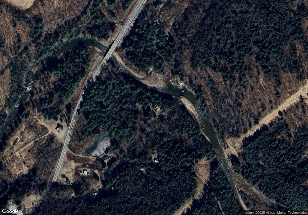
55 Loyalsock Dr Dushore, PA 18614
Estimated Value: $321,000 - $519,345
13
Beds
8
Baths
4,354
Sq Ft
$100/Sq Ft
Est. Value
About This Home
This home is located at 55 Loyalsock Dr, Dushore, PA 18614 and is currently estimated at $433,586, approximately $99 per square foot. 55 Loyalsock Dr is a home with nearby schools including Sullivan County Elementary School and Sullivan County High School.
Ownership History
Date
Name
Owned For
Owner Type
Purchase Details
Closed on
Apr 29, 2021
Sold by
Martin Elmer R and Hurst Grace Z
Bought by
Hurst Grace Z
Current Estimated Value
Purchase Details
Closed on
Apr 23, 2021
Sold by
Hurst Marlene M
Bought by
Hurst Richard M and Hurst Bertha M
Purchase Details
Closed on
Jun 26, 2017
Sold by
Martin Elmer R and Hurst Grace Z
Bought by
Martin Elmer R and Martin Grace Z
Purchase Details
Closed on
Apr 30, 2009
Sold by
Hurst Walter M
Bought by
Martin Elmer R and Hurst Grace Z
Create a Home Valuation Report for This Property
The Home Valuation Report is an in-depth analysis detailing your home's value as well as a comparison with similar homes in the area
Home Values in the Area
Average Home Value in this Area
Purchase History
| Date | Buyer | Sale Price | Title Company |
|---|---|---|---|
| Hurst Grace Z | -- | None Available | |
| Hurst Richard M | -- | None Available | |
| Martin Elmer R | -- | None Available | |
| Martin Elmer R | -- | None Available |
Source: Public Records
Tax History Compared to Growth
Tax History
| Year | Tax Paid | Tax Assessment Tax Assessment Total Assessment is a certain percentage of the fair market value that is determined by local assessors to be the total taxable value of land and additions on the property. | Land | Improvement |
|---|---|---|---|---|
| 2025 | $4,727 | $229,900 | $19,500 | $210,400 |
| 2024 | $4,552 | $229,900 | $19,500 | $210,400 |
| 2023 | $4,308 | $229,900 | $19,500 | $210,400 |
| 2022 | $4,308 | $229,900 | $19,500 | $210,400 |
| 2021 | $1,138 | $229,900 | $19,500 | $210,400 |
| 2020 | $4,145 | $229,900 | $19,500 | $210,400 |
| 2019 | $4,058 | $229,900 | $19,500 | $210,400 |
| 2017 | $3,932 | $229,900 | $19,500 | $210,400 |
| 2015 | $2,616 | $229,900 | $19,500 | $210,400 |
| 2014 | $2,616 | $225,300 | $19,500 | $205,800 |
| 2012 | $2,616 | $225,300 | $19,500 | $205,800 |
Source: Public Records
Map
Nearby Homes
- 108 Stansfield Rd
- 126 James Rd
- 0 Snyder Rd
- 595 Old Bernice Rd
- Snyder Rd Lot Unit WP001
- 72 Carl Rd
- 0 Old Bernice Rd Unit 31721825
- 0 Pole Bridge Rd Unit LOT 39 WB-100451
- 0 Pole Bridge Rd Unit LOT 37 WB-100448
- 0 Pole Bridge Rd Unit LOT 38 WB-100450
- 13 Thorne St
- 1146 Eagle Rock Rd
- 70 Jackson St
- 68 Center St
- 1050 Old Bernice Rd
- 5240 U S 220
- 49 Bear Run Ln
- Lot 24 Cavanaugh Rd
- 167 Payne Run Ln
- 30 Hemlock Dr
- Lot Loyalsock Dr
- 0 Loyalsock Dr
- 39 Thornedale Rd
- 24 Loyalsock Dr
- 89 Thornedale Rd
- 10 Birch Creek Dr
- 33 Thornedale Rd
- 33 Thorndale Rd
- 8 Birch Creek Dr
- 7600 Block Route 220 Hwy
- 0 Thornedale Rd
- 7478 Route 220
- 7478 U S 220
- 7509 U S 220
- 7048 Route 220
- 7600 U S Highway 220
- 7466 U S 220
- 7466/78 Route 220
- 86 Witamy Ln
- 7647 Route 220
