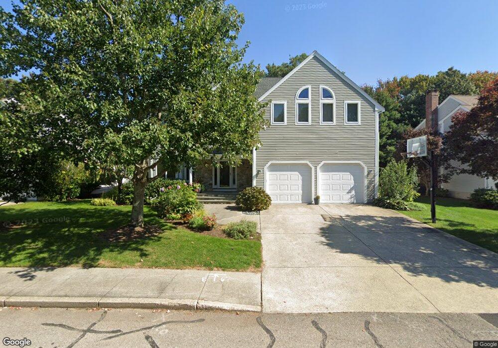
55 Lynn Rd Needham Heights, MA 02494
Estimated Value: $1,732,000 - $2,153,424
4
Beds
5
Baths
1,503
Sq Ft
$1,318/Sq Ft
Est. Value
About This Home
This home is located at 55 Lynn Rd, Needham Heights, MA 02494 and is currently estimated at $1,981,606, approximately $1,318 per square foot. 55 Lynn Rd is a home located in Norfolk County with nearby schools including Eliot Elementary School, High Rock Middle School, and Pollard Middle School.
Ownership History
Date
Name
Owned For
Owner Type
Purchase Details
Closed on
Sep 16, 2014
Sold by
Price Jonathan E and Rubin Kim M
Bought by
Rubin Kim M
Current Estimated Value
Purchase Details
Closed on
Jun 29, 2001
Sold by
Rosenberg Joan A
Bought by
Price Jonathan E
Home Financials for this Owner
Home Financials are based on the most recent Mortgage that was taken out on this home.
Original Mortgage
$560,000
Interest Rate
7.14%
Mortgage Type
Purchase Money Mortgage
Purchase Details
Closed on
Oct 23, 1996
Sold by
Asaff Glenn and Asaff Paula
Bought by
Rosenberg Joan A
Home Financials for this Owner
Home Financials are based on the most recent Mortgage that was taken out on this home.
Original Mortgage
$300,000
Interest Rate
8.22%
Mortgage Type
Purchase Money Mortgage
Create a Home Valuation Report for This Property
The Home Valuation Report is an in-depth analysis detailing your home's value as well as a comparison with similar homes in the area
Home Values in the Area
Average Home Value in this Area
Purchase History
| Date | Buyer | Sale Price | Title Company |
|---|---|---|---|
| Rubin Kim M | -- | -- | |
| Price Jonathan E | $800,000 | -- | |
| Rosenberg Joan A | $612,000 | -- |
Source: Public Records
Mortgage History
| Date | Status | Borrower | Loan Amount |
|---|---|---|---|
| Previous Owner | Rosenberg Joan A | $560,000 | |
| Previous Owner | Rosenberg Joan A | $300,000 |
Source: Public Records
Tax History Compared to Growth
Tax History
| Year | Tax Paid | Tax Assessment Tax Assessment Total Assessment is a certain percentage of the fair market value that is determined by local assessors to be the total taxable value of land and additions on the property. | Land | Improvement |
|---|---|---|---|---|
| 2025 | $18,891 | $1,782,200 | $744,800 | $1,037,400 |
| 2024 | $15,405 | $1,230,400 | $511,500 | $718,900 |
| 2023 | $15,392 | $1,180,400 | $511,500 | $668,900 |
| 2022 | $15,374 | $1,149,900 | $511,500 | $638,400 |
| 2021 | $14,983 | $1,149,900 | $511,500 | $638,400 |
| 2020 | $15,037 | $1,203,900 | $511,500 | $692,400 |
| 2019 | $14,266 | $1,151,400 | $465,000 | $686,400 |
| 2018 | $12,315 | $1,036,600 | $465,000 | $571,600 |
| 2017 | $11,510 | $968,000 | $465,000 | $503,000 |
| 2016 | $11,236 | $973,700 | $465,000 | $508,700 |
| 2015 | $10,993 | $973,700 | $465,000 | $508,700 |
| 2014 | $11,120 | $955,300 | $465,000 | $490,300 |
Source: Public Records
Map
Nearby Homes
- 345 Central Ave
- 41 Lee Rd
- 62 Evelyn Rd
- 443 Central Ave
- 7 Avery St
- 12 Hill St
- 35 Andrea Cir
- 36 Davenport Rd
- 130 Central Ave
- 379 Hunnewell St Unit 379
- 400 Hunnewell St Unit 103
- 98 Hunnewell St
- 18 Evergreen Rd
- 78 Hunnewell St
- 39 Mark Lee Rd
- 310 Oakland St
- 10 Fife Rd
- 206 Cedar St
- 3 Crescent Rd
- 143 Hunting Rd