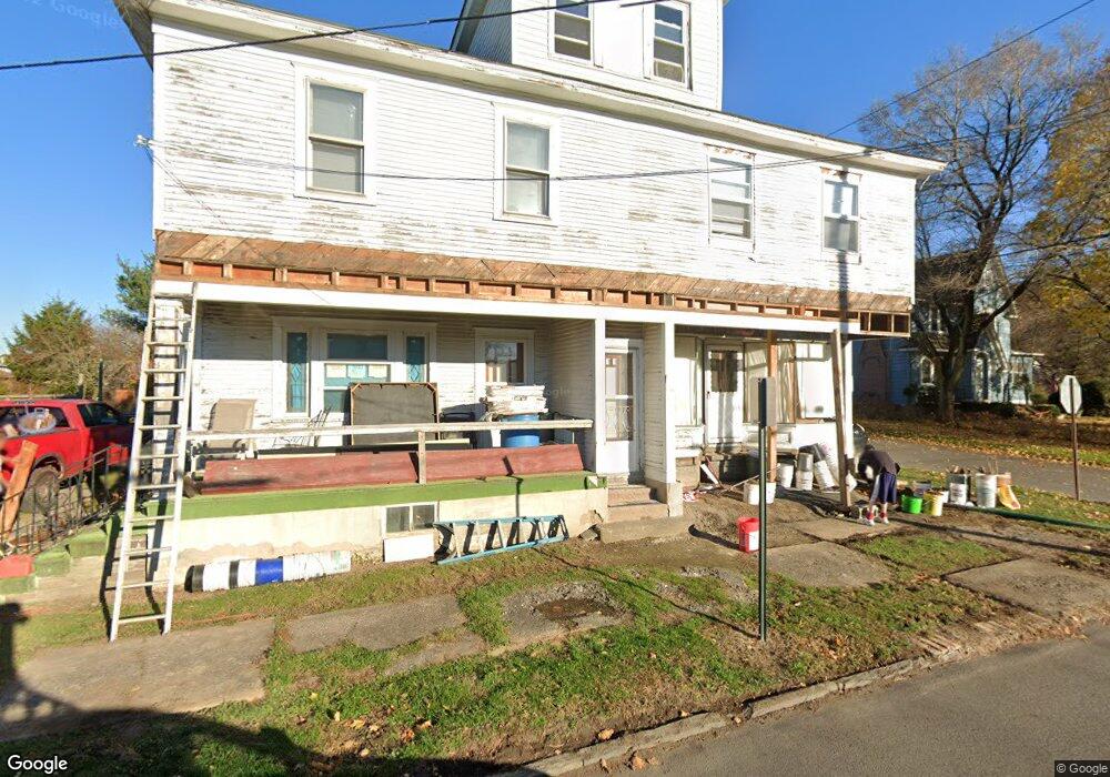
55 Maple St Nanticoke, PA 18634
Estimated Value: $152,000 - $236,000
Studio
--
Bath
3,429
Sq Ft
$54/Sq Ft
Est. Value
About This Home
This home is located at 55 Maple St, Nanticoke, PA 18634 and is currently estimated at $184,317, approximately $53 per square foot. 55 Maple St is a home located in Luzerne County with nearby schools including Kennedy Early Childhood Center, Nanticoke Area Elementary Center Center, and Greater Nanticoke Area Senior High School.
Ownership History
Date
Name
Owned For
Owner Type
Purchase Details
Closed on
Nov 10, 2017
Sold by
Winderman Richard H and Winderman Susan A
Bought by
Gadomski Michael D
Current Estimated Value
Purchase Details
Closed on
Mar 8, 2017
Sold by
Stettler Josephine A and Stettler Josephine A
Bought by
Winderman Susan A
Purchase Details
Closed on
Jul 10, 2015
Sold by
Gorka Albin S
Bought by
Winderman Susan A
Purchase Details
Closed on
May 23, 1986
Bought by
Gorka Albin S
Create a Home Valuation Report for This Property
The Home Valuation Report is an in-depth analysis detailing your home's value as well as a comparison with similar homes in the area
Home Values in the Area
Average Home Value in this Area
Purchase History
| Date | Buyer | Sale Price | Title Company |
|---|---|---|---|
| Gadomski Michael D | $20,000 | None Available | |
| Winderman Susan A | -- | None Available | |
| Winderman Susan A | $500 | None Available | |
| Gorka Albin S | $38,000 | -- |
Source: Public Records
Tax History
| Year | Tax Paid | Tax Assessment Tax Assessment Total Assessment is a certain percentage of the fair market value that is determined by local assessors to be the total taxable value of land and additions on the property. | Land | Improvement |
|---|---|---|---|---|
| 2026 | $1,448 | $75,200 | $16,700 | $58,500 |
| 2025 | $1,779 | $75,200 | $16,700 | $58,500 |
| 2024 | $1,779 | $75,200 | $16,700 | $58,500 |
| 2023 | $1,726 | $75,200 | $16,700 | $58,500 |
| 2022 | $1,712 | $75,200 | $16,700 | $58,500 |
| 2021 | $1,653 | $75,200 | $16,700 | $58,500 |
| 2020 | $1,642 | $75,200 | $16,700 | $58,500 |
| 2019 | $1,601 | $75,200 | $16,700 | $58,500 |
| 2018 | $1,546 | $75,200 | $16,700 | $58,500 |
| 2017 | $1,458 | $75,200 | $16,700 | $58,500 |
| 2016 | -- | $75,200 | $16,700 | $58,500 |
| 2015 | $1,121 | $75,200 | $16,700 | $58,500 |
| 2014 | $1,121 | $75,200 | $16,700 | $58,500 |
Source: Public Records
Map
Nearby Homes
- 0 Fine and Hemlock St
- Hemlock St Hemlock St
- 1045 Lincoln Ave
- 1201 S Hanover St
- 25 W Grove St
- 711 S Hanover St
- 132 Espy St
- 138 Espy St
- 284 E Grand St
- 598 Old Newport St
- 300 Vandermark Rd
- 25 Cherry Dr
- 414 E Field St
- 416 E Washington St
- 20 Locust St
- 22 S Walnut St
- 242 State St
- 854 Lily Lake Rd
- Lot 55 Vista Dr
- Lot 45 Vista Dr
- 1121 Chestnut St
- 55 1/2 Maple St
- 1117 Chestnut St
- 1120 Chestnut St
- 1115 Chestnut St
- 1118 Chestnut St
- 1116 Chestnut St
- 1094 Walnut St
- 1124 Chestnut St
- 1098 Walnut St
- 1126 Chestnut St
- 1090 Walnut St
- 1113 Chestnut St
- 1127 Chestnut St
- 1100 Walnut St
- 1088 Walnut St
- 1111 Chestnut St
- 1128 Chestnut St
- 1114 Chestnut St
- 1102 Walnut St
Your Personal Tour Guide
Ask me questions while you tour the home.