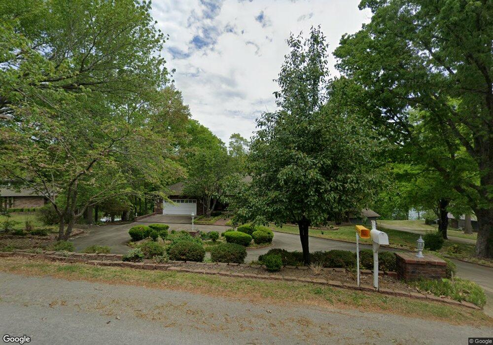
55 Mayfair Dr Bella Vista, AR 72715
Estimated Value: $748,000 - $942,272
3
Beds
3
Baths
3,989
Sq Ft
$215/Sq Ft
Est. Value
About This Home
This home is located at 55 Mayfair Dr, Bella Vista, AR 72715 and is currently estimated at $859,424, approximately $215 per square foot. 55 Mayfair Dr is a home located in Benton County with nearby schools including Cooper Elementary School, Old High Middle School, and Washington Junior High School.
Ownership History
Date
Name
Owned For
Owner Type
Purchase Details
Closed on
Jul 11, 2001
Bought by
Dooley
Current Estimated Value
Purchase Details
Closed on
Oct 20, 1997
Bought by
Trolinger Tr
Purchase Details
Closed on
Dec 21, 1996
Bought by
Dod 12-21-1996
Purchase Details
Closed on
May 2, 1994
Bought by
Trolinger Rev Trust
Purchase Details
Closed on
Feb 25, 1994
Bought by
Trolinger Tr
Purchase Details
Closed on
May 26, 1987
Bought by
Trolinger Tr
Purchase Details
Closed on
Nov 16, 1984
Bought by
Trolinger
Create a Home Valuation Report for This Property
The Home Valuation Report is an in-depth analysis detailing your home's value as well as a comparison with similar homes in the area
Home Values in the Area
Average Home Value in this Area
Purchase History
| Date | Buyer | Sale Price | Title Company |
|---|---|---|---|
| Dooley | $318,000 | -- | |
| Trolinger Tr | -- | -- | |
| Dod 12-21-1996 | -- | -- | |
| Trolinger Rev Trust | -- | -- | |
| Trolinger Tr | -- | -- | |
| Trolinger Family Rev Liv Trust | -- | -- | |
| Trolinger Tr | -- | -- | |
| Trolinger | -- | -- |
Source: Public Records
Tax History Compared to Growth
Tax History
| Year | Tax Paid | Tax Assessment Tax Assessment Total Assessment is a certain percentage of the fair market value that is determined by local assessors to be the total taxable value of land and additions on the property. | Land | Improvement |
|---|---|---|---|---|
| 2025 | $4,924 | $195,298 | $30,000 | $165,298 |
| 2024 | $4,874 | $195,298 | $30,000 | $165,298 |
| 2023 | $4,874 | $102,400 | $15,200 | $87,200 |
| 2022 | $4,656 | $102,400 | $15,200 | $87,200 |
| 2021 | $4,644 | $102,400 | $15,200 | $87,200 |
| 2020 | $4,690 | $89,760 | $13,200 | $76,560 |
| 2019 | $4,690 | $89,760 | $13,200 | $76,560 |
| 2018 | $4,715 | $89,760 | $13,200 | $76,560 |
| 2017 | $4,524 | $89,760 | $13,200 | $76,560 |
| 2016 | $4,524 | $89,760 | $13,200 | $76,560 |
| 2015 | $4,975 | $82,510 | $7,200 | $75,310 |
| 2014 | $4,625 | $82,510 | $7,200 | $75,310 |
Source: Public Records
Map
Nearby Homes
- Lot 5 Neffwood Ln
- 6 Neffwood Ln
- Lot 14 of Block 4 Heather Cir
- 50 Churchill Dr
- 19 Brompton Dr
- 0 Churchill Dr
- 6 Connie Ln
- 9 Connie Ln
- 36 Churchill Dr
- 30 Cromer Dr
- 26 Cromer Dr
- 21 Estes Dr
- 9 Estes Dr
- 7 Joanie Ln
- 22 Pembroke Ln
- 17 Burnham Dr
- Lot 9 Swanage Dr
- 23 Brighstone Ln
- 18 Gillingham Dr
- Lot 3, Block 3 Bridgeport Ln