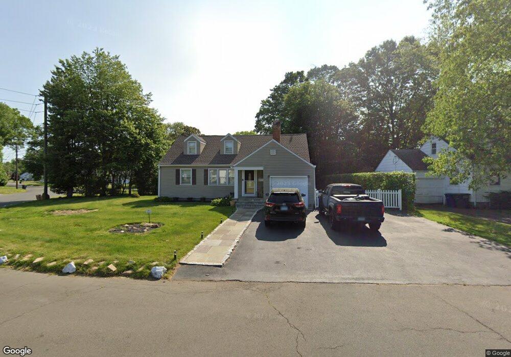
55 Nutmeg Rd Bridgeport, CT 06610
North Bridgeport NeighborhoodEstimated Value: $403,000 - $417,000
4
Beds
2
Baths
1,768
Sq Ft
$234/Sq Ft
Est. Value
About This Home
This home is located at 55 Nutmeg Rd, Bridgeport, CT 06610 and is currently estimated at $413,108, approximately $233 per square foot. 55 Nutmeg Rd is a home located in Fairfield County with nearby schools including Hooker School, Harding High School, and Achievement First Bridgeport Academy Elementary School.
Ownership History
Date
Name
Owned For
Owner Type
Purchase Details
Closed on
Apr 8, 2025
Sold by
Brown Travis L and Brown Maritza
Bought by
Travis L Brown T L and Travis Brown
Current Estimated Value
Purchase Details
Closed on
Oct 22, 1999
Sold by
Deriso Patricia M
Bought by
Brown Travis L and Brown Poindexter-Brown M
Create a Home Valuation Report for This Property
The Home Valuation Report is an in-depth analysis detailing your home's value as well as a comparison with similar homes in the area
Home Values in the Area
Average Home Value in this Area
Purchase History
| Date | Buyer | Sale Price | Title Company |
|---|---|---|---|
| Travis L Brown T L | -- | None Available | |
| Travis L Brown T L | -- | None Available | |
| Brown Travis L | $135,000 | -- | |
| Brown Travis L | $135,000 | -- |
Source: Public Records
Mortgage History
| Date | Status | Borrower | Loan Amount |
|---|---|---|---|
| Previous Owner | Brown Travis L | $15,000 | |
| Previous Owner | Brown Travis L | $236,000 | |
| Previous Owner | Brown Travis L | $153,000 | |
| Previous Owner | Brown Travis L | $23,000 |
Source: Public Records
Tax History Compared to Growth
Tax History
| Year | Tax Paid | Tax Assessment Tax Assessment Total Assessment is a certain percentage of the fair market value that is determined by local assessors to be the total taxable value of land and additions on the property. | Land | Improvement |
|---|---|---|---|---|
| 2025 | $6,964 | $160,280 | $64,670 | $95,610 |
| 2024 | $6,964 | $160,280 | $64,670 | $95,610 |
| 2023 | $6,964 | $160,280 | $64,670 | $95,610 |
| 2022 | $6,964 | $160,280 | $64,670 | $95,610 |
| 2021 | $6,964 | $160,280 | $64,670 | $95,610 |
| 2020 | $6,933 | $128,410 | $53,050 | $75,360 |
| 2019 | $6,933 | $128,410 | $53,050 | $75,360 |
| 2018 | $6,982 | $128,410 | $53,050 | $75,360 |
| 2017 | $6,982 | $128,410 | $53,050 | $75,360 |
| 2016 | $6,982 | $128,410 | $53,050 | $75,360 |
| 2015 | $5,992 | $141,990 | $51,860 | $90,130 |
| 2014 | $5,992 | $141,990 | $51,860 | $90,130 |
Source: Public Records
Map
Nearby Homes
- 50 Pilgrim Rd
- 165 Nutmeg Rd
- 197 Dupont Place Unit 199
- 53 Beverly Dr
- 275 Roger Williams Rd
- 374 Mapledale Place
- 123 Beverly Dr
- 206 Huntington Turnpike
- 69 Glen Cir
- 120 Huntington Turnpike Unit 202
- 120 Huntington Turnpike Unit 606
- 120 Huntington Turnpike Unit 801
- 132 Virginia Ave Unit 132
- 94 Virginia Ave Unit 94
- 11 Nob Hill Cir
- 33 Louisiana Ave Unit 35
- 217 Hillcrest Rd
- 250 Dayton Rd
- 2463 E Main St
- 3699 Broadbridge Ave Unit 107