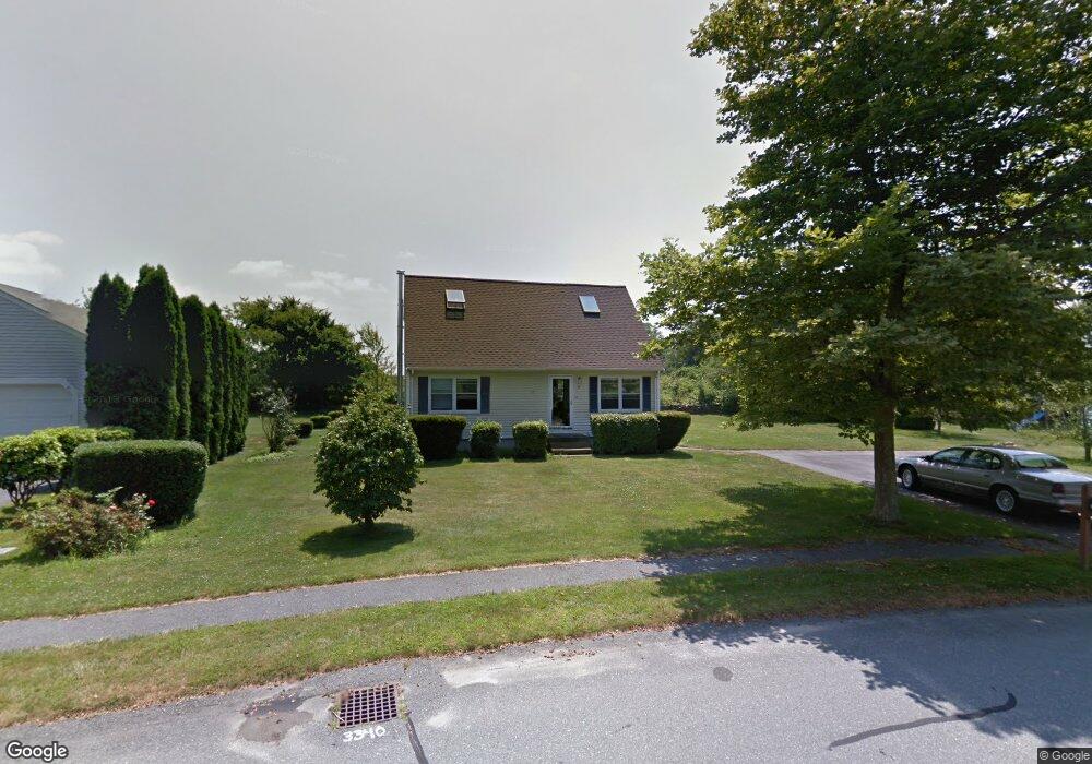
55 Pasture Farm Dr Middletown, RI 02842
Estimated Value: $586,000 - $753,000
3
Beds
2
Baths
1,510
Sq Ft
$436/Sq Ft
Est. Value
About This Home
This home is located at 55 Pasture Farm Dr, Middletown, RI 02842 and is currently estimated at $658,474, approximately $436 per square foot. 55 Pasture Farm Dr is a home located in Newport County with nearby schools including Middletown High School and All Saints STEAM Academy.
Ownership History
Date
Name
Owned For
Owner Type
Purchase Details
Closed on
Feb 7, 2014
Sold by
Britton Vickie L and Britton Daniel A
Bought by
Vickie L Britton Lt
Current Estimated Value
Purchase Details
Closed on
Aug 17, 2000
Sold by
Shupe Larisa L
Bought by
Britton Daniel A and Britton Vickie
Purchase Details
Closed on
Jul 25, 1997
Sold by
Wood Kevin D and Wood Lisa
Bought by
Shupe Larisa L
Purchase Details
Closed on
Aug 6, 1991
Sold by
West Meadow Ptnrshp
Bought by
Wood Kevin
Create a Home Valuation Report for This Property
The Home Valuation Report is an in-depth analysis detailing your home's value as well as a comparison with similar homes in the area
Home Values in the Area
Average Home Value in this Area
Purchase History
| Date | Buyer | Sale Price | Title Company |
|---|---|---|---|
| Vickie L Britton Lt | -- | -- | |
| Britton Daniel A | $174,500 | -- | |
| Shupe Larisa L | $128,000 | -- | |
| Wood Kevin | $110,000 | -- |
Source: Public Records
Mortgage History
| Date | Status | Borrower | Loan Amount |
|---|---|---|---|
| Previous Owner | Wood Kevin | $15,000 | |
| Previous Owner | Wood Kevin | $185,000 |
Source: Public Records
Tax History Compared to Growth
Tax History
| Year | Tax Paid | Tax Assessment Tax Assessment Total Assessment is a certain percentage of the fair market value that is determined by local assessors to be the total taxable value of land and additions on the property. | Land | Improvement |
|---|---|---|---|---|
| 2024 | $6,075 | $539,500 | $316,300 | $223,200 |
| 2023 | $4,736 | $376,200 | $204,100 | $172,100 |
| 2022 | $4,522 | $376,200 | $204,100 | $172,100 |
| 2021 | $4,522 | $376,200 | $204,100 | $172,100 |
| 2020 | $4,169 | $303,000 | $150,900 | $152,100 |
| 2018 | $4,166 | $303,000 | $150,900 | $152,100 |
| 2016 | $4,210 | $273,000 | $126,500 | $146,500 |
| 2015 | $4,106 | $273,000 | $126,500 | $146,500 |
| 2014 | $4,254 | $264,700 | $115,000 | $149,700 |
| 2013 | $4,158 | $264,700 | $115,000 | $149,700 |
Source: Public Records
Map
Nearby Homes
- 188 Greene Ln
- 18 J h Dwyer Dr
- 19 Cows Path Rd
- 68 Rebels Way
- 0 0 Revolution Freedom Dr
- 138 Rebels Way
- 278 Freedom Trail Dr
- 280 Freedom Trail Dr
- 286 Freedom Trail Dr
- 288 Freedom Trail Dr
- 290 Freedom Trail Dr
- 711 Union St
- 481 Oliphant Ln
- 836 Forest Park
- 841 Forest Park
- 521 Forest Park
- 529 Forest Park
- 533 Forest Park
- 1216 E Main Rd
- 134 E Main Rd
- 67 Pasture Farm Dr
- 43 Pasture Farm Dr
- 22 Pasture Farm Dr
- 33 Pasture Farm Dr
- 1785 W Main Rd
- 21 Pasture Farm Dr
- 1777 W Main Rd
- 90 Pasture Farm Dr
- 1769 W Main Rd
- 1837 W Main Rd
- 1796 W Main Rd
- 1782 W Main Rd
- 1778 W Main Rd
- 61 John Kesson Ln
- 17 Thelma Ln Unit 22
- 18 Busher Dr
- 104 Pasture Farm Dr
- 1776 W Main Rd
- 8 Busher Dr
- 28 Busher Dr