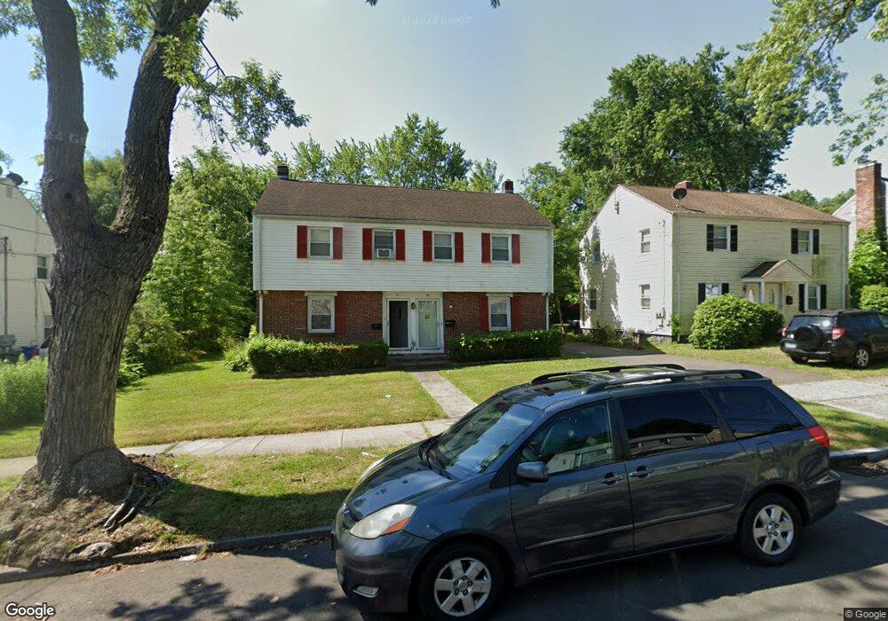
55 Pershing St Unit 57 Hartford, CT 06112
Blue Hills NeighborhoodEstimated Value: $284,000 - $375,000
6
Beds
2
Baths
1,938
Sq Ft
$170/Sq Ft
Est. Value
About This Home
This home is located at 55 Pershing St Unit 57, Hartford, CT 06112 and is currently estimated at $328,611, approximately $169 per square foot. 55 Pershing St Unit 57 is a home located in Hartford County with nearby schools including Rawson School, Noah Webster Micro Society School, and McKinley School.
Ownership History
Date
Name
Owned For
Owner Type
Purchase Details
Closed on
Jan 2, 2004
Sold by
Edwards Geoffrey and Edwards Duzlin
Bought by
Davis Penelope
Current Estimated Value
Home Financials for this Owner
Home Financials are based on the most recent Mortgage that was taken out on this home.
Original Mortgage
$133,900
Outstanding Balance
$61,960
Interest Rate
5.86%
Mortgage Type
Purchase Money Mortgage
Estimated Equity
$266,651
Create a Home Valuation Report for This Property
The Home Valuation Report is an in-depth analysis detailing your home's value as well as a comparison with similar homes in the area
Home Values in the Area
Average Home Value in this Area
Purchase History
| Date | Buyer | Sale Price | Title Company |
|---|---|---|---|
| Davis Penelope | $135,000 | -- |
Source: Public Records
Mortgage History
| Date | Status | Borrower | Loan Amount |
|---|---|---|---|
| Open | Davis Penelope | $133,900 |
Source: Public Records
Tax History Compared to Growth
Tax History
| Year | Tax Paid | Tax Assessment Tax Assessment Total Assessment is a certain percentage of the fair market value that is determined by local assessors to be the total taxable value of land and additions on the property. | Land | Improvement |
|---|---|---|---|---|
| 2025 | $4,784 | $69,384 | $5,843 | $63,541 |
| 2024 | $4,784 | $69,384 | $5,843 | $63,541 |
| 2023 | $4,784 | $69,384 | $5,843 | $63,541 |
| 2022 | $4,784 | $69,384 | $5,843 | $63,541 |
| 2021 | $3,747 | $50,435 | $6,965 | $43,470 |
| 2020 | $3,747 | $50,435 | $6,965 | $43,470 |
| 2019 | $3,747 | $50,435 | $6,965 | $43,470 |
| 2018 | $3,621 | $48,735 | $6,731 | $42,004 |
| 2016 | $3,742 | $50,376 | $6,409 | $43,967 |
| 2015 | $3,565 | $47,984 | $6,106 | $41,878 |
| 2014 | $3,478 | $46,811 | $5,957 | $40,854 |
Source: Public Records
Map
Nearby Homes
- 10 Baltic St Unit 12
- 36 Baltic St Unit 38
- 11 Pershing St Unit 13
- 97 Boothbay St
- 125 Lebanon St Unit 127
- 97 E Burnham St
- 117 E Harold St
- 77 Harold St
- 175 E Pershing St
- 70 Burnham St Unit 72
- 86 Hartland St
- 355 Cornwall St Unit 357
- 90 Manchester St
- 30 Harding Ave
- 13 Patton Rd
- 67 Elizabeth Ave
- 218 Holcomb St Unit 220
- 211 Holcomb St Unit 213
- 147 Morningside St W
- 83 Colebrook St Unit 85
- 51 Pershing St Unit 53
- 97 Pershing St
- 61 Pershing St Unit 63
- 49 Pershing St
- 52 Pershing St Unit 54
- 56 Pershing St Unit 58
- 48 Pershing St Unit 50
- 62 Pershing St Unit 64
- 67 Pershing St
- 50 Lebanon St Unit 52
- 71 Pershing St Unit 73
- 52 Lebanon St
- 44 Lebanon St Unit 46
- 16 Baltic St Unit 18
- 68 Pershing St Unit 70
- 60 Lebanon St Unit 62
- 40 Lebanon St Unit 42
- 10-12 Baltic St
- 40-42 Lebanon St Unit 42
- 22 Baltic St Unit 24