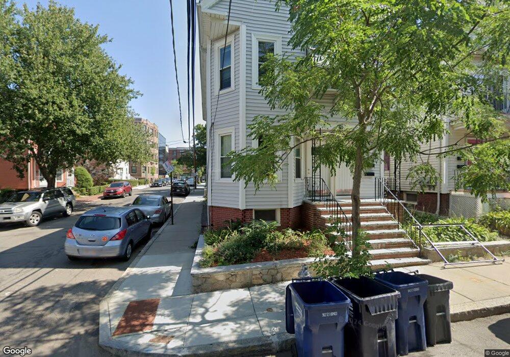
55 Porter Rd Cambridge, MA 02140
North Cambridge NeighborhoodEstimated Value: $1,180,000 - $1,771,317
5
Beds
2
Baths
2,474
Sq Ft
$617/Sq Ft
Est. Value
About This Home
-Available May 1st!!
-2 Bedroom 1 Bathroom
-Cambridge (Porter Square)
-Coin op Laundry In adjacent building
-Dishwasher
-Hardwood Floors
-One Tandem parking space included
-Private Porch
**Broker Fee due upon approval**
Ownership History
Date
Name
Owned For
Owner Type
Purchase Details
Closed on
Aug 30, 1989
Sold by
Hynes Kenneth
Bought by
Shahid Robin
Current Estimated Value
Home Financials for this Owner
Home Financials are based on the most recent Mortgage that was taken out on this home.
Original Mortgage
$222,300
Interest Rate
9.7%
Mortgage Type
Purchase Money Mortgage
Create a Home Valuation Report for This Property
The Home Valuation Report is an in-depth analysis detailing your home's value as well as a comparison with similar homes in the area
Home Values in the Area
Average Home Value in this Area
Purchase History
| Date | Buyer | Sale Price | Title Company |
|---|---|---|---|
| Shahid Robin | $247,000 | -- | |
| Shahid Robin | $247,000 | -- |
Source: Public Records
Mortgage History
| Date | Status | Borrower | Loan Amount |
|---|---|---|---|
| Closed | Shahid Robin | $222,300 |
Source: Public Records
Property History
| Date | Event | Price | List to Sale | Price per Sq Ft |
|---|---|---|---|---|
| 11/29/2024 11/29/24 | Off Market | $3,500 | -- | -- |
| 10/01/2024 10/01/24 | For Rent | $3,500 | -- | -- |
Tax History Compared to Growth
Tax History
| Year | Tax Paid | Tax Assessment Tax Assessment Total Assessment is a certain percentage of the fair market value that is determined by local assessors to be the total taxable value of land and additions on the property. | Land | Improvement |
|---|---|---|---|---|
| 2025 | $9,219 | $1,451,800 | $614,200 | $837,600 |
| 2024 | $8,699 | $1,469,400 | $663,200 | $806,200 |
| 2023 | $8,116 | $1,385,000 | $678,200 | $706,800 |
| 2022 | $7,799 | $1,317,400 | $679,300 | $638,100 |
| 2021 | $7,480 | $1,278,700 | $664,800 | $613,900 |
| 2020 | $7,248 | $1,260,500 | $658,300 | $602,200 |
| 2019 | $6,757 | $1,137,600 | $571,100 | $566,500 |
| 2018 | $6,627 | $1,053,500 | $529,000 | $524,500 |
| 2017 | $6,504 | $1,002,200 | $505,000 | $497,200 |
| 2016 | $6,275 | $897,700 | $435,800 | $461,900 |
| 2015 | $5,865 | $750,000 | $342,700 | $407,300 |
| 2014 | $5,439 | $649,000 | $285,500 | $363,500 |
Source: Public Records
Map
Nearby Homes
- 1 Richdale Ave Unit 2
- 7 Beech St Unit 319
- 7 Beech St Unit 211
- 24 Cambridge Terrace Unit 2
- 32-40 White St
- 8 Cogswell Ave
- 3 Arlington St Unit 52
- 22 Agassiz St
- 12 Rindge Ave Unit 1
- 86 Avon Hill St
- 353 Summer St Unit 310
- 15-15A Forest St
- 749 Somerville Ave Unit 1
- 12 Windsor Rd Unit 1
- 79 Willow Ave
- 371 Highland Ave
- 3 Fairlee St
- 34 Day St
- 43 Linnaean St Unit 42
- 8 Craigie St
- 55 Porter Rd
- 51 Porter Rd
- 53 Porter Rd Unit A
- 55 Porter Rd Unit 3
- 53 Porter Rd Unit 53 Porter Rd
- 53 Porter Rd Unit T
- 51 Porter Rd Unit T
- 53 Porter Rd Unit 53-1
- 53 Porter Rd Unit 1
- 53 Porter Rd
- 55 Porter Rd Unit 1
- 51 Porter Rd Unit 1
- 55 Porter Rd Unit 55 Porter Rd
- 51 Porter Rd
- 51 Porter Rd Unit 2
- 53 Porter Rd
- 53 Porter Rd Unit 2
- 53 Porter Rd Unit o
- 49 Porter Rd
- 49 Porter Rd Unit 1