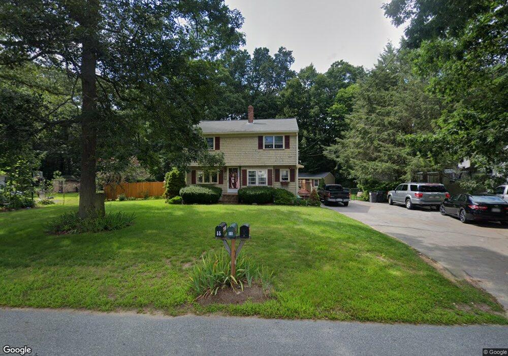
55 Power St Norton, MA 02766
Estimated Value: $522,607 - $623,000
3
Beds
2
Baths
1,568
Sq Ft
$355/Sq Ft
Est. Value
About This Home
This home is located at 55 Power St, Norton, MA 02766 and is currently estimated at $556,902, approximately $355 per square foot. 55 Power St is a home located in Bristol County with nearby schools including J.C. Solmonese Elementary School, Henri A. Yelle Elementary School, and Norton Middle School.
Ownership History
Date
Name
Owned For
Owner Type
Purchase Details
Closed on
May 22, 1998
Sold by
Keene Guy M and Keene Laura G
Bought by
Mclaughlin Scott and Mclaughlin Melissa
Current Estimated Value
Home Financials for this Owner
Home Financials are based on the most recent Mortgage that was taken out on this home.
Original Mortgage
$156,900
Interest Rate
7.03%
Mortgage Type
Purchase Money Mortgage
Purchase Details
Closed on
Jun 19, 1987
Sold by
Vacher Ernest C Est
Bought by
Keene Guy M
Create a Home Valuation Report for This Property
The Home Valuation Report is an in-depth analysis detailing your home's value as well as a comparison with similar homes in the area
Home Values in the Area
Average Home Value in this Area
Purchase History
| Date | Buyer | Sale Price | Title Company |
|---|---|---|---|
| Mclaughlin Scott | $172,600 | -- | |
| Keene Guy M | $108,000 | -- |
Source: Public Records
Mortgage History
| Date | Status | Borrower | Loan Amount |
|---|---|---|---|
| Open | Keene Guy M | $151,000 | |
| Closed | Keene Guy M | $156,900 |
Source: Public Records
Tax History Compared to Growth
Tax History
| Year | Tax Paid | Tax Assessment Tax Assessment Total Assessment is a certain percentage of the fair market value that is determined by local assessors to be the total taxable value of land and additions on the property. | Land | Improvement |
|---|---|---|---|---|
| 2025 | $53 | $410,900 | $181,200 | $229,700 |
| 2024 | $5,070 | $391,500 | $172,600 | $218,900 |
| 2023 | $4,800 | $369,500 | $162,800 | $206,700 |
| 2022 | $4,660 | $326,800 | $148,000 | $178,800 |
| 2021 | $4,454 | $298,300 | $140,900 | $157,400 |
| 2020 | $4,289 | $289,800 | $136,800 | $153,000 |
| 2019 | $4,188 | $281,100 | $131,600 | $149,500 |
| 2018 | $4,149 | $273,700 | $131,600 | $142,100 |
| 2017 | $4,078 | $265,300 | $131,600 | $133,700 |
| 2016 | $3,957 | $253,500 | $131,600 | $121,900 |
| 2015 | $3,874 | $251,700 | $129,000 | $122,700 |
| 2014 | $3,689 | $240,000 | $122,900 | $117,100 |
Source: Public Records
Map
Nearby Homes
- 145 S Worcester St
- 170 S Worcester St Unit 3
- 178 S Worcester St
- 108 S Worcester St
- 225 S Worcester St Unit 1
- 225 S Worcester St Unit 2
- 75 Barrows St
- 16 Park Ln
- 182 John Scott Blvd
- 53 Sturdy St
- 55 Sturdy St
- 38 Danielle St
- 48 Dean St
- 127 John Scott Blvd
- 125 John Scott Blvd
- 4 Colonial Dr Unit 4
- 3 Lloyd Cir Unit 43
- 20 Lloyd Cir Unit 32
- 18 Lloyd Cir Unit 31
- 14 Lloyd Cir Unit 29