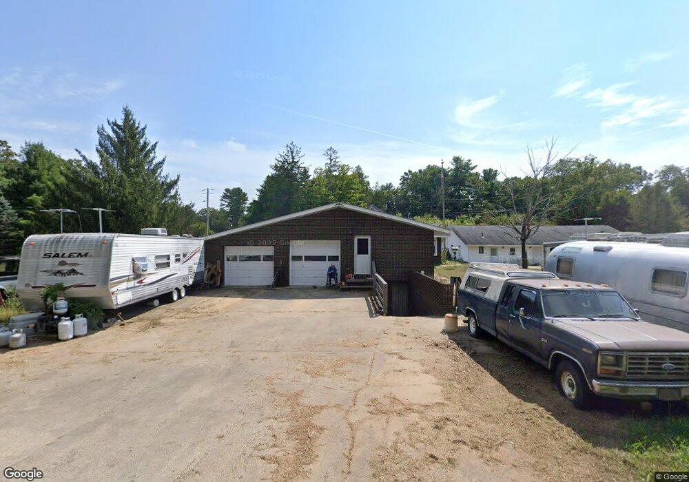
55 River Rd Haddam, CT 06438
Estimated Value: $530,000 - $698,000
4
Beds
4
Baths
2,654
Sq Ft
$237/Sq Ft
Est. Value
About This Home
This home is located at 55 River Rd, Haddam, CT 06438 and is currently estimated at $629,508, approximately $237 per square foot. 55 River Rd is a home located in Middlesex County with nearby schools including Haddam-Killingworth High School.
Ownership History
Date
Name
Owned For
Owner Type
Purchase Details
Closed on
Jul 6, 2020
Sold by
Holt Mack
Bought by
Holt Mack and Holt Mingyin L
Current Estimated Value
Purchase Details
Closed on
Oct 22, 2008
Sold by
Holt Michelle M and Holt Glenn H
Bought by
Holt Mack
Home Financials for this Owner
Home Financials are based on the most recent Mortgage that was taken out on this home.
Original Mortgage
$175,000
Interest Rate
5.83%
Create a Home Valuation Report for This Property
The Home Valuation Report is an in-depth analysis detailing your home's value as well as a comparison with similar homes in the area
Home Values in the Area
Average Home Value in this Area
Purchase History
| Date | Buyer | Sale Price | Title Company |
|---|---|---|---|
| Holt Mack | -- | None Available | |
| Holt Mack | $100,000 | -- |
Source: Public Records
Mortgage History
| Date | Status | Borrower | Loan Amount |
|---|---|---|---|
| Previous Owner | Holt Mack | $175,000 | |
| Previous Owner | Holt Mack | $80,000 | |
| Previous Owner | Holt Mack | $90,000 |
Source: Public Records
Tax History
| Year | Tax Paid | Tax Assessment Tax Assessment Total Assessment is a certain percentage of the fair market value that is determined by local assessors to be the total taxable value of land and additions on the property. | Land | Improvement |
|---|---|---|---|---|
| 2025 | $10,725 | $312,220 | $63,000 | $249,220 |
| 2024 | $10,725 | $312,220 | $63,000 | $249,220 |
| 2023 | $10,575 | $312,220 | $63,000 | $249,220 |
| 2022 | $10,094 | $312,220 | $63,000 | $249,220 |
| 2021 | $10,041 | $312,220 | $63,000 | $249,220 |
| 2020 | $10,838 | $341,990 | $73,260 | $268,730 |
| 2019 | $10,838 | $341,990 | $73,260 | $268,730 |
| 2018 | $10,838 | $341,990 | $73,260 | $268,730 |
| 2017 | $10,838 | $341,990 | $73,260 | $268,730 |
| 2016 | $10,670 | $341,990 | $73,260 | $268,730 |
| 2015 | $9,585 | $307,210 | $73,260 | $233,950 |
| 2014 | $9,490 | $307,210 | $73,260 | $233,950 |
Source: Public Records
Map
Nearby Homes
- 77 Main St
- 86 Main St
- 32 Porges Rd
- 2 Morgan Ln
- 1572 Saybrook Rd
- 23 Main St
- 0 Plains Rd Unit 24163414
- 5 Brooke Hill Rd
- 10 Ridge Rd
- 10 Highland Ave
- 195A Injun Hollow Rd
- 0 Saybrook Rd
- 56 Neptune Ave
- 5 Joe Williams Rd
- 53 Shanaghans Rd
- 114 Walkley Hill Rd
- 0 Turkey Hill Rd
- 5 Pinehurst Ln Unit 5
- 18 Augusta Cir
- 0 Swain Johnson Trail Unit 2
- 47 River Rd
- 56 River Rd
- 57 Rutty Ferry Rd
- 65 Rutty Ferry Rd
- 43 River Rd
- 8 Haddam View Heights
- 15 Haddam View Heights
- 14 Haddam View Heights
- 37 River Rd
- 20 Haddam View Heights
- Lot 19 Haddam Ridge
- 31 River Rd
- 32 Rutty Ferry Rd
- 19 Haddam View Heights
- 34 River Rd
- 59 Haddam View Heights Unit HEIGHTS
- Lot 24 Haddam Ridge
- 24 Haddam View Heights
- 24 River Rd
- 26 Rutty Ferry Rd
Your Personal Tour Guide
Ask me questions while you tour the home.