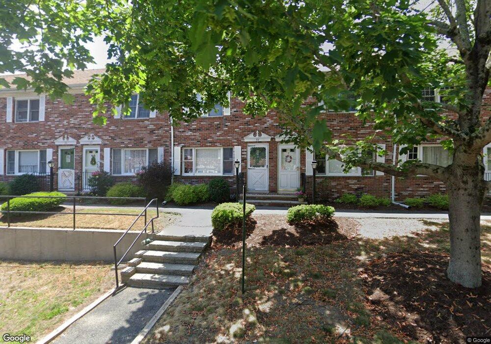
55 Robins St East Bridgewater, MA 02333
Estimated Value: $363,000 - $398,000
2
Beds
2
Baths
1,088
Sq Ft
$350/Sq Ft
Est. Value
About This Home
This home is located at 55 Robins St, East Bridgewater, MA 02333 and is currently estimated at $380,747, approximately $349 per square foot. 55 Robins St is a home located in Plymouth County with nearby schools including Gordon W Mitchell Middle School and East Bridgewater Jr./Sr. High School.
Ownership History
Date
Name
Owned For
Owner Type
Purchase Details
Closed on
Oct 27, 2006
Sold by
Robins Street Nt
Bought by
Chandler Amy J
Current Estimated Value
Home Financials for this Owner
Home Financials are based on the most recent Mortgage that was taken out on this home.
Original Mortgage
$200,450
Outstanding Balance
$120,359
Interest Rate
6.48%
Mortgage Type
Purchase Money Mortgage
Estimated Equity
$260,388
Purchase Details
Closed on
May 8, 1996
Sold by
Oleary Timothy P and Oleary Karen A
Bought by
Cugini Donald J
Purchase Details
Closed on
Jun 19, 1989
Sold by
Minsk Michael S
Bought by
Oleary Timothy P
Home Financials for this Owner
Home Financials are based on the most recent Mortgage that was taken out on this home.
Original Mortgage
$73,150
Interest Rate
10.87%
Mortgage Type
Purchase Money Mortgage
Create a Home Valuation Report for This Property
The Home Valuation Report is an in-depth analysis detailing your home's value as well as a comparison with similar homes in the area
Home Values in the Area
Average Home Value in this Area
Purchase History
| Date | Buyer | Sale Price | Title Company |
|---|---|---|---|
| Chandler Amy J | $211,000 | -- | |
| Cugini Donald J | $52,000 | -- | |
| Oleary Timothy P | $104,500 | -- |
Source: Public Records
Mortgage History
| Date | Status | Borrower | Loan Amount |
|---|---|---|---|
| Open | Oleary Timothy P | $200,450 | |
| Previous Owner | Oleary Timothy P | $125,000 | |
| Previous Owner | Oleary Timothy P | $73,150 |
Source: Public Records
Tax History Compared to Growth
Tax History
| Year | Tax Paid | Tax Assessment Tax Assessment Total Assessment is a certain percentage of the fair market value that is determined by local assessors to be the total taxable value of land and additions on the property. | Land | Improvement |
|---|---|---|---|---|
| 2025 | $4,127 | $301,900 | $0 | $301,900 |
| 2024 | $3,961 | $286,200 | $0 | $286,200 |
| 2023 | $3,719 | $257,400 | $0 | $257,400 |
| 2022 | $3,508 | $224,900 | $0 | $224,900 |
| 2021 | $3,425 | $200,900 | $0 | $200,900 |
| 2020 | $3,391 | $196,100 | $0 | $196,100 |
| 2019 | $3,184 | $181,300 | $0 | $181,300 |
| 2018 | $2,972 | $165,500 | $0 | $165,500 |
| 2017 | $2,628 | $143,600 | $0 | $143,600 |
| 2016 | $2,533 | $139,500 | $0 | $139,500 |
| 2015 | $2,604 | $146,600 | $0 | $146,600 |
| 2014 | $2,526 | $145,400 | $0 | $145,400 |
Source: Public Records
Map
Nearby Homes
- 1 Robins St Unit 1
- 96 Trailwood Dr
- 24 High Pond Dr
- 67 Country Dr
- 1993 Washington St
- 23 Stone Meadow Dr
- 148 Lot 1a Elm St
- 1 Lamppost Dr
- 114 Plain St
- 10 Eliab Latham Way
- 74 Magnolia Way
- Lot 1 Mill St
- 780 Old Plymouth St
- 2 Lydon Ln Unit A1
- 0 Three Rivers Dr
- 4 Sycamore Ln
- 477 Cherry St
- 199 Cherry St
- 865 Plymouth St Unit 865
- 26 Old Summit St
- 63 Robins St
- 61 Robins St
- 59 Robins St
- 57 Robins St
- 53 Robins St
- 51 Robins St
- 49 Robins St
- 63 Robins St Unit 63*
- 74 Robins St
- 96 Robins St
- 10 Douglas Dr
- 6 Douglas Dr
- 2 Douglas Dr
- 10 Douglas Dr Unit 10
- 10 Douglas Dr Unit 10,10
- 2 Douglas Dr Unit 2
- 14 Douglas Dr
- 8 Douglas Dr
- 4 Douglas Dr
- 4 Douglas Dr Unit 4