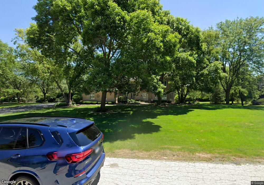
55 Rusty Rd Lemont, IL 60439
Hastings NeighborhoodEstimated Value: $967,908 - $1,349,000
4
Beds
3
Baths
4,900
Sq Ft
$230/Sq Ft
Est. Value
About This Home
This home is located at 55 Rusty Rd, Lemont, IL 60439 and is currently estimated at $1,126,977, approximately $229 per square foot. 55 Rusty Rd is a home located in Cook County with nearby schools including Oakwood School, River Valley School, and Old Quarry Middle School.
Ownership History
Date
Name
Owned For
Owner Type
Purchase Details
Closed on
May 24, 2007
Sold by
Furlong Robert and Furlong Debra
Bought by
Furlong Robert J and Furlong Debra D
Current Estimated Value
Purchase Details
Closed on
Jun 7, 2001
Sold by
Sigman John
Bought by
Furlong Robert and Furlong Debra
Home Financials for this Owner
Home Financials are based on the most recent Mortgage that was taken out on this home.
Original Mortgage
$625,000
Outstanding Balance
$222,981
Interest Rate
6.75%
Estimated Equity
$903,996
Create a Home Valuation Report for This Property
The Home Valuation Report is an in-depth analysis detailing your home's value as well as a comparison with similar homes in the area
Home Values in the Area
Average Home Value in this Area
Purchase History
| Date | Buyer | Sale Price | Title Company |
|---|---|---|---|
| Furlong Robert J | -- | None Available | |
| Furlong Robert | $835,000 | -- |
Source: Public Records
Mortgage History
| Date | Status | Borrower | Loan Amount |
|---|---|---|---|
| Open | Furlong Robert | $625,000 |
Source: Public Records
Tax History
| Year | Tax Paid | Tax Assessment Tax Assessment Total Assessment is a certain percentage of the fair market value that is determined by local assessors to be the total taxable value of land and additions on the property. | Land | Improvement |
|---|---|---|---|---|
| 2025 | $12,186 | $66,179 | $17,668 | $48,511 |
| 2024 | $12,186 | $66,179 | $17,668 | $48,511 |
| 2023 | $14,938 | $72,000 | $17,668 | $54,332 |
| 2022 | $14,938 | $69,732 | $14,950 | $54,782 |
| 2021 | $15,319 | $73,332 | $14,949 | $58,383 |
| 2020 | $15,588 | $73,332 | $14,949 | $58,383 |
| 2019 | $14,403 | $70,221 | $14,949 | $55,272 |
| 2018 | $14,178 | $70,221 | $14,949 | $55,272 |
| 2017 | $14,761 | $73,847 | $14,949 | $58,898 |
| 2016 | $12,175 | $57,859 | $12,231 | $45,628 |
| 2015 | $13,214 | $61,672 | $12,231 | $49,441 |
| 2014 | $13,951 | $64,190 | $12,231 | $51,959 |
| 2013 | $12,688 | $62,260 | $12,231 | $50,029 |
Source: Public Records
Map
Nearby Homes
- 11250 Dineff Rd
- 12876 Rosa Ln
- 11289 Tuscany Ln
- 12843 Collina Ln
- 12890 Collina Ln
- 12879 Collina Ln
- 11166 Tuscany Ln
- 11158 Tuscany Ln
- 11120 Tuscany Ct
- 11130 Tuscany Ct
- 11201 Archer Ave
- 12970 Mccarthy Rd
- 12426 Conneely Ct
- 12462 Killarney Dr
- 12486 Killarney Dr
- 12644 Derry Dr Unit 34201
- 12420 Eileen St
- 12460 Portrush Ln
- 12440 Portrush Ln
- 12444 Portrush Ln Unit 31601
- 57 Rusty Rd
- 53 Rusty Rd
- 54 Stone Creek Dr
- 58 Stone Creek Dr
- 10 Clearview Ct
- 59 Rusty Rd
- 51 Rusty Rd
- 60 Stone Creek Dr
- 1 Clearview Ct
- 60 Rusty Rd
- 50 Stone Creek Dr
- 9 Clearview Ct
- 2 Clearview Ct
- 55 Stone Creek Dr
- 57 Stone Creek Dr
- 22 115th St
- 53 Stone Creek Dr
- 59 Stone Creek Dr
- 49 Rusty Rd
- 8 Clearview Ct
Your Personal Tour Guide
Ask me questions while you tour the home.