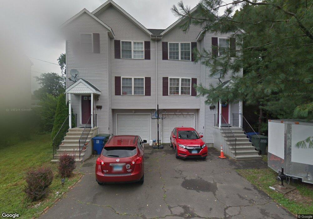
55 Saint Andrews St Bridgeport, CT 06610
Estimated Value: $388,000 - $427,000
3
Beds
2
Baths
1,332
Sq Ft
$304/Sq Ft
Est. Value
About This Home
This home is located at 55 Saint Andrews St, Bridgeport, CT 06610 and is currently estimated at $404,809, approximately $303 per square foot. 55 Saint Andrews St is a home located in Fairfield County with nearby schools including Hall School and Harding High School.
Ownership History
Date
Name
Owned For
Owner Type
Purchase Details
Closed on
Nov 19, 2004
Sold by
Pillai Radhakrishna and Pillai Arthi
Bought by
Moyano Marco and Ricaurte Martha
Current Estimated Value
Purchase Details
Closed on
May 30, 2002
Sold by
Saint Andrews Est Llc
Bought by
Pillai Radhakrishna and Pillai Arthi
Home Financials for this Owner
Home Financials are based on the most recent Mortgage that was taken out on this home.
Original Mortgage
$164,800
Interest Rate
7%
Create a Home Valuation Report for This Property
The Home Valuation Report is an in-depth analysis detailing your home's value as well as a comparison with similar homes in the area
Home Values in the Area
Average Home Value in this Area
Purchase History
| Date | Buyer | Sale Price | Title Company |
|---|---|---|---|
| Moyano Marco | $225,000 | -- | |
| Pillai Radhakrishna | $169,900 | -- |
Source: Public Records
Mortgage History
| Date | Status | Borrower | Loan Amount |
|---|---|---|---|
| Previous Owner | Pillai Radhakrishna | $169,000 | |
| Previous Owner | Pillai Radhakrishna | $164,800 |
Source: Public Records
Tax History Compared to Growth
Tax History
| Year | Tax Paid | Tax Assessment Tax Assessment Total Assessment is a certain percentage of the fair market value that is determined by local assessors to be the total taxable value of land and additions on the property. | Land | Improvement |
|---|---|---|---|---|
| 2025 | $6,461 | $160,720 | $55,930 | $104,790 |
| 2024 | $6,461 | $160,720 | $55,930 | $104,790 |
| 2023 | $6,461 | $160,720 | $55,930 | $104,790 |
| 2022 | $6,342 | $160,720 | $55,930 | $104,790 |
| 2021 | $6,344 | $160,720 | $55,930 | $104,790 |
| 2020 | $6,371 | $160,720 | $55,930 | $104,790 |
| 2019 | $4,432 | $111,150 | $33,310 | $77,840 |
| 2018 | $4,435 | $111,150 | $33,310 | $77,840 |
| 2017 | $4,443 | $111,150 | $33,310 | $77,840 |
| 2016 | $4,334 | $111,150 | $33,310 | $77,840 |
| 2015 | $4,110 | $111,150 | $33,310 | $77,840 |
| 2014 | $4,898 | $137,480 | $36,820 | $100,660 |
Source: Public Records
Map
Nearby Homes
- 69 Weber Ave
- 216 Clover St
- 290 N Bishop Bishop Ave Unit 12
- 561 Canaan Rd
- 260 Success Ave Unit 21
- 295 N Bishop Bld 92 Ave Unit 13
- 401 Granfield Ave Unit 2
- 3 Granfield Ave
- 102 Bowe Ave
- 357 Granfield Ave Unit B
- 361 Granfield Ave Unit Bldg 8, A
- 744 Canaan Rd Unit 23
- 14 Court a
- 1922 Boston Ave Unit 1924
- 88 Bdlg 84 Canaan Ct Unit 11
- 127 Canaan Ct Unit 13 Building 82
- 440 Success Ave Unit BLDG-86, APT-18
- 652 Bishop Ave Unit 656
- 2152 Barnum Ave
- 117 Canaan Ct Unit Bld 81, 18
- 25 Saint Andrews St
- 15 Saint Andrews St
- 35 Saint Andrews St
- 45 Saint Andrews St
- 45 Saint Andrews St Unit ANDREWS
- 180 Weber Ave
- 192 Weber Ave
- 30 Saint Andrews St
- 45 Saint Andrews St
- 10 Saint Andrews St
- 55 St Andrews St
- 146 Weber Ave
- 50 Saint Andrews St
- 40 Saint Andrews St
- 169 Weber Ave
- 153 Weber Ave
- 179 Weber Ave Unit 181
- 189 Weber Ave
- 91 Pond St
- 210 Weber Ave