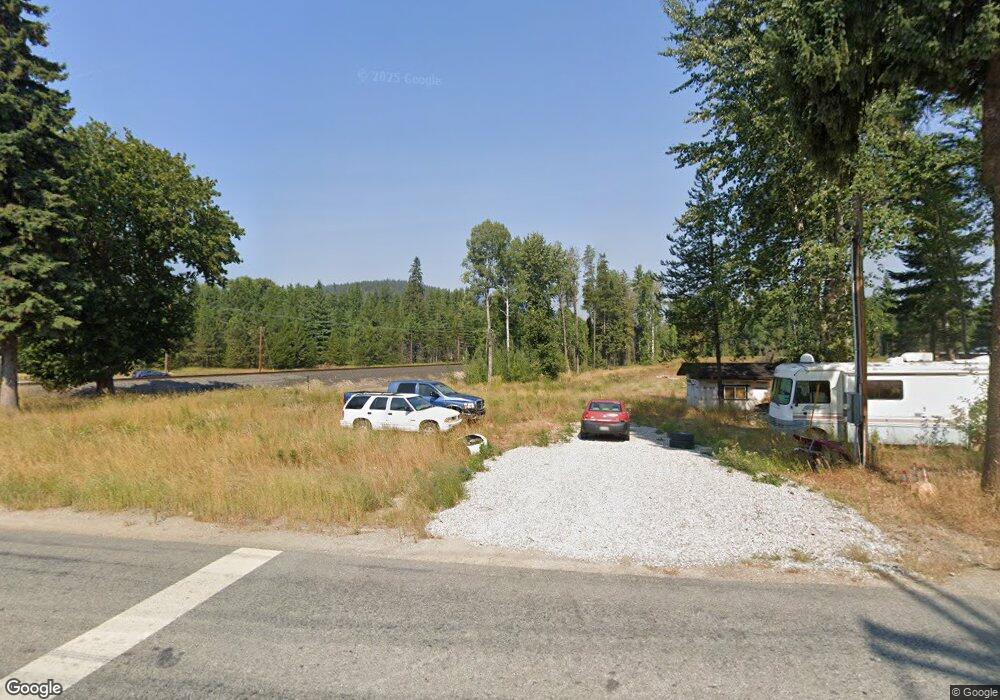
55 Samuels Rd Sandpoint, ID 83864
Estimated Value: $419,000
3
Beds
2
Baths
1,681
Sq Ft
$249/Sq Ft
Est. Value
About This Home
This home is located at 55 Samuels Rd, Sandpoint, ID 83864 and is currently estimated at $419,000, approximately $249 per square foot. 55 Samuels Rd is a home located in Bonner County with nearby schools including Kootenai Elementary School, Sandpoint Middle School, and Sandpoint High School.
Ownership History
Date
Name
Owned For
Owner Type
Purchase Details
Closed on
May 12, 2022
Sold by
Duane Costa
Bought by
J & J Development Llc
Current Estimated Value
Purchase Details
Closed on
Jul 12, 2018
Sold by
Costa Duane Dale
Bought by
Costa Duane and Costa Dennis
Home Financials for this Owner
Home Financials are based on the most recent Mortgage that was taken out on this home.
Original Mortgage
$120,000
Interest Rate
4.5%
Mortgage Type
New Conventional
Purchase Details
Closed on
May 23, 2018
Sold by
Costa Shellee Vee Townsend
Bought by
Costa Duane Dale
Home Financials for this Owner
Home Financials are based on the most recent Mortgage that was taken out on this home.
Original Mortgage
$120,000
Interest Rate
4.5%
Mortgage Type
New Conventional
Purchase Details
Closed on
Sep 15, 2016
Sold by
Pjd Partnership
Bought by
Costa Duane and Costa Shellee
Create a Home Valuation Report for This Property
The Home Valuation Report is an in-depth analysis detailing your home's value as well as a comparison with similar homes in the area
Home Values in the Area
Average Home Value in this Area
Purchase History
| Date | Buyer | Sale Price | Title Company |
|---|---|---|---|
| J & J Development Llc | -- | Title One Title | |
| Costa Duane | -- | Accommodation | |
| Costa Duane Dale | -- | None Available | |
| Costa Duane | -- | Sandpoint Title Insurance |
Source: Public Records
Mortgage History
| Date | Status | Borrower | Loan Amount |
|---|---|---|---|
| Previous Owner | Costa Duane | $120,000 |
Source: Public Records
Tax History
| Year | Tax Paid | Tax Assessment Tax Assessment Total Assessment is a certain percentage of the fair market value that is determined by local assessors to be the total taxable value of land and additions on the property. | Land | Improvement |
|---|---|---|---|---|
| 2025 | $460 | $114,846 | $114,846 | $0 |
| 2024 | $723 | $133,016 | $114,846 | $18,170 |
| 2023 | $799 | $146,260 | $114,846 | $31,414 |
| 2022 | $861 | $148,395 | $115,643 | $32,752 |
| 2021 | $817 | $90,771 | $68,987 | $21,784 |
| 2020 | $821 | $85,701 | $68,987 | $16,714 |
| 2019 | $660 | $75,150 | $59,656 | $15,494 |
| 2018 | $725 | $66,660 | $50,800 | $15,860 |
| 2017 | $718 | $72,450 | $0 | $0 |
| 2016 | $645 | $61,200 | $0 | $0 |
| 2015 | $644 | $61,200 | $0 | $0 |
| 2014 | $680 | $65,200 | $0 | $0 |
Source: Public Records
Map
Nearby Homes
- 5 A St
- 842 Samuels Rd
- 870 Samuels Rd
- 1464 Hulett Hill Dr
- NNA Elk St
- 778 B St
- 2489 N Center Valley Rd
- 299 Reload Rd
- 35 Norway Lodge Heights Rd
- 35 Norway Lodge Heights
- Lot 14 Ridge Way
- Parcel B Berry Canyon Rd
- 774 Old Kootenai Trail
- 713 N Center Valley Rd
- 455 Elk Grove Rd
- 521 Magpie Ln
- 2727 Selkirk Rd
- NKA Snowberry Ln
- 2298 Selkirk Rd
- 672 Hopkins Rd
- NKA Bowen Arrow Rd Lot 1
- 2 Samuels Rd
- 1 Samuels Rd
- 3 Samuels Rd
- Lot 32 Birch Grove
- nna Bonner St
- 998 Samuels
- 26 Husky Way
- 95 Samuels Rd
- 486350 Highway 95
- nna W2 Reload
- 1770 Bowen Arrow
- NNA Chief Joseph
- NNA E2 Reload Rd
- 51 Moose Haven Ln
- 110 Moose Haven Ln
- 2 Upper Pack River Rd
- 1 Upper Pack River Rd
- 4 Upper Pack River Rd
- 3 Upper Pack River Rd
Your Personal Tour Guide
Ask me questions while you tour the home.
