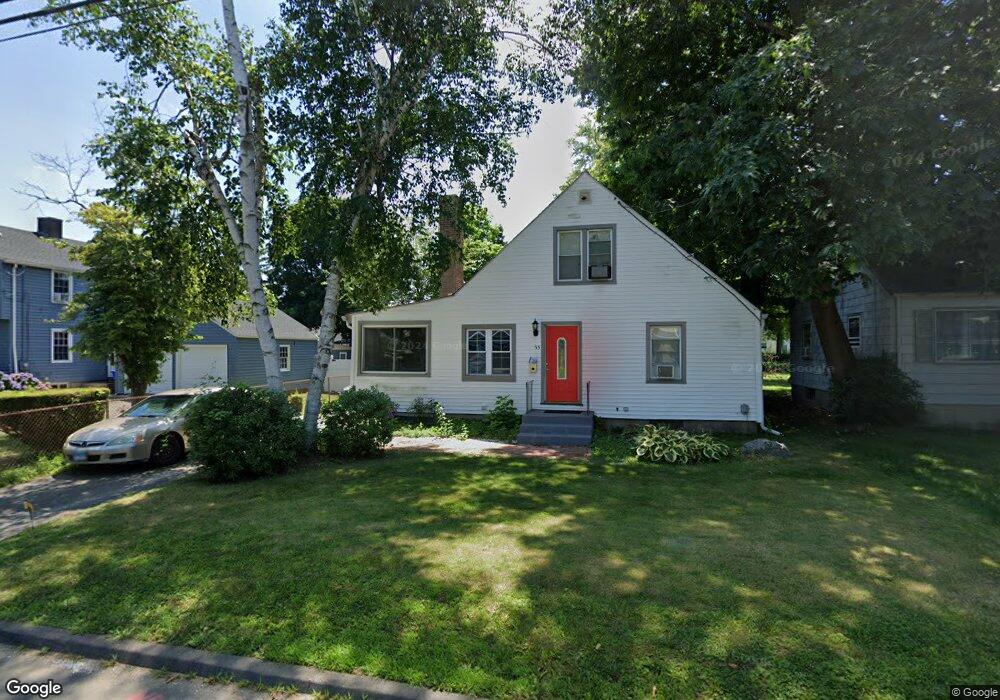
55 Stanley St East Hartford, CT 06108
Estimated Value: $246,000 - $297,000
4
Beds
2
Baths
1,558
Sq Ft
$171/Sq Ft
Est. Value
About This Home
This home is located at 55 Stanley St, East Hartford, CT 06108 and is currently estimated at $267,081, approximately $171 per square foot. 55 Stanley St is a home located in Hartford County with nearby schools including Anna E. Norris School, East Hartford Middle School, and East Hartford High School.
Ownership History
Date
Name
Owned For
Owner Type
Purchase Details
Closed on
Sep 11, 2002
Sold by
Andreoli Lori M
Bought by
Smith Icilda
Current Estimated Value
Create a Home Valuation Report for This Property
The Home Valuation Report is an in-depth analysis detailing your home's value as well as a comparison with similar homes in the area
Home Values in the Area
Average Home Value in this Area
Purchase History
| Date | Buyer | Sale Price | Title Company |
|---|---|---|---|
| Smith Icilda | $127,000 | -- |
Source: Public Records
Mortgage History
| Date | Status | Borrower | Loan Amount |
|---|---|---|---|
| Open | Smith Icilda | $117,600 | |
| Closed | Smith Icilda | $136,000 | |
| Closed | Smith Icilda | $15,854 |
Source: Public Records
Tax History Compared to Growth
Tax History
| Year | Tax Paid | Tax Assessment Tax Assessment Total Assessment is a certain percentage of the fair market value that is determined by local assessors to be the total taxable value of land and additions on the property. | Land | Improvement |
|---|---|---|---|---|
| 2025 | $5,940 | $129,420 | $27,510 | $101,910 |
| 2024 | $5,694 | $129,420 | $27,510 | $101,910 |
| 2023 | $5,506 | $129,420 | $27,510 | $101,910 |
| 2022 | $5,306 | $129,420 | $27,510 | $101,910 |
| 2021 | $4,901 | $99,310 | $25,650 | $73,660 |
| 2020 | $4,958 | $99,310 | $25,650 | $73,660 |
| 2019 | $4,877 | $99,310 | $25,650 | $73,660 |
| 2018 | $4,733 | $99,310 | $25,650 | $73,660 |
| 2017 | $4,673 | $99,310 | $25,650 | $73,660 |
| 2016 | $4,649 | $101,370 | $25,650 | $75,720 |
| 2015 | $4,649 | $101,370 | $25,650 | $75,720 |
| 2014 | $4,602 | $101,370 | $25,650 | $75,720 |
Source: Public Records
Map
Nearby Homes
- 52 Burnside Ave
- 47 Elm St
- 1589 Main St
- 41 Bissell St
- 279 Prospect St
- 98 Olmsted St
- 85R Olmsted St
- 181 Burnside Ave
- 88 Governor St Unit 90
- 347 Prospect St Unit 349
- 10 Kenyon Place
- 115 Governor St
- 61 Central Ave Unit 63
- 265 Burnside Ave
- 50 Garvan St
- 30 Oakwood St
- 67 Laurel St
- 18 Lincoln St
- 6 Cherry St
- 39 Tiffany Rd