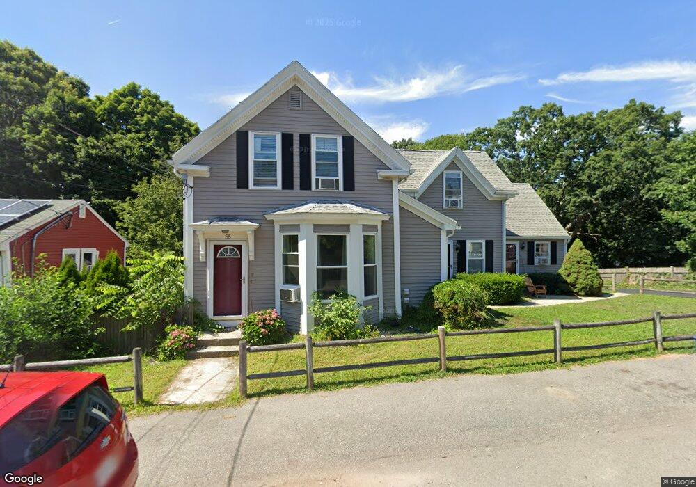
55 Station St Unit 3 Quincy, MA 02169
South Quincy NeighborhoodEstimated Value: $327,657 - $524,000
1
Bed
1
Bath
665
Sq Ft
$577/Sq Ft
Est. Value
About This Home
This home is located at 55 Station St Unit 3, Quincy, MA 02169 and is currently estimated at $383,914, approximately $577 per square foot. 55 Station St Unit 3 is a home located in Norfolk County with nearby schools including South West Middle School, Lincoln-Hancock Community School, and Quincy High School.
Ownership History
Date
Name
Owned For
Owner Type
Purchase Details
Closed on
Nov 25, 2002
Sold by
D A Rt
Bought by
Rooney Sean P
Current Estimated Value
Home Financials for this Owner
Home Financials are based on the most recent Mortgage that was taken out on this home.
Original Mortgage
$157,500
Outstanding Balance
$66,826
Interest Rate
6.07%
Mortgage Type
Purchase Money Mortgage
Estimated Equity
$317,088
Create a Home Valuation Report for This Property
The Home Valuation Report is an in-depth analysis detailing your home's value as well as a comparison with similar homes in the area
Home Values in the Area
Average Home Value in this Area
Purchase History
| Date | Buyer | Sale Price | Title Company |
|---|---|---|---|
| Rooney Sean P | $175,000 | -- |
Source: Public Records
Mortgage History
| Date | Status | Borrower | Loan Amount |
|---|---|---|---|
| Open | Rooney Sean P | $157,500 |
Source: Public Records
Tax History Compared to Growth
Tax History
| Year | Tax Paid | Tax Assessment Tax Assessment Total Assessment is a certain percentage of the fair market value that is determined by local assessors to be the total taxable value of land and additions on the property. | Land | Improvement |
|---|---|---|---|---|
| 2025 | $3,848 | $333,700 | $0 | $333,700 |
| 2024 | $3,718 | $329,900 | $0 | $329,900 |
| 2023 | $2,903 | $260,800 | $0 | $260,800 |
| 2022 | $3,206 | $267,600 | $0 | $267,600 |
| 2021 | $3,125 | $257,400 | $0 | $257,400 |
| 2020 | $2,895 | $232,900 | $0 | $232,900 |
| 2019 | $2,669 | $212,700 | $0 | $212,700 |
| 2018 | $2,633 | $197,400 | $0 | $197,400 |
| 2017 | $2,872 | $202,700 | $0 | $202,700 |
| 2016 | $2,865 | $199,500 | $0 | $199,500 |
| 2015 | $2,761 | $189,100 | $0 | $189,100 |
| 2014 | $2,572 | $173,100 | $0 | $173,100 |
Source: Public Records
Map
Nearby Homes
- 42 West St
- 57 Buckley St
- 46-48 Buckley St
- 211 West St Unit 12B
- 510 Willard St
- 211 Copeland St
- 14 Arthur Ave
- 21 Arthur St
- 12 Arthur Ave
- 46 Suomi Rd
- 46 Suomi Rd Unit 46
- 91 Garfield St
- 64 Garfield St Unit B
- 52 Bunker Hill Ln
- 63 Adele Rd
- 21 Totman St Unit 202
- 21 Totman St Unit 309
- 21 Totman St Unit Model-1
- 21 Totman St Unit 209
- 21 Totman St Unit 203
- 55 Station St Unit 5
- 55 Station St Unit 2
- 55 Station St Unit 1
- 55 Station St Unit 4
- 57 Station St
- 45 Station St
- 50 Station St
- 67 Station St
- 58 Station St
- 54 Station St
- 5 Westford St
- 25 Hynes Ave
- 26 Hynes Ave
- 40 Station St
- 40 Station St Unit 1
- 8 Greystone St
- 56 Station St Unit 5
- 56 Station St Unit A
- 56 Station St Unit B
- 71a Station St Unit 5A