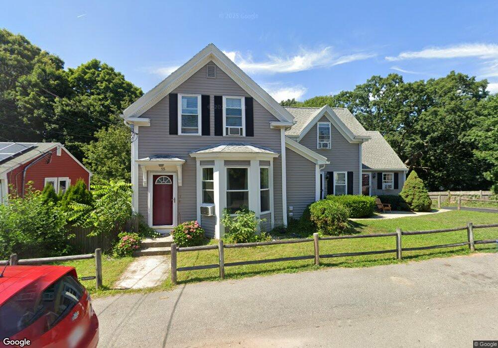
55 Station St Unit 5 Quincy, MA 02169
South Quincy NeighborhoodEstimated Value: $227,000 - $553,000
--
Bed
1
Bath
230
Sq Ft
$1,415/Sq Ft
Est. Value
About This Home
This home is located at 55 Station St Unit 5, Quincy, MA 02169 and is currently estimated at $325,365, approximately $1,414 per square foot. 55 Station St Unit 5 is a home located in Norfolk County with nearby schools including South West Middle School, Lincoln-Hancock Community School, and Quincy High School.
Ownership History
Date
Name
Owned For
Owner Type
Purchase Details
Closed on
Nov 22, 2006
Sold by
Fine Robert C
Bought by
Lombard D Brendan and Lombard Margaret M
Current Estimated Value
Purchase Details
Closed on
Jun 1, 2006
Sold by
Kubit Steven M
Bought by
Fine Robert C
Purchase Details
Closed on
Jan 6, 2003
Sold by
D A Rt
Bought by
Kubit Steve M and Kubit Steven M
Home Financials for this Owner
Home Financials are based on the most recent Mortgage that was taken out on this home.
Original Mortgage
$104,500
Interest Rate
6.08%
Mortgage Type
Purchase Money Mortgage
Create a Home Valuation Report for This Property
The Home Valuation Report is an in-depth analysis detailing your home's value as well as a comparison with similar homes in the area
Home Values in the Area
Average Home Value in this Area
Purchase History
| Date | Buyer | Sale Price | Title Company |
|---|---|---|---|
| Lombard D Brendan | $124,000 | -- | |
| Fine Robert C | $120,000 | -- | |
| Kubit Steve M | $110,000 | -- |
Source: Public Records
Mortgage History
| Date | Status | Borrower | Loan Amount |
|---|---|---|---|
| Previous Owner | Kubit Steve M | $104,500 |
Source: Public Records
Tax History Compared to Growth
Tax History
| Year | Tax Paid | Tax Assessment Tax Assessment Total Assessment is a certain percentage of the fair market value that is determined by local assessors to be the total taxable value of land and additions on the property. | Land | Improvement |
|---|---|---|---|---|
| 2025 | $2,067 | $179,300 | $0 | $179,300 |
| 2024 | $1,998 | $177,300 | $0 | $177,300 |
| 2023 | $1,563 | $140,400 | $0 | $140,400 |
| 2022 | $1,725 | $144,000 | $0 | $144,000 |
| 2021 | $1,683 | $138,600 | $0 | $138,600 |
| 2020 | $1,649 | $132,700 | $0 | $132,700 |
| 2019 | $1,524 | $121,400 | $0 | $121,400 |
| 2018 | $1,505 | $112,800 | $0 | $112,800 |
| 2017 | $1,642 | $115,900 | $0 | $115,900 |
| 2016 | $1,640 | $114,200 | $0 | $114,200 |
| 2015 | $1,581 | $108,300 | $0 | $108,300 |
| 2014 | $1,476 | $99,300 | $0 | $99,300 |
Source: Public Records
Map
Nearby Homes
- 42 West St
- 57 Buckley St
- 46-48 Buckley St
- 211 West St Unit 12B
- 510 Willard St
- 211 Copeland St
- 14 Arthur Ave
- 21 Arthur St
- 12 Arthur Ave
- 46 Suomi Rd
- 46 Suomi Rd Unit 46
- 91 Garfield St
- 64 Garfield St Unit B
- 52 Bunker Hill Ln
- 63 Adele Rd
- 21 Totman St Unit 202
- 21 Totman St Unit 309
- 21 Totman St Unit Model-1
- 21 Totman St Unit 209
- 21 Totman St Unit 203
- 55 Station St Unit 3
- 55 Station St Unit 2
- 55 Station St Unit 1
- 55 Station St Unit 4
- 57 Station St
- 45 Station St
- 50 Station St
- 67 Station St
- 58 Station St
- 54 Station St
- 5 Westford St
- 25 Hynes Ave
- 26 Hynes Ave
- 40 Station St
- 40 Station St Unit 1
- 8 Greystone St
- 56 Station St Unit 5
- 56 Station St Unit A
- 56 Station St Unit B
- 71a Station St Unit 5A