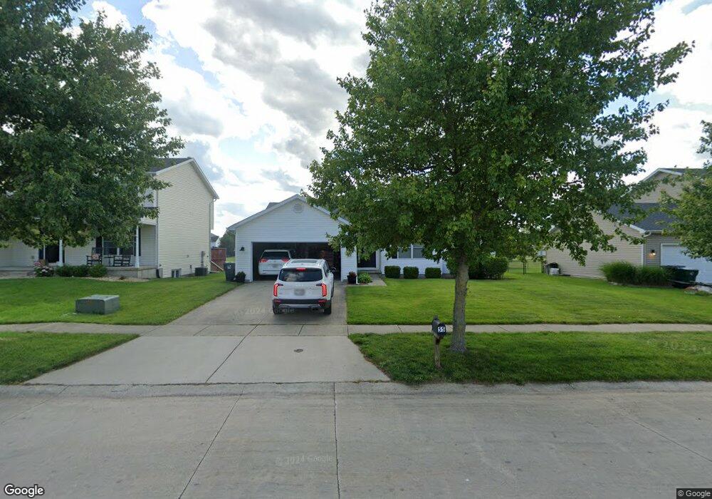
55 Sundance Dr Mount Zion, IL 62549
Estimated Value: $270,000 - $320,000
4
Beds
3
Baths
2,066
Sq Ft
$143/Sq Ft
Est. Value
About This Home
This home is located at 55 Sundance Dr, Mount Zion, IL 62549 and is currently estimated at $296,009, approximately $143 per square foot. 55 Sundance Dr is a home located in Macon County with nearby schools including McGaughey Elementary School, Mt. Zion Elementary School, and Mt. Zion Intermediate School.
Ownership History
Date
Name
Owned For
Owner Type
Purchase Details
Closed on
Jun 15, 2011
Sold by
Briner Chad E and Briner Jennifer L
Bought by
Gibbs Griffin A and Gibbs Ashley N
Current Estimated Value
Home Financials for this Owner
Home Financials are based on the most recent Mortgage that was taken out on this home.
Original Mortgage
$177,287
Outstanding Balance
$122,904
Interest Rate
4.75%
Mortgage Type
FHA
Estimated Equity
$173,105
Purchase Details
Closed on
May 1, 2011
Home Financials for this Owner
Home Financials are based on the most recent Mortgage that was taken out on this home.
Original Mortgage
$177,287
Outstanding Balance
$122,904
Interest Rate
4.75%
Mortgage Type
FHA
Estimated Equity
$173,105
Create a Home Valuation Report for This Property
The Home Valuation Report is an in-depth analysis detailing your home's value as well as a comparison with similar homes in the area
Home Values in the Area
Average Home Value in this Area
Purchase History
| Date | Buyer | Sale Price | Title Company |
|---|---|---|---|
| Gibbs Griffin A | $182,000 | None Available | |
| -- | $181,900 | -- |
Source: Public Records
Mortgage History
| Date | Status | Borrower | Loan Amount |
|---|---|---|---|
| Open | Gibbs Griffin A | $177,287 |
Source: Public Records
Tax History Compared to Growth
Tax History
| Year | Tax Paid | Tax Assessment Tax Assessment Total Assessment is a certain percentage of the fair market value that is determined by local assessors to be the total taxable value of land and additions on the property. | Land | Improvement |
|---|---|---|---|---|
| 2024 | $5,812 | $80,466 | $8,470 | $71,996 |
| 2023 | $5,621 | $74,839 | $7,878 | $66,961 |
| 2022 | $5,377 | $70,984 | $7,472 | $63,512 |
| 2021 | $5,219 | $66,500 | $7,000 | $59,500 |
| 2020 | $4,188 | $55,121 | $7,294 | $47,827 |
| 2019 | $4,188 | $55,121 | $7,294 | $47,827 |
| 2018 | $4,059 | $53,714 | $7,108 | $46,606 |
| 2017 | $4,002 | $52,681 | $6,971 | $45,710 |
| 2016 | $3,960 | $51,765 | $6,850 | $44,915 |
| 2015 | $3,829 | $51,252 | $6,782 | $44,470 |
| 2014 | $3,691 | $51,252 | $6,782 | $44,470 |
| 2013 | $3,734 | $51,252 | $6,782 | $44,470 |
Source: Public Records
Map
Nearby Homes
- 50 Sundance Dr
- 1820 Buckhead Ln
- 2125 Buckhead Ave
- 2110 Buckhead Ln
- 2130 Buckhead Ave
- 1610 Robin Ct
- 1935 Buckhead Ct
- 2020 Buckhead Ln
- 2030 Buckhead Ln
- 695 Country Ct
- 860 W Wildwood Dr
- 3330 S Baltimore Ave
- 925 S Wildwood Dr
- 1625 Ridgewood Ct
- 570 Fawn Ct
- 4090 S Lake Ct
- 3930 S Mount Zion Rd
- 265 Carrington Ave
- 2554 S Nantucket Dr
- 2571 Lansdowne Dr
- 54 Sundance Dr
- 56 Sundance Dr
- 53 Sundance Dr
- 57 Sundance Dr
- 113 Sundance Dr
- 113 Sundance Fields Dr
- 117 Sundance Dr
- 13 Morning Glory Ct
- 52 Sundance Dr
- 60 Sundance Dr
- 1 Morning Glory Ct
- 12 Morning Glory Ct
- 51 Sundance Dr
- 2 Morning Glory Ct
- 1504 Hunters View Dr
- 1504 Hunter's View Dr
- 1605 Hunters Pointe Ct
- 11 Morning Glory Ct
- 3 Morning Glory Ct
- 15 Prairie Rose Ct