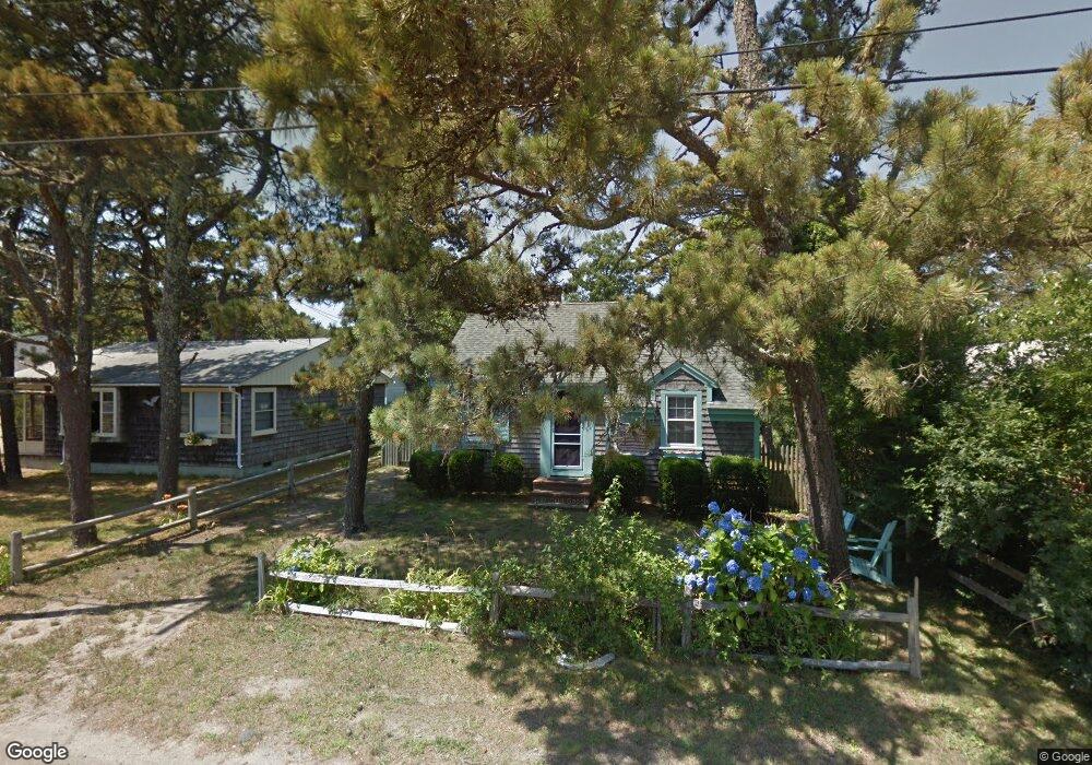
55 Uncle Rolf Rd Dennis Port, MA 02639
Dennis Port NeighborhoodEstimated Value: $485,000 - $628,297
2
Beds
1
Bath
684
Sq Ft
$832/Sq Ft
Est. Value
About This Home
This home is located at 55 Uncle Rolf Rd, Dennis Port, MA 02639 and is currently estimated at $569,324, approximately $832 per square foot. 55 Uncle Rolf Rd is a home located in Barnstable County with nearby schools including Dennis-Yarmouth Regional High School and St. Pius X. School.
Ownership History
Date
Name
Owned For
Owner Type
Purchase Details
Closed on
Jul 10, 2025
Sold by
Clarkin William S and Clarkin Loralyn E
Bought by
Clarkin Ft and Clarkin
Current Estimated Value
Purchase Details
Closed on
Aug 29, 2020
Sold by
Lang Robert G and Lang Susan V
Bought by
Clarkin William S and Clarkin Loralyn E
Home Financials for this Owner
Home Financials are based on the most recent Mortgage that was taken out on this home.
Original Mortgage
$332,100
Interest Rate
3%
Mortgage Type
New Conventional
Purchase Details
Closed on
Jul 25, 2001
Sold by
Finn Timothy E and Finn Amy J
Bought by
Lang Robert G and Lang Susan V
Home Financials for this Owner
Home Financials are based on the most recent Mortgage that was taken out on this home.
Original Mortgage
$50,000
Interest Rate
7.18%
Mortgage Type
Purchase Money Mortgage
Purchase Details
Closed on
Jul 17, 2000
Sold by
Garwood Ann M and Garwood Gary J
Bought by
Finn Timothy E and Finn Amy J
Home Financials for this Owner
Home Financials are based on the most recent Mortgage that was taken out on this home.
Original Mortgage
$50,050
Interest Rate
8.5%
Mortgage Type
Purchase Money Mortgage
Create a Home Valuation Report for This Property
The Home Valuation Report is an in-depth analysis detailing your home's value as well as a comparison with similar homes in the area
Home Values in the Area
Average Home Value in this Area
Purchase History
| Date | Buyer | Sale Price | Title Company |
|---|---|---|---|
| Clarkin Ft | -- | -- | |
| Clarkin William S | $369,000 | None Available | |
| Lang Robert G | $155,000 | -- | |
| Lang Robert G | $155,000 | -- | |
| Finn Timothy E | $125,000 | -- | |
| Finn Timothy E | $125,000 | -- |
Source: Public Records
Mortgage History
| Date | Status | Borrower | Loan Amount |
|---|---|---|---|
| Previous Owner | Clarkin William S | $332,100 | |
| Previous Owner | Lang Robert G | $50,000 | |
| Previous Owner | Finn Timothy E | $50,050 |
Source: Public Records
Tax History Compared to Growth
Tax History
| Year | Tax Paid | Tax Assessment Tax Assessment Total Assessment is a certain percentage of the fair market value that is determined by local assessors to be the total taxable value of land and additions on the property. | Land | Improvement |
|---|---|---|---|---|
| 2025 | $2,377 | $548,900 | $276,500 | $272,400 |
| 2024 | $2,195 | $499,900 | $265,900 | $234,000 |
| 2023 | $2,123 | $454,500 | $241,700 | $212,800 |
| 2022 | $1,941 | $346,600 | $190,500 | $156,100 |
| 2021 | $1,816 | $301,100 | $186,800 | $114,300 |
| 2020 | $1,797 | $294,600 | $186,800 | $107,800 |
| 2019 | $1,819 | $294,800 | $198,800 | $96,000 |
| 2018 | $1,782 | $281,100 | $189,300 | $91,800 |
| 2017 | $1,637 | $266,100 | $174,300 | $91,800 |
| 2016 | $1,575 | $241,200 | $164,400 | $76,800 |
| 2015 | $1,544 | $241,200 | $164,400 | $76,800 |
| 2014 | $1,453 | $228,800 | $154,400 | $74,400 |
Source: Public Records
Map
Nearby Homes
- 64 Beaten Rd
- 37 Ocean Dr Unit 2
- 112 Old Wharf Rd Unit E4
- 112 Old Wharf Rd Unit E1
- 154 Old Wharf Rd Unit 26
- 154 Old Wharf Rd Unit 14
- 120 Old Wharf Rd Unit 11
- 217 Old Wharf Rd Unit 64
- 241 Old Wharf Rd Unit 82
- 241 Old Wharf Rd Unit 127
- 241 Old Wharf Rd Unit 90
- 80 Michaels Ave
- 262 Old Wharf Rd Unit 67
- 262 Old Wharf Rd Unit 5
- 262 Old Wharf Rd Unit 5
- 262 Old Wharf Rd Unit 20
- 262 Old Wharf Rd Unit 87
- 31 Easy St
- 37 Beach Hills Rd
- 37-A Beach Hills Rd
- 53 Uncle Rolf Rd
- 59 Uncle Rolf Rd
- 51 Uncle Rolf Rd
- 61 Uncle Rolf Rd
- 52 Bain Rd
- 58 Uncle Rolf Rd
- 60 Uncle Rolf Rd
- 49 Uncle Rolf Rd
- 63 Uncle Rolf Rd
- 52 Uncle Rolf Rd
- 50 Bain Rd
- 64 Uncle Rolf Rd
- 47 Uncle Rolf Rd
- 171-173 Captain Chase Rd
- 177 Captain Chase Rd
- 171 Captain Chase Rd Unit 173
- 173 Captain Chase Rd
- 173 Captain Chase Rd Unit B
- 173 Captain Chase Rd Unit A
- 171 Captain Chase Rd