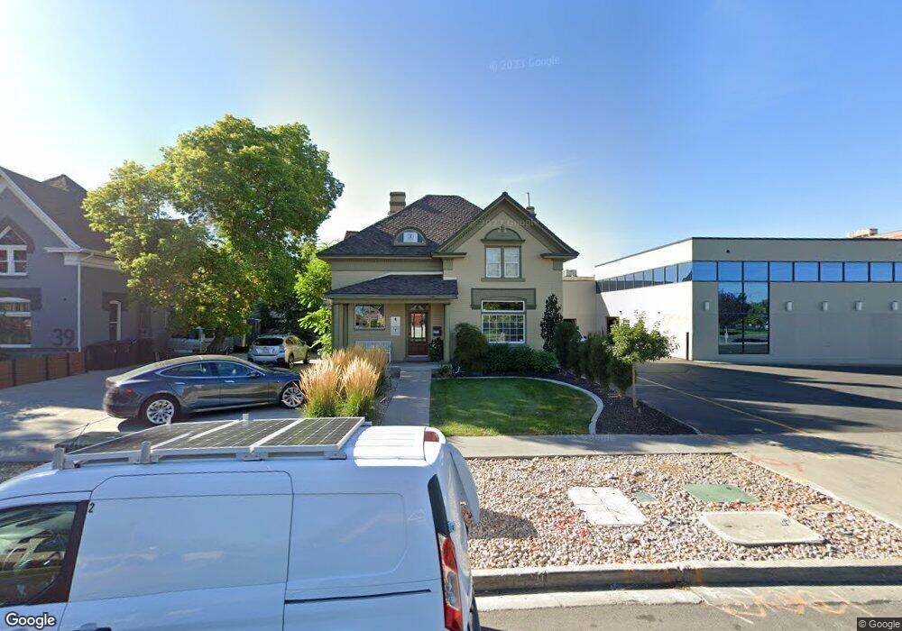
55 W 200 N Provo, UT 84601
Downtown Provo Neighborhood
4
Beds
2
Baths
2,142
Sq Ft
4,792
Sq Ft Lot
About This Home
This home is located at 55 W 200 N, Provo, UT 84601. 55 W 200 N is a home located in Utah County with nearby schools including Provo Peaks School, Centennial Middle School, and Timpview High School.
Ownership History
Date
Name
Owned For
Owner Type
Purchase Details
Closed on
Mar 30, 2010
Sold by
Keystone Real Estate Llc
Bought by
Cobblestone
Purchase Details
Closed on
Mar 11, 2003
Sold by
Stone R Scott
Bought by
Keystone Real Estate Llc
Purchase Details
Closed on
Mar 10, 2003
Sold by
Tucker Larry Karl and Tucker Becky Mary
Bought by
Stone R Scott and Stone Melinda C
Purchase Details
Closed on
Oct 26, 2000
Sold by
Skinner Guy B and Skinner Christina M
Bought by
Tucker Larry Karl and Tucker Becky Mary
Create a Home Valuation Report for This Property
The Home Valuation Report is an in-depth analysis detailing your home's value as well as a comparison with similar homes in the area
Home Values in the Area
Average Home Value in this Area
Purchase History
| Date | Buyer | Sale Price | Title Company |
|---|---|---|---|
| Cobblestone | -- | Cornerstone Title | |
| Keystone Real Estate Llc | -- | First American Title Co | |
| Stone R Scott | -- | Old Republic Title Of Utah | |
| Tucker Larry Karl | -- | Old Republic Title |
Source: Public Records
Tax History Compared to Growth
Tax History
| Year | Tax Paid | Tax Assessment Tax Assessment Total Assessment is a certain percentage of the fair market value that is determined by local assessors to be the total taxable value of land and additions on the property. | Land | Improvement |
|---|---|---|---|---|
| 2025 | $3,257 | $313,600 | $179,700 | $133,900 |
| 2024 | $3,257 | $320,600 | $0 | $0 |
| 2023 | $3,253 | $315,700 | $0 | $0 |
| 2022 | $3,037 | $297,200 | $160,800 | $136,400 |
| 2021 | $2,437 | $228,700 | $124,300 | $104,400 |
| 2020 | $2,680 | $235,800 | $124,300 | $111,500 |
| 2019 | $2,512 | $229,900 | $119,500 | $110,400 |
| 2018 | $2,406 | $223,300 | $116,000 | $107,300 |
| 2017 | $2,390 | $221,600 | $0 | $0 |
| 2016 | $2,307 | $199,400 | $0 | $0 |
| 2015 | $2,167 | $189,300 | $0 | $0 |
| 2014 | $2,027 | $184,600 | $0 | $0 |
Source: Public Records
Map
Nearby Homes
- 250 N 100 W Unit 109
- 75 E 200 N Unit 106
- 136 E 400 N Unit 107
- 40 S Freedom Blvd
- 361 N 300 W Unit 201
- 270 N 400 W
- 237 E Center St
- 209 N 400 W
- 466 N 200 E
- 70 E 200 S
- 394 N 300 E
- 213 S 100 E
- 144 E 200 S
- 168 S 300 E
- 215 S 400 W
- 244 W 400 S
- 393 W 300 S
- 614 W 400 N
- 836 N University Ave Unit 111
- 491 S Freedom Blvd Unit 104204
- 39 W 200 N Unit 2
- 39 W 200 N Unit 35-39
- 39 W 200 N Unit 35-41
- 39 W 200 N
- 149 N University Ave
- 145 N University Ave
- 225 N University Ave
- 135 N University Ave
- 180 N University Ave Unit 410
- 180 N University Ave Unit 200
- 250 N 100 W Unit 121
- 250 N 100 W Unit 102
- 250 N 100 W Unit 114
- 250 N 100 W Unit 103
- 250 N 100 W Unit 112
- 250 N 100 W Unit 117
- 180 N University Avenure Ave Unit 200
- 261 N University Ave
- 117 N University Ave
- 85 W 300 N
