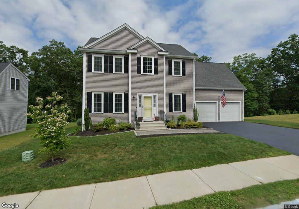
55 Westview Ave Millbury, MA 01527
Estimated Value: $695,000 - $781,000
4
Beds
3
Baths
2,442
Sq Ft
$302/Sq Ft
Est. Value
About This Home
This home is located at 55 Westview Ave, Millbury, MA 01527 and is currently estimated at $737,724, approximately $302 per square foot. 55 Westview Ave is a home with nearby schools including Elmwood Street Elementary School, Raymond E. Shaw Elementary School, and Millbury Junior/Senior High School.
Ownership History
Date
Name
Owned For
Owner Type
Purchase Details
Closed on
Feb 15, 2018
Sold by
Hayr Llc
Bought by
Pompei Jonathan R and Pompei Lisa M
Current Estimated Value
Home Financials for this Owner
Home Financials are based on the most recent Mortgage that was taken out on this home.
Original Mortgage
$303,000
Outstanding Balance
$256,355
Interest Rate
3.95%
Mortgage Type
New Conventional
Estimated Equity
$481,369
Create a Home Valuation Report for This Property
The Home Valuation Report is an in-depth analysis detailing your home's value as well as a comparison with similar homes in the area
Home Values in the Area
Average Home Value in this Area
Purchase History
| Date | Buyer | Sale Price | Title Company |
|---|---|---|---|
| Pompei Jonathan R | $441,056 | -- | |
| Pompei Jonathan R | $441,056 | -- |
Source: Public Records
Mortgage History
| Date | Status | Borrower | Loan Amount |
|---|---|---|---|
| Open | Pompei Jonathan R | $303,000 | |
| Closed | Pompei Jonathan R | $303,000 |
Source: Public Records
Tax History Compared to Growth
Tax History
| Year | Tax Paid | Tax Assessment Tax Assessment Total Assessment is a certain percentage of the fair market value that is determined by local assessors to be the total taxable value of land and additions on the property. | Land | Improvement |
|---|---|---|---|---|
| 2025 | $9,251 | $690,900 | $130,200 | $560,700 |
| 2024 | $8,488 | $641,600 | $120,600 | $521,000 |
| 2023 | $7,949 | $550,100 | $84,600 | $465,500 |
| 2022 | $6,644 | $442,900 | $81,200 | $361,700 |
| 2021 | $938 | $427,500 | $81,200 | $346,300 |
| 2020 | $6,508 | $424,500 | $81,200 | $343,300 |
| 2019 | $6,174 | $389,500 | $61,500 | $328,000 |
| 2018 | $301 | $18,450 | $18,450 | $0 |
| 2017 | $2,924 | $18,450 | $18,450 | $0 |
Source: Public Records
Map
Nearby Homes
- 12 Irene Ct
- 27 A-B Grafton St
- 3 Stidsen Way
- 11 Westview Ave
- 11 Maplewood Rd
- 232 Weatherstone Dr
- 76 Weatherstone Dr
- 1 Pineland Ave
- 86 Wheelock Ave
- 2 Diane St
- 1 Broadmeadow Ave
- 497 Massasoit Rd
- 330 Millbury Ave
- 3 May St
- 1203 Grafton St Unit 38
- 1201 Grafton St Unit 73
- 1195 Grafton St Unit 3
- 1199 Grafton St Unit 93
- 31 Crane St
- 11 Margin St
- 53 Westview Ave
- 57 Westview Ave
- 51 Westview Ave
- 59 Westview Ave
- 52 Westview Ave
- 50 Westview Ave
- 49 Westview Ave
- 48 Westview Ave
- 47 Westview Ave
- 46 Westview Ave
- 14 Hilltop Dr
- 45 Westview Ave
- 16 Hilltop Dr
- 10 Hilltop Dr
- 18 Hilltop Dr
- 44 Westview Ave
- 20 Hilltop Dr
- 8 Hilltop Dr
- 43 Westview Ave
- 42 Westview Ave