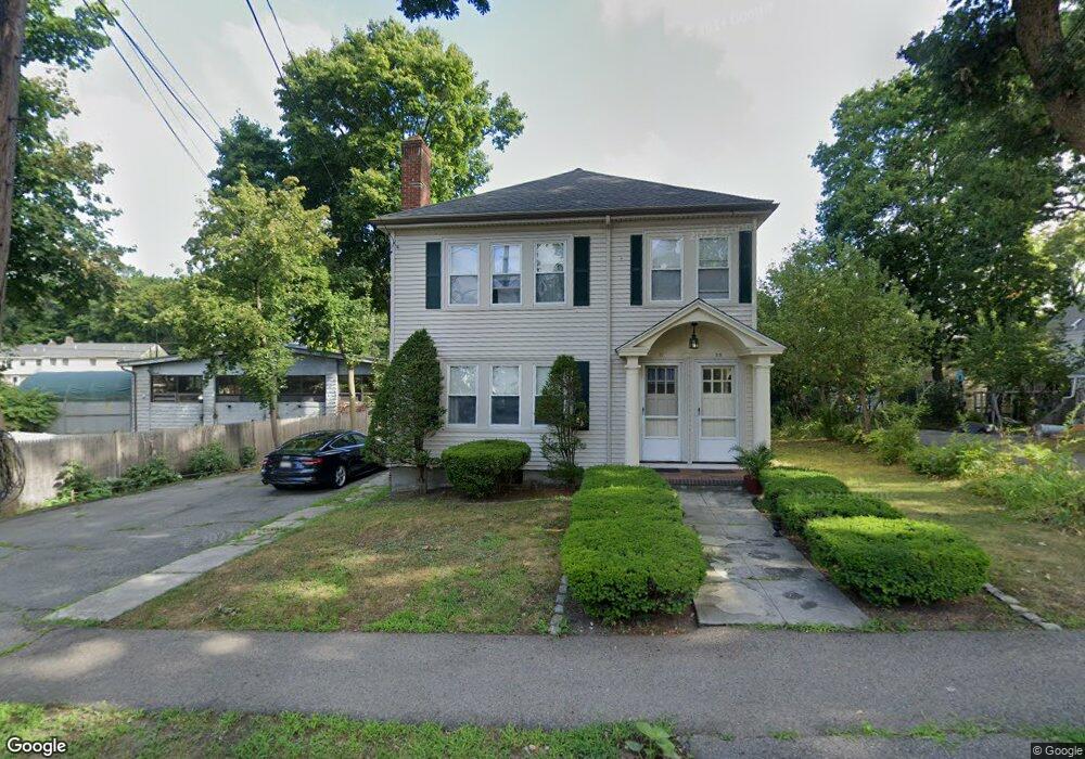
55 Woodbine St Auburndale, MA 02466
Auburndale NeighborhoodEstimated Value: $1,011,000 - $1,493,000
4
Beds
2
Baths
2,288
Sq Ft
$547/Sq Ft
Est. Value
About This Home
This home is located at 55 Woodbine St, Auburndale, MA 02466 and is currently estimated at $1,251,455, approximately $546 per square foot. 55 Woodbine St is a home located in Middlesex County with nearby schools including Williams Elementary School, C.C. Burr, and Charles E Brown Middle School.
Ownership History
Date
Name
Owned For
Owner Type
Purchase Details
Closed on
Sep 3, 2024
Sold by
Woodbine Street 55-57 Rt and Fitzpatrick
Bought by
Woodbine Street T and Woodbine Fitzpatrick
Current Estimated Value
Purchase Details
Closed on
Dec 20, 2019
Sold by
Fitzpatrick Robert E and Fitzpatrick Alberta L
Bought by
Woodbine Street 55 & 57 Rt
Create a Home Valuation Report for This Property
The Home Valuation Report is an in-depth analysis detailing your home's value as well as a comparison with similar homes in the area
Home Values in the Area
Average Home Value in this Area
Purchase History
| Date | Buyer | Sale Price | Title Company |
|---|---|---|---|
| Woodbine Street T | -- | None Available | |
| Woodbine Street T | -- | None Available | |
| Woodbine Street 55 & 57 Rt | -- | None Available |
Source: Public Records
Tax History Compared to Growth
Tax History
| Year | Tax Paid | Tax Assessment Tax Assessment Total Assessment is a certain percentage of the fair market value that is determined by local assessors to be the total taxable value of land and additions on the property. | Land | Improvement |
|---|---|---|---|---|
| 2025 | $9,175 | $936,200 | $617,100 | $319,100 |
| 2024 | $8,871 | $908,900 | $599,100 | $309,800 |
| 2023 | $8,405 | $825,600 | $477,900 | $347,700 |
| 2022 | $8,041 | $764,400 | $442,500 | $321,900 |
| 2021 | $7,546 | $701,300 | $406,000 | $295,300 |
| 2020 | $7,322 | $701,300 | $406,000 | $295,300 |
| 2019 | $6,849 | $655,400 | $379,400 | $276,000 |
| 2018 | $6,782 | $626,800 | $359,600 | $267,200 |
| 2017 | $6,394 | $575,000 | $329,900 | $245,100 |
| 2016 | $6,003 | $527,500 | $302,700 | $224,800 |
| 2015 | $5,724 | $493,000 | $282,900 | $210,100 |
Source: Public Records
Map
Nearby Homes
- 2202 Commonwealth Ave Unit 2
- 2202 Commonwealth Ave Unit 1
- 283 Melrose St
- 17 Lasell St
- 27 Oakwood Rd
- 224 Auburn St Unit 224
- 224 Auburn St Unit A
- 226 Auburn St Unit 226
- 49 Staniford St
- 62-64 Rowe St Unit B
- 13 Weir St
- 160 Pine St Unit 12
- 283 Woodland Rd
- 103 Loring Rd
- 17 Crescent St
- 707 South St
- 51 Bourne St
- 10 Crescent St Unit 1
- 10 Crescent St Unit 2
- 1639 Washington St
- 49 Woodbine St
- 2236 Commonwealth Ave Unit 2236
- 2236 Commonwealth Ave Unit 2
- 2236 Commonwealth Ave
- 2234 Commonwealth Ave
- 2234 Commonwealth Ave Unit 2236
- 2234 Commonwealth Ave Unit 1
- 2226 Commonwealth Ave
- 65 Woodbine St
- 54 Woodbine St
- 45 Woodbine St
- 60 Woodbine St
- 60 Woodbine St Unit 1
- 48 Woodbine St
- 2222 Commonwealth Ave
- 44 Woodbine St
- 2220 Commonwealth Ave
- 68 Woodbine St
- 39 Woodbine St
- 22 Woodbine Terrace Unit 22