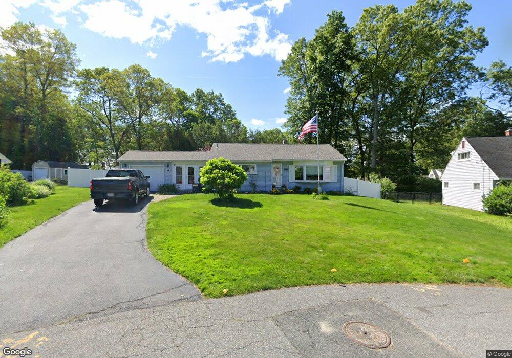
55 Yamaska Rd Springfield, MA 01118
East Forest Park NeighborhoodEstimated Value: $283,833 - $308,000
2
Beds
1
Bath
1,022
Sq Ft
$293/Sq Ft
Est. Value
About This Home
This home is located at 55 Yamaska Rd, Springfield, MA 01118 and is currently estimated at $298,958, approximately $292 per square foot. 55 Yamaska Rd is a home located in Hampden County with nearby schools including Frederick Harris Elementary School, M Marcus Kiley Middle, and Springfield High School of Science and Technology.
Ownership History
Date
Name
Owned For
Owner Type
Purchase Details
Closed on
Mar 16, 2001
Sold by
Perry Irving
Bought by
Martin Thomas W and Martin Linda C
Current Estimated Value
Home Financials for this Owner
Home Financials are based on the most recent Mortgage that was taken out on this home.
Original Mortgage
$97,900
Outstanding Balance
$35,621
Interest Rate
7.01%
Mortgage Type
Purchase Money Mortgage
Estimated Equity
$263,337
Create a Home Valuation Report for This Property
The Home Valuation Report is an in-depth analysis detailing your home's value as well as a comparison with similar homes in the area
Home Values in the Area
Average Home Value in this Area
Purchase History
| Date | Buyer | Sale Price | Title Company |
|---|---|---|---|
| Martin Thomas W | $96,000 | -- |
Source: Public Records
Mortgage History
| Date | Status | Borrower | Loan Amount |
|---|---|---|---|
| Open | Martin Thomas W | $97,900 |
Source: Public Records
Tax History
| Year | Tax Paid | Tax Assessment Tax Assessment Total Assessment is a certain percentage of the fair market value that is determined by local assessors to be the total taxable value of land and additions on the property. | Land | Improvement |
|---|---|---|---|---|
| 2025 | $3,694 | $235,600 | $50,100 | $185,500 |
| 2024 | $3,769 | $234,700 | $50,100 | $184,600 |
| 2023 | $3,800 | $222,900 | $47,700 | $175,200 |
| 2022 | $3,280 | $174,300 | $47,700 | $126,600 |
| 2021 | $3,326 | $176,000 | $43,400 | $132,600 |
| 2020 | $3,086 | $158,000 | $43,400 | $114,600 |
| 2019 | $3,163 | $160,700 | $43,400 | $117,300 |
| 2018 | $2,820 | $143,300 | $43,400 | $99,900 |
| 2017 | $2,686 | $136,600 | $43,400 | $93,200 |
| 2016 | $2,599 | $132,200 | $43,400 | $88,800 |
| 2015 | $2,524 | $128,300 | $43,400 | $84,900 |
Source: Public Records
Map
Nearby Homes
- 46 Hadley St
- 206 Treetop Ave
- 125 Manor Ct Unit 125
- 19 Manor Ct Unit 19
- 119 Powell Ave
- 17 Pebble Mill Rd
- 116 Carr St
- 49 Corcoran Blvd
- 55 Allen St
- 86 Talmadge Dr
- 65 Helen Cir
- 85 Talmadge Dr
- 47 Hartford Terrace
- 48 Fairview St
- 13 Bither St
- 24 Wands St
- 1088 Sumner Ave
- 101 Regal St
- 41 Hillside Dr
- 161 Dorset St
- 49 Yamaska Rd
- 284 E Allen Ridge Rd
- 120 Hadley St
- 104 Hadley St
- 41 Yamaska Rd
- 48 Yamaska Rd
- 276 E Allen Ridge Rd
- 114 Signal Hill Cir
- 138 Hadley St
- 94 Hadley St
- 33 Yamaska Rd
- 266 E Allen Ridge Rd
- 115 Hadley St
- 123 Hadley St
- 105 Hadley St
- 131 Hadley St
- 148 Hadley St
- 100 Signal Hill Cir
- 25 Lenn Rd
- 97 Hadley St
Your Personal Tour Guide
Ask me questions while you tour the home.