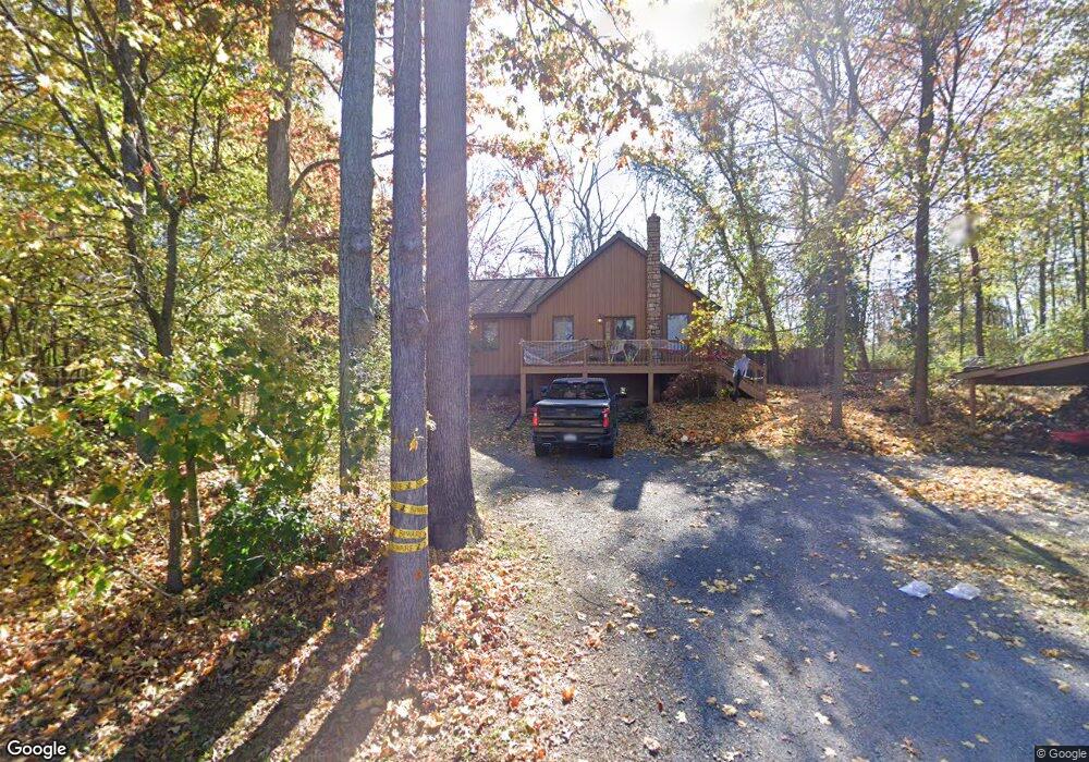
550 Barnstable Rd Carlisle, PA 17015
Estimated Value: $305,000 - $359,000
3
Beds
2
Baths
1,608
Sq Ft
$208/Sq Ft
Est. Value
About This Home
This home is located at 550 Barnstable Rd, Carlisle, PA 17015 and is currently estimated at $334,472, approximately $208 per square foot. 550 Barnstable Rd is a home located in Cumberland County with nearby schools including Oak Flat El School, Big Spring Middle School, and Big Spring High School.
Ownership History
Date
Name
Owned For
Owner Type
Purchase Details
Closed on
Nov 13, 2020
Sold by
Motter Casey D and Motter Amanda J
Bought by
Recchia Francesco M
Current Estimated Value
Home Financials for this Owner
Home Financials are based on the most recent Mortgage that was taken out on this home.
Original Mortgage
$211,500
Outstanding Balance
$188,205
Interest Rate
2.8%
Mortgage Type
New Conventional
Estimated Equity
$146,267
Purchase Details
Closed on
Jul 19, 2004
Sold by
Baer Harry E
Bought by
Motter Georgia B
Home Financials for this Owner
Home Financials are based on the most recent Mortgage that was taken out on this home.
Original Mortgage
$65,000
Interest Rate
6.28%
Mortgage Type
New Conventional
Create a Home Valuation Report for This Property
The Home Valuation Report is an in-depth analysis detailing your home's value as well as a comparison with similar homes in the area
Home Values in the Area
Average Home Value in this Area
Purchase History
| Date | Buyer | Sale Price | Title Company |
|---|---|---|---|
| Recchia Francesco M | $235,000 | None Available | |
| Motter Georgia B | $45,000 | -- |
Source: Public Records
Mortgage History
| Date | Status | Borrower | Loan Amount |
|---|---|---|---|
| Open | Recchia Francesco M | $211,500 | |
| Previous Owner | Motter Georgia B | $65,000 |
Source: Public Records
Tax History Compared to Growth
Tax History
| Year | Tax Paid | Tax Assessment Tax Assessment Total Assessment is a certain percentage of the fair market value that is determined by local assessors to be the total taxable value of land and additions on the property. | Land | Improvement |
|---|---|---|---|---|
| 2025 | $3,675 | $188,400 | $43,500 | $144,900 |
| 2024 | $3,641 | $188,400 | $43,500 | $144,900 |
| 2023 | $3,534 | $188,400 | $43,500 | $144,900 |
| 2022 | $3,461 | $188,400 | $43,500 | $144,900 |
| 2021 | $3,369 | $188,400 | $43,500 | $144,900 |
| 2020 | $3,300 | $188,400 | $43,500 | $144,900 |
| 2019 | $2,041 | $188,400 | $43,500 | $144,900 |
| 2018 | $3,186 | $188,400 | $43,500 | $144,900 |
| 2017 | $3,122 | $188,400 | $43,500 | $144,900 |
| 2016 | -- | $188,400 | $43,500 | $144,900 |
| 2015 | -- | $188,400 | $43,500 | $144,900 |
| 2014 | -- | $188,400 | $43,500 | $144,900 |
Source: Public Records
Map
Nearby Homes
- 399 Barnstable Rd
- 2123 Ritner Hwy
- 151 Limekiln Rd
- 871 Alexander Spring Rd
- 3 Elton Dr
- 0 W Linden Dr
- 103 E Main St
- 101 E Main St
- 32 E Main St
- 48 Back St
- 0 Pine Unit PACB2046228
- 0 Pine Unit PACB2046224
- 7 Burgners Mill Rd
- 2071 Newville Rd
- 2113 Newville Rd
- 880 Creek Rd
- 114 LOT #16 Richland Rd
- 182 Kerrsville Rd
- 18 Annendale Dr
- 99 Garfield Dr
- 520 Barnstable Rd
- 549 Barnstable Rd
- 516 Barnstable Rd
- 540 Barnstable Rd
- 551 Barnstable Rd
- 510 Barnstable Rd
- 511 Barnstable Rd
- 560 Barnstable Rd
- 600 Barnstable Rd
- 505 Barnstable Rd
- 460 Barnstable Rd
- 620 Barnstable Rd
- 683 Barnstable Rd
- 108 Fairway Dr
- 640 Barnstable Rd
- 450 Barnstable Rd
- 110 Fairway Dr
- 106 Fairway Dr
- 660 Barnstable Rd
- 111 Fairway Dr