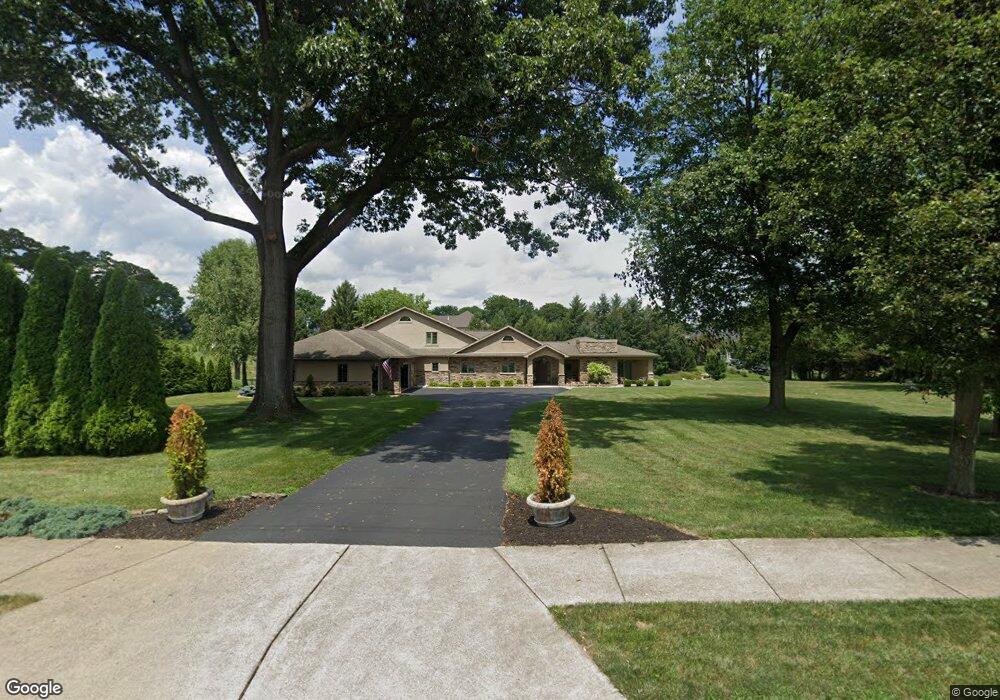
550 Bridle Path Rd Bethlehem, PA 18017
Estimated Value: $610,000 - $655,000
3
Beds
2
Baths
2,861
Sq Ft
$220/Sq Ft
Est. Value
About This Home
This home is located at 550 Bridle Path Rd, Bethlehem, PA 18017 and is currently estimated at $630,263, approximately $220 per square foot. 550 Bridle Path Rd is a home located in Northampton County with nearby schools including Asa Packer Elementary School, Nitschmann Middle School, and Liberty High School.
Ownership History
Date
Name
Owned For
Owner Type
Purchase Details
Closed on
Oct 5, 2007
Sold by
Crisci Pasquale
Bought by
Walton John C
Current Estimated Value
Home Financials for this Owner
Home Financials are based on the most recent Mortgage that was taken out on this home.
Original Mortgage
$313,500
Outstanding Balance
$193,070
Interest Rate
6.49%
Mortgage Type
New Conventional
Estimated Equity
$437,193
Purchase Details
Closed on
Sep 1, 1996
Bought by
Crisci Pasquale and Crisci Rosalba
Create a Home Valuation Report for This Property
The Home Valuation Report is an in-depth analysis detailing your home's value as well as a comparison with similar homes in the area
Home Values in the Area
Average Home Value in this Area
Purchase History
| Date | Buyer | Sale Price | Title Company |
|---|---|---|---|
| Walton John C | $330,000 | -- | |
| Crisci Pasquale | $196,000 | -- |
Source: Public Records
Mortgage History
| Date | Status | Borrower | Loan Amount |
|---|---|---|---|
| Open | Walton John C | $313,500 |
Source: Public Records
Tax History
| Year | Tax Paid | Tax Assessment Tax Assessment Total Assessment is a certain percentage of the fair market value that is determined by local assessors to be the total taxable value of land and additions on the property. | Land | Improvement |
|---|---|---|---|---|
| 2026 | $1,317 | $121,900 | $58,600 | $63,300 |
| 2025 | $1,317 | $121,900 | $58,600 | $63,300 |
| 2024 | $8,887 | $121,900 | $58,600 | $63,300 |
| 2023 | $8,917 | $121,900 | $58,600 | $63,300 |
| 2022 | $8,833 | $121,900 | $58,600 | $63,300 |
| 2021 | $8,761 | $121,900 | $58,600 | $63,300 |
| 2020 | $8,772 | $121,900 | $58,600 | $63,300 |
| 2019 | $3,199 | $121,900 | $58,600 | $63,300 |
| 2018 | $8,563 | $121,900 | $58,600 | $63,300 |
| 2017 | $8,503 | $121,900 | $58,600 | $63,300 |
| 2016 | -- | $121,900 | $58,600 | $63,300 |
| 2015 | -- | $121,900 | $58,600 | $63,300 |
| 2014 | -- | $121,900 | $58,600 | $63,300 |
Source: Public Records
Map
Nearby Homes
- 801 Yorkshire Rd
- 951 W MacAda Rd
- 2713 Center St
- 2821 Center St
- 0 Rosewood Dr Unit 766427
- 2610 Jacksonville Rd
- 706 Overlook Dr
- 1385 W MacAda Rd
- 1425 Roselawn Dr
- 2740 Stonewood Dr
- 436 E MacAda Rd
- 3424 Park Place
- 449 Elmhurst Ave
- 3470 Park Place
- 512 Forrest Ave
- 1339 Richard Ave
- 1224 Eaton Ave
- 1557 Kaywin Ave
- 1645 Mark Twain Cir
- 1655 Mark Twain Cir
- 540 Bridle Path Rd
- 560 Bridle Path Rd
- 142 Cross Creek Ct
- 2835 Cross Creek Rd
- 132 Cross Creek Ct
- 2825 Cross Creek Rd
- 162 Cross Creek Ct
- 2855 Cross Creek Rd
- 122 Cross Creek Ct
- 2632 Pioneer Rd
- 2628 Pioneer Rd
- 1003 Declaration Dr
- 141 Cross Creek Ct
- 1007 Declaration Dr
- 2820 Cross Creek Rd
- 2624 Pioneer Rd
- 492 Sugar Maple Ct
- 1009 Declaration Dr
- 151 Cross Creek Ct
- 131 Cross Creek Ct
Your Personal Tour Guide
Ask me questions while you tour the home.