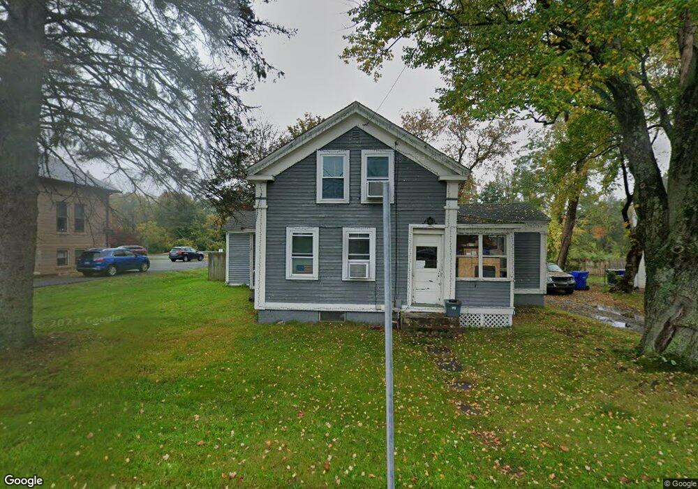
550 Buckland Rd South Windsor, CT 06074
Estimated Value: $372,000 - $507,000
3
Beds
1
Bath
1,458
Sq Ft
$282/Sq Ft
Est. Value
About This Home
This home is located at 550 Buckland Rd, South Windsor, CT 06074 and is currently estimated at $411,065, approximately $281 per square foot. 550 Buckland Rd is a home located in Hartford County with nearby schools including Timothy Edwards School, South Windsor High School, and Odyssey Community School.
Ownership History
Date
Name
Owned For
Owner Type
Purchase Details
Closed on
Sep 10, 2013
Sold by
Smith J B and Weaver Stephen T
Bought by
Caron Neil A and Caron Nadine S
Current Estimated Value
Home Financials for this Owner
Home Financials are based on the most recent Mortgage that was taken out on this home.
Original Mortgage
$136,000
Outstanding Balance
$101,246
Interest Rate
4.34%
Estimated Equity
$309,819
Purchase Details
Closed on
Mar 25, 2004
Sold by
Smith J Brian and Smith Robert
Bought by
Weaver Stephen and Brian Smith J
Home Financials for this Owner
Home Financials are based on the most recent Mortgage that was taken out on this home.
Original Mortgage
$147,250
Interest Rate
4.5%
Purchase Details
Closed on
Jan 5, 1987
Sold by
Sacks Sharon
Bought by
Smith Robert
Create a Home Valuation Report for This Property
The Home Valuation Report is an in-depth analysis detailing your home's value as well as a comparison with similar homes in the area
Home Values in the Area
Average Home Value in this Area
Purchase History
| Date | Buyer | Sale Price | Title Company |
|---|---|---|---|
| Caron Neil A | $170,000 | -- | |
| Weaver Stephen | $155,000 | -- | |
| Smith Robert | $20,000 | -- |
Source: Public Records
Mortgage History
| Date | Status | Borrower | Loan Amount |
|---|---|---|---|
| Open | Caron Neil A | $136,000 | |
| Previous Owner | Smith Robert | $147,250 | |
| Previous Owner | Smith Robert | $131,250 |
Source: Public Records
Tax History Compared to Growth
Tax History
| Year | Tax Paid | Tax Assessment Tax Assessment Total Assessment is a certain percentage of the fair market value that is determined by local assessors to be the total taxable value of land and additions on the property. | Land | Improvement |
|---|---|---|---|---|
| 2024 | $5,462 | $158,500 | $71,500 | $87,000 |
| 2023 | $5,253 | $158,500 | $71,500 | $87,000 |
| 2022 | $4,424 | $114,100 | $66,900 | $47,200 |
| 2021 | $4,320 | $114,100 | $66,900 | $47,200 |
| 2020 | $4,322 | $114,100 | $66,900 | $47,200 |
| 2019 | $4,393 | $114,100 | $66,900 | $47,200 |
| 2018 | $4,298 | $114,100 | $66,900 | $47,200 |
| 2017 | $4,383 | $115,100 | $70,400 | $44,700 |
| 2016 | $4,298 | $115,100 | $70,400 | $44,700 |
| 2015 | $4,206 | $115,100 | $70,400 | $44,700 |
| 2014 | $3,512 | $98,900 | $63,400 | $35,500 |
Source: Public Records
Map
Nearby Homes
- 11 Kupchunos Rd
- 4 Alpine Dr
- 301 Summer Hill Dr
- 33 Daisy Ln
- 10 Mohegan Trail
- 307 Sand Stone Dr
- 25 Summit Dr
- 909 Summer Hill Dr
- 244 Carriage Dr
- 175 Valley View Dr
- 122 Greenwood Dr
- 455 Oakland Rd
- 51 Carriage Dr
- 96 Candlewood Dr Unit 96
- 41 Candlewood Dr Unit 41
- 88 Andreis Trail
- 80 Candlewood Dr Unit 80
- 250 Foster Rd
- 204 Kebalo Ln
- 203 Kebalo Ln
- 19 Oakland Rd
- 544 Buckland Rd
- 542 Buckland Rd
- 530 Buckland Rd
- 115 Petersen Way
- 35 Oakland Rd
- 30 Oakland Rd
- 41 Oakland Rd
- 512 Buckland Rd
- 1760 Ellington Rd
- 49 Oakland Rd
- 85 Petersen Way
- 19 Community Rd
- 1750 Ellington Rd Unit 3
- 1744 Ellington Rd
- 1741 Ellington Road Suite 2 4
- 1741 Ellington Road Suite 2 3
- 1741 Ellington Rd Rt 30
- 1741 Ellington Rd
- 490 Buckland Rd