550 Corinth Rd Hogansville, GA 30230
Estimated Value: $126,000 - $230,000
2
Beds
2
Baths
1,256
Sq Ft
$139/Sq Ft
Est. Value
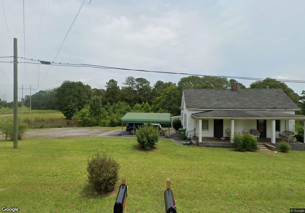
About This Home
This home is located at 550 Corinth Rd, Hogansville, GA 30230 and is currently estimated at $174,156, approximately $138 per square foot. 550 Corinth Rd is a home located in Troup County with nearby schools including Hogansville Elementary School, Callaway Elementary School, and Callaway Middle School.
Ownership History
Date
Name
Owned For
Owner Type
Purchase Details
Closed on
Sep 20, 2011
Sold by
Brock Dennis
Bought by
Pittman James B
Current Estimated Value
Purchase Details
Closed on
Sep 14, 2011
Sold by
Brock Dennis
Bought by
Pittman James B
Purchase Details
Closed on
Aug 3, 2011
Sold by
Brock Dennis
Bought by
Brock Robert Brad
Purchase Details
Closed on
Jan 1, 1957
Bought by
Brock Dennis
Create a Home Valuation Report for This Property
The Home Valuation Report is an in-depth analysis detailing your home's value as well as a comparison with similar homes in the area
Home Values in the Area
Average Home Value in this Area
Purchase History
| Date | Buyer | Sale Price | Title Company |
|---|---|---|---|
| Pittman James B | -- | -- | |
| Pittman James B | -- | -- | |
| Brock Robert Brad | -- | -- | |
| Brock Dennis | -- | -- |
Source: Public Records
Tax History Compared to Growth
Tax History
| Year | Tax Paid | Tax Assessment Tax Assessment Total Assessment is a certain percentage of the fair market value that is determined by local assessors to be the total taxable value of land and additions on the property. | Land | Improvement |
|---|---|---|---|---|
| 2024 | $1,509 | $55,320 | $21,440 | $33,880 |
| 2023 | $1,443 | $52,920 | $21,440 | $31,480 |
| 2022 | $1,194 | $42,788 | $21,440 | $21,348 |
| 2021 | $1,283 | $42,552 | $21,440 | $21,112 |
| 2020 | $1,283 | $42,552 | $21,440 | $21,112 |
| 2019 | $1,134 | $37,615 | $16,367 | $21,248 |
| 2018 | $1,068 | $35,415 | $16,367 | $19,048 |
| 2016 | $1,051 | $34,857 | $16,367 | $18,490 |
| 2015 | $1,053 | $34,857 | $16,367 | $18,490 |
| 2014 | $1,025 | $33,884 | $16,367 | $17,518 |
| 2013 | -- | $34,796 | $16,367 | $18,429 |
Source: Public Records
Map
Nearby Homes
- 221 Power Plant Rd
- 402 Power Plant Rd
- 243 Ralls Rd
- 993 Glover Rd
- GARDNER Plan at Huntcliff - Villages
- ESSEX Plan at Huntcliff - Villages
- DUPONT Plan at Huntcliff - Villages
- ROANOKE Plan at Huntcliff - Villages
- 618 Rifle Ridge
- 100 International St
- 501 Sporting Dr
- 502 Sporting Dr
- 500 Sporting Dr
- 407 Green Ave
- 717 N Boyd Rd
- 341 Foxtrot Trail
- 340 Foxtrot Trail
- 342 Foxtrot Trail
- 344 Foxtrot Trail
- 346 Foxtrot Trail