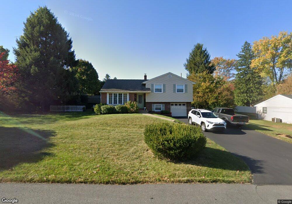
550 Hightop Rd West Chester, PA 19380
Estimated Value: $455,000 - $490,000
3
Beds
2
Baths
1,190
Sq Ft
$392/Sq Ft
Est. Value
About This Home
This home is located at 550 Hightop Rd, West Chester, PA 19380 and is currently estimated at $466,595, approximately $392 per square foot. 550 Hightop Rd is a home located in Chester County with nearby schools including Glen Acres Elementary School, J.R. Fugett Middle School, and West Chester East High School.
Ownership History
Date
Name
Owned For
Owner Type
Purchase Details
Closed on
Nov 17, 2006
Sold by
Henrickson Albert E and Henrickson Gertrude M
Bought by
Gerress Robin R and Gerress Joseph S
Current Estimated Value
Home Financials for this Owner
Home Financials are based on the most recent Mortgage that was taken out on this home.
Original Mortgage
$180,000
Outstanding Balance
$107,188
Interest Rate
6.33%
Mortgage Type
Purchase Money Mortgage
Estimated Equity
$359,407
Create a Home Valuation Report for This Property
The Home Valuation Report is an in-depth analysis detailing your home's value as well as a comparison with similar homes in the area
Home Values in the Area
Average Home Value in this Area
Purchase History
| Date | Buyer | Sale Price | Title Company |
|---|---|---|---|
| Gerress Robin R | $289,000 | None Available |
Source: Public Records
Mortgage History
| Date | Status | Borrower | Loan Amount |
|---|---|---|---|
| Open | Gerress Robin R | $180,000 |
Source: Public Records
Tax History Compared to Growth
Tax History
| Year | Tax Paid | Tax Assessment Tax Assessment Total Assessment is a certain percentage of the fair market value that is determined by local assessors to be the total taxable value of land and additions on the property. | Land | Improvement |
|---|---|---|---|---|
| 2025 | $3,289 | $113,470 | $35,000 | $78,470 |
| 2024 | $3,289 | $113,470 | $35,000 | $78,470 |
| 2023 | $3,289 | $113,470 | $35,000 | $78,470 |
| 2022 | $3,247 | $113,470 | $35,000 | $78,470 |
| 2021 | $3,201 | $113,470 | $35,000 | $78,470 |
| 2020 | $3,181 | $113,470 | $35,000 | $78,470 |
| 2019 | $3,136 | $113,470 | $35,000 | $78,470 |
| 2018 | $3,070 | $113,470 | $35,000 | $78,470 |
| 2017 | $3,003 | $113,470 | $35,000 | $78,470 |
| 2016 | $2,394 | $113,470 | $35,000 | $78,470 |
| 2015 | $2,394 | $113,470 | $35,000 | $78,470 |
| 2014 | $2,394 | $113,470 | $35,000 | $78,470 |
Source: Public Records
Map
Nearby Homes
- 1209 Thistlewood Ln
- 210 Spring Ln
- 220 Spring Ln
- 201 Seal Ln
- 130 Chatwood Ave
- 1220 Hawthorne Ln
- 1521 Honeysuckle Ct
- 4 New Countryside Dr
- 1114 Stoneybrook Ln
- 852 Cedar Ave
- 404 Warren Rd
- 503 Warren Rd
- 662 Reservoir Rd
- 107 Adrienne Ct
- 501 Glen Ave
- 1212 Sylvan Rd
- 809 Amelia Dr
- 904 Sylvania Ln
- 1401 Timber Mill Ln
- 1402 Timber Mill Ln
- 549 Fernhill Rd
- 548 Hightop Rd
- 552 Hightop Rd
- 551 Fernhill Rd
- 547 Fernhill Rd
- 1203 Thistlewood Ln
- 1206 Thistlewood Ln
- 546 Hightop Rd
- 545 Fernhill Rd
- 554 Hightop Rd
- 1205 Lotus Ln
- 550 Fernhill Rd
- 1204 Paoli Pike
- 553 Fernhill Rd
- 1205 Thistlewood Ln
- 552 Fernhill Rd
- 548 Fernhill Rd
- 1208 Thistlewood Ln
- 1206 Paoli Pike
- 543 Fernhill Rd