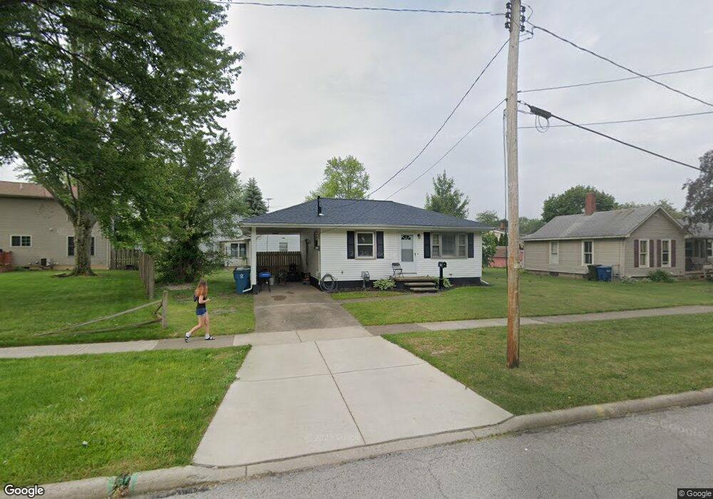
550 Maple Ave Amherst, OH 44001
Estimated Value: $91,943 - $133,000
2
Beds
1
Bath
672
Sq Ft
$169/Sq Ft
Est. Value
About This Home
This home is located at 550 Maple Ave, Amherst, OH 44001 and is currently estimated at $113,486, approximately $168 per square foot. 550 Maple Ave is a home located in Lorain County with nearby schools including Powers Elementary School, Walter G. Nord Middle School, and Amherst Junior High School.
Ownership History
Date
Name
Owned For
Owner Type
Purchase Details
Closed on
Mar 1, 2021
Sold by
Ritter Daniel R
Bought by
Nichart William C
Current Estimated Value
Purchase Details
Closed on
Aug 6, 2005
Sold by
Ritter Michelle R
Bought by
Ritter Daniel R
Purchase Details
Closed on
Jul 7, 2000
Sold by
Ralph L & Mary S Walker Family Trust
Bought by
Ritter Daniel Ralph and Ritter Michelle R
Create a Home Valuation Report for This Property
The Home Valuation Report is an in-depth analysis detailing your home's value as well as a comparison with similar homes in the area
Home Values in the Area
Average Home Value in this Area
Purchase History
| Date | Buyer | Sale Price | Title Company |
|---|---|---|---|
| Nichart William C | $55,000 | 1St Nationwide Title Agency | |
| Ritter Daniel R | -- | -- | |
| Ritter Daniel Ralph | $65,000 | -- |
Source: Public Records
Tax History Compared to Growth
Tax History
| Year | Tax Paid | Tax Assessment Tax Assessment Total Assessment is a certain percentage of the fair market value that is determined by local assessors to be the total taxable value of land and additions on the property. | Land | Improvement |
|---|---|---|---|---|
| 2024 | $1,404 | $33,943 | $9,202 | $24,742 |
| 2023 | $1,432 | $27,115 | $8,617 | $18,498 |
| 2022 | $1,379 | $27,115 | $8,617 | $18,498 |
| 2021 | $1,383 | $27,115 | $8,617 | $18,498 |
| 2020 | $1,325 | $23,000 | $7,310 | $15,690 |
| 2019 | $1,302 | $23,000 | $7,310 | $15,690 |
| 2018 | $1,183 | $23,000 | $7,310 | $15,690 |
| 2017 | $1,159 | $20,740 | $6,200 | $14,540 |
| 2016 | $1,169 | $20,740 | $6,200 | $14,540 |
| 2015 | $1,164 | $20,740 | $6,200 | $14,540 |
| 2014 | $1,072 | $19,020 | $5,680 | $13,340 |
| 2013 | $1,046 | $19,020 | $5,680 | $13,340 |
Source: Public Records
Map
Nearby Homes
- 2176 Myla Way
- 2180 Myla Way
- 891 Park Ave
- 653 Brennan Dr
- 168 Orchard Hill Dr
- 1140 Woodside Dr
- 825 Cleveland Ave
- V/L Middle Ridge Rd
- 394 Long St
- 0 Middle Ridge Rd Unit 5160578
- 0 Middle Ridge Rd Unit 5102632
- 483 N Main St
- 328 Buttermere Ln Unit 328
- 281 English Lakes Blvd Unit 67281
- 133 Ambleside Way
- 621 Van Oaks Dr
- 923 Longitude Ln
- 0 Stonebridge Dr
- 726 Sunrise Dr
- 812 Bearing Ct
- 536 Maple Ave
- 567 Franklin Ave
- 571 Franklin Ave
- 541 Franklin Ave
- 541 Franklin Ave
- 492 Maple Ave
- 505 Franklin Ave
- 570 Franklin Ave
- 504 East St
- 536 Franklin Ave
- 0 Middle St
- 450 Middle St
- 450 Middle St
- 488 Maple Ave
- 489 Franklin Ave
- 506 Franklin Ave
- 644 Mill St
- 621 Mill St
- 467 Franklin Ave
- 527 Middle St