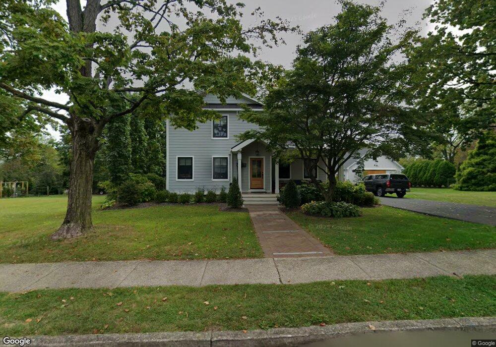
550 Maple Ave Doylestown, PA 18901
Estimated Value: $523,000 - $884,000
4
Beds
3
Baths
2,348
Sq Ft
$334/Sq Ft
Est. Value
About This Home
This home is located at 550 Maple Ave, Doylestown, PA 18901 and is currently estimated at $783,174, approximately $333 per square foot. 550 Maple Ave is a home located in Bucks County with nearby schools including Linden El School, Lenape Middle School, and Central Bucks High School-West.
Ownership History
Date
Name
Owned For
Owner Type
Purchase Details
Closed on
Nov 14, 2018
Sold by
Fonash Yvonne T
Bought by
Castor Grant W and Castor Marie R
Current Estimated Value
Purchase Details
Closed on
Jun 8, 2017
Sold by
Fonash Yvonne T
Bought by
Fonash Yvonne T and Switch Marielllen
Purchase Details
Closed on
Aug 17, 1964
Bought by
Fonash William J and Fonash Yvonne
Create a Home Valuation Report for This Property
The Home Valuation Report is an in-depth analysis detailing your home's value as well as a comparison with similar homes in the area
Home Values in the Area
Average Home Value in this Area
Purchase History
| Date | Buyer | Sale Price | Title Company |
|---|---|---|---|
| Castor Grant W | $275,000 | Principle Abstract & Settlem | |
| Fonash Yvonne T | -- | None Available | |
| Fonash William J | -- | -- |
Source: Public Records
Tax History
| Year | Tax Paid | Tax Assessment Tax Assessment Total Assessment is a certain percentage of the fair market value that is determined by local assessors to be the total taxable value of land and additions on the property. | Land | Improvement |
|---|---|---|---|---|
| 2025 | $7,134 | $39,600 | $10,400 | $29,200 |
| 2024 | $7,134 | $39,600 | $10,400 | $29,200 |
| 2023 | $5,810 | $33,850 | $10,400 | $23,450 |
| 2022 | $5,729 | $33,850 | $10,400 | $23,450 |
| 2021 | $5,666 | $33,850 | $10,400 | $23,450 |
| 2020 | $4,370 | $26,400 | $10,400 | $16,000 |
| 2019 | $4,322 | $26,400 | $10,400 | $16,000 |
| 2018 | $4,270 | $26,400 | $10,400 | $16,000 |
| 2017 | $4,225 | $26,400 | $10,400 | $16,000 |
| 2016 | $4,225 | $26,400 | $10,400 | $16,000 |
| 2015 | -- | $26,400 | $10,400 | $16,000 |
| 2014 | -- | $26,400 | $10,400 | $16,000 |
Source: Public Records
Map
Nearby Homes
- 5 Belmont Square
- 9 Maple Ln
- 607 S Chubb Dr
- 146 E Court St
- 150 Selner Ln
- 169 N Main St
- 102 Clear Springs Ct
- 34 Houk Rd
- 110 E Ashland St
- 69 E Oakland Ave
- 3660 Buttonwood Dr
- 236 Green St
- 45 Springs Dr
- 3795 Route 202
- 117 Cottonwood Ct
- 6 Edison Ln Unit 1
- 807 N Broad St
- 117 Windover Ln
- 3775 Buckingham Dr
- 000 Cherry Ln
Your Personal Tour Guide
Ask me questions while you tour the home.