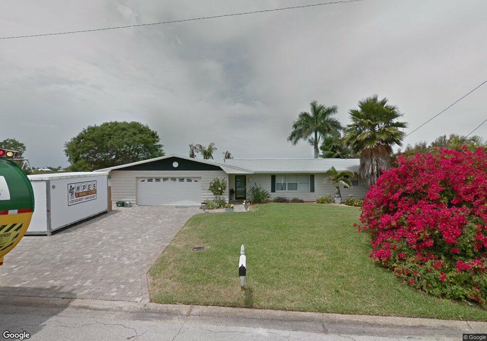
550 Mcnabb Pkwy Cocoa Beach, FL 32931
Estimated Value: $825,000 - $1,029,000
3
Beds
2
Baths
2,121
Sq Ft
$430/Sq Ft
Est. Value
About This Home
This home is located at 550 Mcnabb Pkwy, Cocoa Beach, FL 32931 and is currently estimated at $912,001, approximately $429 per square foot. 550 Mcnabb Pkwy is a home located in Brevard County with nearby schools including Theodore Roosevelt Elementary School, Cocoa Beach Junior/Senior High School, and Cocoa Beach Christian School.
Ownership History
Date
Name
Owned For
Owner Type
Purchase Details
Closed on
Jul 6, 2009
Sold by
Zorn David Edgar
Bought by
Zorn Barbara J
Current Estimated Value
Purchase Details
Closed on
Feb 24, 1995
Sold by
Hahn Kenneth Wu and Hahn Norma Jacqueline
Bought by
Zorn David E and Horn Barbara J
Home Financials for this Owner
Home Financials are based on the most recent Mortgage that was taken out on this home.
Original Mortgage
$159,600
Interest Rate
9.18%
Create a Home Valuation Report for This Property
The Home Valuation Report is an in-depth analysis detailing your home's value as well as a comparison with similar homes in the area
Home Values in the Area
Average Home Value in this Area
Purchase History
| Date | Buyer | Sale Price | Title Company |
|---|---|---|---|
| Zorn Barbara J | -- | Attorney | |
| Zorn David E | $168,000 | -- |
Source: Public Records
Mortgage History
| Date | Status | Borrower | Loan Amount |
|---|---|---|---|
| Previous Owner | Zorn David E | $159,600 |
Source: Public Records
Tax History Compared to Growth
Tax History
| Year | Tax Paid | Tax Assessment Tax Assessment Total Assessment is a certain percentage of the fair market value that is determined by local assessors to be the total taxable value of land and additions on the property. | Land | Improvement |
|---|---|---|---|---|
| 2025 | $4,159 | $302,340 | -- | -- |
| 2024 | $4,075 | $293,820 | -- | -- |
| 2023 | $4,075 | $285,270 | $0 | $0 |
| 2022 | $3,780 | $276,970 | $0 | $0 |
| 2021 | $3,773 | $268,910 | $0 | $0 |
| 2020 | $3,743 | $265,200 | $0 | $0 |
| 2019 | $3,720 | $259,240 | $0 | $0 |
| 2018 | $3,704 | $254,410 | $0 | $0 |
| 2017 | $3,728 | $249,180 | $0 | $0 |
| 2016 | $3,717 | $244,060 | $240,000 | $4,060 |
| 2015 | $3,713 | $242,370 | $240,000 | $2,370 |
| 2014 | $3,726 | $240,450 | $215,000 | $25,450 |
Source: Public Records
Map
Nearby Homes
- 492 Dempsey Dr
- 416 N 4th St
- 308 Formosa Dr
- 276 Curacau Dr
- 240 Woodland Ave Unit 2
- 150 Cedar Ave
- 249 Curacau Dr
- 255 Woodland Ave Unit 1
- 344 N Brevard Ave
- 500 Catalina Rd Unit 203
- 380 N Brevard Ave Unit C1
- 29 Azalea Dr
- 300 N Brevard Ave
- 335 N Brevard Ave
- 714 Catalina Rd Unit 15
- 714 Catalina Rd Unit 2
- 737 Nassau Rd
- 0 Unknown Unit 1061043
- 17 Danube River Dr
- 310 N Atlantic Ave
- 560 Mcnabb Pkwy
- 491 Dempsey Dr
- 570 Mcnabb Pkwy
- 490 Blakey Blvd
- 483 Dempsey Dr
- 484 Dempsey Dr
- 580 Mcnabb Pkwy
- 482 Blakey Blvd
- 489 Blakey Blvd
- 517 Naish Ave
- 474 Blakey Blvd
- 481 Blakey Blvd
- 476 Dempsey Dr
- 493 Watts Way
- 485 Watts Way
- 467 Dempsey Dr
- 509 Naish Ave
- 473 Blakey Blvd
- 398 Mcnabb Pkwy
- 466 Blakey Blvd