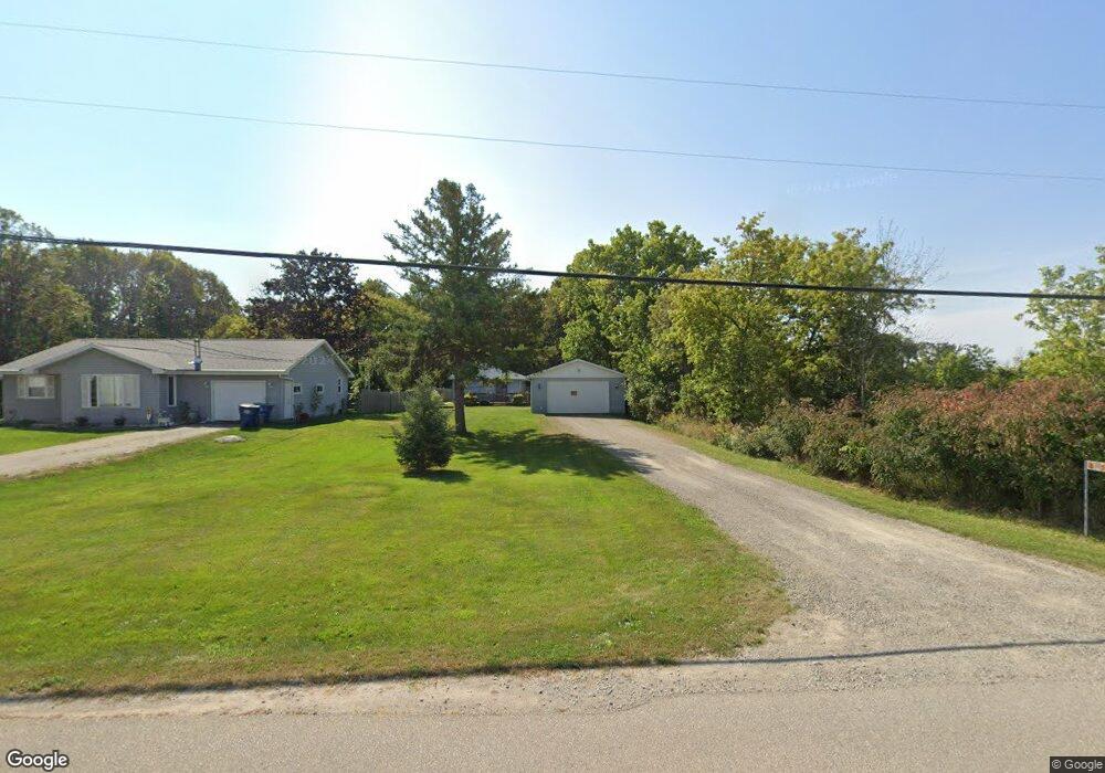
550 Muttart Rd Neenah, WI 54956
Estimated Value: $256,262 - $346,000
3
Beds
2
Baths
1,632
Sq Ft
$189/Sq Ft
Est. Value
About This Home
This home is located at 550 Muttart Rd, Neenah, WI 54956 and is currently estimated at $308,066, approximately $188 per square foot. 550 Muttart Rd is a home located in Winnebago County with nearby schools including Lakeview Elementary School, Horace Mann Middle School, and Neenah Middle School.
Ownership History
Date
Name
Owned For
Owner Type
Purchase Details
Closed on
Feb 22, 2019
Sold by
Debroux Zabrina L
Bought by
Debroux Adam A
Current Estimated Value
Home Financials for this Owner
Home Financials are based on the most recent Mortgage that was taken out on this home.
Original Mortgage
$114,600
Outstanding Balance
$100,548
Interest Rate
4.4%
Mortgage Type
New Conventional
Estimated Equity
$207,518
Purchase Details
Closed on
Sep 22, 2010
Sold by
Lehrke Don W
Bought by
Calumet County Bank
Purchase Details
Closed on
Dec 21, 2005
Sold by
Lemmers Cynthia L
Bought by
Lehrke Don W
Home Financials for this Owner
Home Financials are based on the most recent Mortgage that was taken out on this home.
Original Mortgage
$116,000
Interest Rate
6.48%
Mortgage Type
Purchase Money Mortgage
Create a Home Valuation Report for This Property
The Home Valuation Report is an in-depth analysis detailing your home's value as well as a comparison with similar homes in the area
Home Values in the Area
Average Home Value in this Area
Purchase History
| Date | Buyer | Sale Price | Title Company |
|---|---|---|---|
| Debroux Adam A | -- | Knight Barry Title | |
| Calumet County Bank | $113,000 | -- | |
| Lehrke Don W | $105,000 | None Available |
Source: Public Records
Mortgage History
| Date | Status | Borrower | Loan Amount |
|---|---|---|---|
| Open | Debroux Adam A | $114,600 | |
| Previous Owner | Lehrke Don W | $116,000 |
Source: Public Records
Tax History Compared to Growth
Tax History
| Year | Tax Paid | Tax Assessment Tax Assessment Total Assessment is a certain percentage of the fair market value that is determined by local assessors to be the total taxable value of land and additions on the property. | Land | Improvement |
|---|---|---|---|---|
| 2024 | $1,994 | $144,300 | $26,800 | $117,500 |
| 2023 | $1,934 | $144,300 | $26,800 | $117,500 |
| 2022 | $1,987 | $144,300 | $26,800 | $117,500 |
| 2021 | $1,910 | $144,300 | $26,800 | $117,500 |
| 2020 | $2,079 | $144,300 | $26,800 | $117,500 |
| 2019 | $1,874 | $120,900 | $19,500 | $101,400 |
| 2018 | $1,804 | $120,900 | $19,500 | $101,400 |
| 2017 | $1,928 | $120,900 | $19,500 | $101,400 |
| 2016 | $2,041 | $120,900 | $19,500 | $101,400 |
| 2015 | $1,863 | $120,900 | $19,500 | $101,400 |
| 2014 | -- | $120,900 | $19,500 | $101,400 |
| 2013 | -- | $120,900 | $19,500 | $101,400 |
Source: Public Records
Map
Nearby Homes
- 140 Schramm Way
- 1618 Paynes Point Rd
- 260 Fort Dr
- 2616 Marathon Ave
- 1433 Freedom Ct
- 1442 Baytree Ln
- 2513 Bishops Ln
- 2375 Fiesta Ct Unit 2377
- 1468 Plains Ave
- 2419 Maple Grove Dr
- 130 Southfield Ct
- 0 S Commercial St Unit 50063338
- 123 Southfield Ct
- 127 Southfield Ct
- 1599 Redwing Dr
- 1372 Baytree Ln
- 1562 Lone Oak Dr
- 1341 Alpine Ln
- 1516 Kingswood Dr
- 1316 Wedgewood Ln
- 548 Muttart Rd
- 540 Muttart Rd
- 530 Muttart Rd
- 522 Muttart Rd
- 516 Muttart Rd
- 511 Muttart Rd
- 2637 Towerview Dr
- 500 Muttart Rd
- 2620 Towerview Dr
- 2638 Towerview Dr
- 2619 Towerview Dr
- 2632 Towerview Dr
- 2626 Towerview Dr
- 2625 Towerview Dr
- 0 Towerview Dr
- 0 Towerview Dr
- 0 Towerview Dr
- 0 Towerview Dr
- 0 Towerview Dr
- 0 Towerview Dr