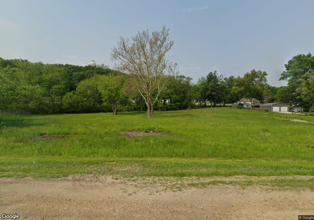
550 N 2nd Ave Carbon Cliff, IL 61239
Estimated Value: $51,000 - $81,216
Studio
--
Bath
1,656
Sq Ft
$40/Sq Ft
Est. Value
About This Home
This home is located at 550 N 2nd Ave, Carbon Cliff, IL 61239 and is currently estimated at $65,554, approximately $39 per square foot. 550 N 2nd Ave is a home located in Rock Island County with nearby schools including Eagle Ridge School, United Township High School, and Our Lady Of Grace.
Ownership History
Date
Name
Owned For
Owner Type
Purchase Details
Closed on
Dec 4, 2024
Sold by
Rotz William L and Rotz Lorna J
Bought by
Dans Automotive Properties Llc
Current Estimated Value
Home Financials for this Owner
Home Financials are based on the most recent Mortgage that was taken out on this home.
Original Mortgage
$76,000
Outstanding Balance
$66,118
Interest Rate
6.54%
Mortgage Type
New Conventional
Estimated Equity
-$564
Purchase Details
Closed on
May 6, 2021
Sold by
Village Of Carbon Cliff
Bought by
Rotz William L and Rotz Lorna J
Create a Home Valuation Report for This Property
The Home Valuation Report is an in-depth analysis detailing your home's value as well as a comparison with similar homes in the area
Home Values in the Area
Average Home Value in this Area
Purchase History
| Date | Buyer | Sale Price | Title Company |
|---|---|---|---|
| Dans Automotive Properties Llc | $60,000 | None Listed On Document | |
| Rotz William L | $30,000 | Mason And Scott Pc |
Source: Public Records
Mortgage History
| Date | Status | Borrower | Loan Amount |
|---|---|---|---|
| Open | Dans Automotive Properties Llc | $76,000 |
Source: Public Records
Tax History
| Year | Tax Paid | Tax Assessment Tax Assessment Total Assessment is a certain percentage of the fair market value that is determined by local assessors to be the total taxable value of land and additions on the property. | Land | Improvement |
|---|---|---|---|---|
| 2024 | $1,170 | $12,185 | $12,185 | $0 |
| 2023 | $1,170 | $11,420 | $11,420 | $0 |
| 2022 | $1,011 | $10,460 | $10,460 | $0 |
| 2021 | $633 | $6,689 | $6,689 | $0 |
| 2020 | $0 | $0 | $0 | $0 |
| 2019 | $59 | $0 | $0 | $0 |
| 2018 | $0 | $0 | $0 | $0 |
| 2017 | -- | $0 | $0 | $0 |
| 2016 | -- | $0 | $0 | $0 |
| 2015 | -- | $0 | $0 | $0 |
| 2014 | -- | $41,172 | $5,760 | $35,412 |
| 2013 | -- | $41,172 | $5,760 | $35,412 |
Source: Public Records
Map
Nearby Homes
- 809 Foret Mansur Ln
- 16713 10th Ave N
- OUTLOT C Foret Mansur
- 701 Williams Way
- 705 Williams Way
- 709 Williams Way
- 805 Williams Way
- 801 Williams Way
- 809 Williams Way
- 813 Williams Way
- 704 Mansur Ln
- 800 John's Place
- 800 Rebecca Ln
- 1000 Rebecca Ln
- 900 Rebecca Ln
- 908 Rebecca Ln
- 801 Rebecca Dr
- 1812 10th Ave
- 16806 10th Ave N
- 1013 14th St
- 619 Mansur Ave
- 636 N 2nd Ave
- 550 Mansur Ave
- 625 Mansur Ave
- 602 Mansur Ave
- 622 Mansur Ave
- 631 Mansur Ave
- 638 N 2nd Ave
- 534 Mansur Ave Unit AE
- 534 Mansur Ave
- 628 Mansur Ave
- 718 N 2nd Ave Unit 1
- 718 N 2nd Ave
- 624 Mansur Ave
- 348 Valley View Dr
- 703 Allen St
- 521 Mansur Ave
- 521 Mansur Ave
- 705 Allen St
- 338 N 2nd Ave
Your Personal Tour Guide
Ask me questions while you tour the home.
