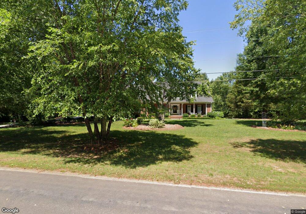
550 Price Farm Rd Stokesdale, NC 27357
Estimated Value: $393,000 - $540,847
4
Beds
5
Baths
4,300
Sq Ft
$108/Sq Ft
Est. Value
About This Home
This home is located at 550 Price Farm Rd, Stokesdale, NC 27357 and is currently estimated at $463,712, approximately $107 per square foot. 550 Price Farm Rd is a home located in Rockingham County with nearby schools including Huntsville Elementary School, John W. Dillard Academy, and Western Rockingham Middle School.
Ownership History
Date
Name
Owned For
Owner Type
Purchase Details
Closed on
Nov 26, 2014
Sold by
Ellis Gary Wayne and Ellis Lois Kallam
Bought by
Ellis Lois Kallam
Current Estimated Value
Purchase Details
Closed on
Apr 5, 2007
Sold by
Marshall Woods Llc
Bought by
Ellis Gary Wayne
Purchase Details
Closed on
Mar 19, 2007
Sold by
Ellis Gary Wayne and Ellis Lois Kallam
Bought by
Ellis Gary Wayne and Ellis Lois Kallam
Purchase Details
Closed on
Feb 2, 2007
Sold by
Ellis Gary Wayne and Ellis Lois Kallam
Bought by
Ellis Gary Wayne and Ellis Lois Kallam
Create a Home Valuation Report for This Property
The Home Valuation Report is an in-depth analysis detailing your home's value as well as a comparison with similar homes in the area
Home Values in the Area
Average Home Value in this Area
Purchase History
| Date | Buyer | Sale Price | Title Company |
|---|---|---|---|
| Ellis Lois Kallam | -- | None Available | |
| Ellis Gary Wayne | $252,000 | None Available | |
| Ellis Gary Wayne | -- | None Available | |
| Ellis Gary Wayne | -- | None Available |
Source: Public Records
Tax History Compared to Growth
Tax History
| Year | Tax Paid | Tax Assessment Tax Assessment Total Assessment is a certain percentage of the fair market value that is determined by local assessors to be the total taxable value of land and additions on the property. | Land | Improvement |
|---|---|---|---|---|
| 2025 | $3,616 | $520,219 | $44,875 | $475,344 |
| 2024 | $3,444 | $520,219 | $44,875 | $475,344 |
| 2023 | $3,444 | $315,244 | $27,333 | $287,911 |
| 2022 | $2,459 | $315,244 | $27,333 | $287,911 |
| 2021 | $2,459 | $315,244 | $27,333 | $287,911 |
| 2020 | $2,459 | $315,244 | $27,333 | $287,911 |
| 2019 | $2,459 | $315,244 | $27,333 | $287,911 |
| 2018 | $2,376 | $304,226 | $34,477 | $269,749 |
| 2017 | $2,376 | $304,226 | $34,477 | $269,749 |
| 2015 | $2,400 | $304,226 | $34,477 | $269,749 |
| 2014 | $2,392 | $304,226 | $34,477 | $269,749 |
Source: Public Records
Map
Nearby Homes
- 478 Price Farm Rd
- 230 Welcome Home Rd
- 325 Twin Creeks Dr
- 223 Twin Creeks Dr
- 0 Rockwood Dr
- 215 Northcrest Dr
- Belhaven Plan at Neal Farm
- Penwell Plan at Neal Farm
- Taylor Plan at Neal Farm
- Freeport Plan at Neal Farm
- 177 E Farm Loop
- 113 W Farm Loop
- 163 E Farm Loop
- 128 Willowbrooke Way
- 129 W Holly Oak Way
- 410 Willowbrooke Way
- 406 Willowbrooke Way
- 130 W Holly Oak Way
- 119 W Holly Oak Way
- 409 Willowbrooke Way
- 342 Price Farm Rd
- 524 Price Farm Rd
- 586 Price Farm Rd
- 514 Price Farm Rd
- 121 Welcome Home Rd
- 486 Price Farm Rd
- 151 Welcome Home Rd
- 120 Welcome Home Rd
- 628 Price Farm Rd
- 500 Price Farm Rd
- 468 Price Farm Rd
- 171 Welcome Home Rd
- 146 Welcome Home Rd
- 499 Twin Creeks Dr
- 481 Twin Creeks Dr
- 458 Price Farm Rd
- 523 Bennett Farm Rd
- 493 Bennett Farm Rd
- 188 Welcome Home Rd
- 450 Price Farm Rd