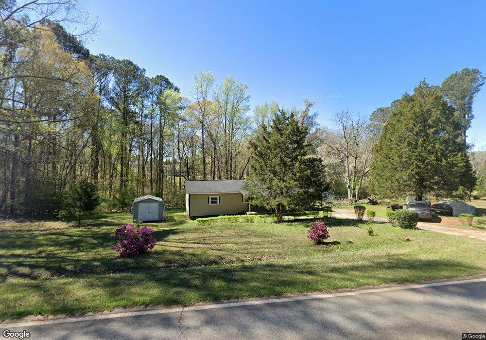
550 Pyne Rd Lagrange, GA 30240
Estimated Value: $87,859 - $185,000
2
Beds
1
Bath
840
Sq Ft
$174/Sq Ft
Est. Value
About This Home
This home is located at 550 Pyne Rd, Lagrange, GA 30240 and is currently estimated at $146,465, approximately $174 per square foot. 550 Pyne Rd is a home located in Troup County with nearby schools including Long Cane Elementary School, Berta Weathersbee Elementary School, and Whitesville Road Elementary School.
Ownership History
Date
Name
Owned For
Owner Type
Purchase Details
Closed on
Mar 15, 1990
Sold by
Carl Whitfield
Bought by
Huguley Nellie M
Current Estimated Value
Purchase Details
Closed on
Feb 22, 1984
Sold by
Austell Whitfield Jr Etal
Bought by
Carl Whitfield
Purchase Details
Closed on
Jan 1, 1974
Sold by
Nellie Mae Whitfield
Bought by
Austell Whitfield Jr Etal
Purchase Details
Closed on
Jan 1, 1959
Sold by
Shady Grove Baptist Church
Bought by
Nellie Mae Whitfield
Create a Home Valuation Report for This Property
The Home Valuation Report is an in-depth analysis detailing your home's value as well as a comparison with similar homes in the area
Purchase History
| Date | Buyer | Sale Price | Title Company |
|---|---|---|---|
| Huguley Nellie M | -- | -- | |
| Carl Whitfield | -- | -- | |
| Austell Whitfield Jr Etal | -- | -- | |
| Nellie Mae Whitfield | -- | -- |
Source: Public Records
Tax History
| Year | Tax Paid | Tax Assessment Tax Assessment Total Assessment is a certain percentage of the fair market value that is determined by local assessors to be the total taxable value of land and additions on the property. | Land | Improvement |
|---|---|---|---|---|
| 2025 | $819 | $30,040 | $6,040 | $24,000 |
| 2024 | $706 | $25,900 | $6,040 | $19,860 |
| 2023 | $579 | $21,232 | $6,040 | $15,192 |
| 2022 | $567 | $20,312 | $6,040 | $14,272 |
| 2021 | $284 | $9,408 | $5,680 | $3,728 |
| 2020 | $284 | $9,408 | $5,680 | $3,728 |
| 2019 | $296 | $9,824 | $5,680 | $4,144 |
| 2018 | $285 | $9,440 | $5,680 | $3,760 |
| 2017 | $1 | $9,440 | $5,680 | $3,760 |
| 2016 | $69 | $12,242 | $5,700 | $6,542 |
| 2015 | $9 | $10,232 | $5,700 | $4,532 |
| 2014 | $9 | $10,232 | $5,700 | $4,532 |
| 2013 | -- | $10,232 | $5,700 | $4,532 |
Source: Public Records
Map
Nearby Homes
- 135 Planters Ridge Dr
- 113 Colonial Ct Unit 100
- 119 Plymouth Dr
- 311 Cumberland Dr
- 101 Ivy Springs Dr
- 474 Newton Rd
- 104 Bridlewood Dr
- 124 Foxdale Dr
- 440 & 448 Kimbrough Rd
- 4.5 ACRES Whatley Rd N
- 0 Deming St Unit 10550189
- 0 Salem Rd Tract 2 Unit 10675187
- 213 Linda Ln
- 266 Glass Bridge Rd
- 640 Hudson Rd
- 226 Linda Ln
- 3835 W Point Rd
- 104 Dogwood Point
- 0 Glass Bridge Rd Unit 10679358
- 104 Hidden Springs Dr
- 0 Pyne Rd Unit 2.19+/- Acre 8619666
- 0 Pyne Rd Unit 2.19+/- Acre 8515698
- 594 Pyne Rd
- 583 Pyne Rd
- 547 Pyne Rd
- 102 Newton Rd
- 498 Pyne Rd
- 613 Pyne Rd
- 82 Newton Rd Unit 6
- 82 Newton Rd
- 72 Newton Rd
- 72 Newton Rd Unit 7
- 636 Pyne Rd
- 475 Pyne Rd
- 92 Newton Rd
- 122 Newton Rd
- 112 Newton Rd
- 132 Newton Rd
- 52 Newton Rd
- 656 Pyne Rd
Your Personal Tour Guide
Ask me questions while you tour the home.