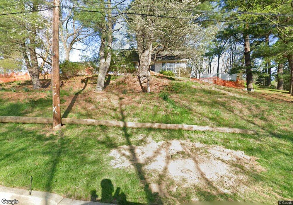
550 Spring Ln Philadelphia, PA 19128
Upper Roxborough NeighborhoodEstimated Value: $475,000 - $735,000
3
Beds
4
Baths
1,575
Sq Ft
$374/Sq Ft
Est. Value
About This Home
This home is located at 550 Spring Ln, Philadelphia, PA 19128 and is currently estimated at $588,319, approximately $373 per square foot. 550 Spring Ln is a home located in Philadelphia County with nearby schools including Shawmont School, Roxborough High School, and Green Woods CS.
Ownership History
Date
Name
Owned For
Owner Type
Purchase Details
Closed on
Dec 28, 2009
Sold by
Hood Patricia B and Hood Ian C
Bought by
Koltes Steven
Current Estimated Value
Purchase Details
Closed on
Dec 17, 2002
Sold by
Hood Patricia B and Hood Ian C
Bought by
Hood Ian C and Hood Patricia B
Home Financials for this Owner
Home Financials are based on the most recent Mortgage that was taken out on this home.
Original Mortgage
$115,822
Interest Rate
6.11%
Purchase Details
Closed on
Jan 25, 1995
Sold by
Hood Ian C and Hood Patricia B
Bought by
Hood Patricia B
Create a Home Valuation Report for This Property
The Home Valuation Report is an in-depth analysis detailing your home's value as well as a comparison with similar homes in the area
Home Values in the Area
Average Home Value in this Area
Purchase History
| Date | Buyer | Sale Price | Title Company |
|---|---|---|---|
| Koltes Steven | $360,000 | None Available | |
| Hood Ian C | -- | -- | |
| Hood Patricia B | -- | -- |
Source: Public Records
Mortgage History
| Date | Status | Borrower | Loan Amount |
|---|---|---|---|
| Previous Owner | Hood Ian C | $115,822 |
Source: Public Records
Tax History Compared to Growth
Tax History
| Year | Tax Paid | Tax Assessment Tax Assessment Total Assessment is a certain percentage of the fair market value that is determined by local assessors to be the total taxable value of land and additions on the property. | Land | Improvement |
|---|---|---|---|---|
| 2025 | $5,813 | $442,200 | $88,440 | $353,760 |
| 2024 | $5,813 | $442,200 | $88,440 | $353,760 |
| 2023 | $5,813 | $415,300 | $83,060 | $332,240 |
| 2022 | $4,598 | $415,300 | $83,060 | $332,240 |
| 2021 | $4,598 | $0 | $0 | $0 |
| 2020 | $4,598 | $0 | $0 | $0 |
| 2019 | $4,520 | $0 | $0 | $0 |
| 2018 | $4,089 | $0 | $0 | $0 |
| 2017 | $4,089 | $0 | $0 | $0 |
| 2016 | $4,089 | $0 | $0 | $0 |
| 2015 | $3,914 | $0 | $0 | $0 |
| 2014 | -- | $292,100 | $90,457 | $201,643 |
| 2012 | -- | $44,256 | $16,866 | $27,390 |
Source: Public Records
Map
Nearby Homes
- 615 Spring Ln
- 625 Spring Ln
- 8669 Steeple Dr
- 9001 Ridge Ave Unit 31
- 9001 Ridge Ave Unit 14
- 853 Ronnie Ln
- 857 Hamilton Dr
- 622 Keely Ct
- 929 Manatawna Ave
- 714 Crestview Rd
- 804 Keely Place
- 385 Port Royal Ave
- 937 Caledonia St
- 488 Evergreen Ave
- 571 Shawmont Ave
- 604 Palairet Rd
- 661 Ridge Pike
- 909 Glenroy Rd
- 261 Shawmont Ave Unit D
- 32 River Rd
- 510 Lantern Ln
- 512 Lantern Ln
- 508 Lantern Ln
- 514 Lantern Ln
- 506 Lantern Ln
- 560 Spring Ln
- 516 Lantern Ln
- 505 Lantern Ln
- 518 Lantern Ln
- 507 Lantern Ln
- 502 Lantern Ln
- 503 Lantern Ln
- 509 Lantern Ln
- 511 Lantern Ln
- 718 Manatawna Ave
- 522 Lantern Ln
- 513 Lantern Ln
- 570 Spring Ln
- 500 Lantern Ln
- 501 Lantern Ln