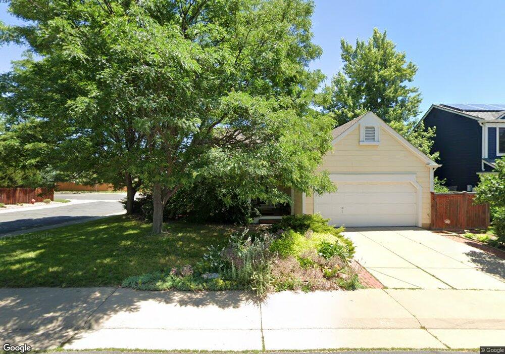
550 W Sandbar Cir Louisville, CO 80027
Estimated Value: $681,000 - $812,000
3
Beds
3
Baths
1,236
Sq Ft
$623/Sq Ft
Est. Value
About This Home
This home is located at 550 W Sandbar Cir, Louisville, CO 80027 and is currently estimated at $769,909, approximately $622 per square foot. 550 W Sandbar Cir is a home located in Boulder County with nearby schools including Fireside Elementary School, Monarch K-8 School, and Monarch High School.
Ownership History
Date
Name
Owned For
Owner Type
Purchase Details
Closed on
Nov 10, 1992
Bought by
Newton Mary Kathleen P
Current Estimated Value
Purchase Details
Closed on
Apr 10, 1992
Bought by
Newton Mary Kathleen P
Purchase Details
Closed on
Mar 13, 1987
Bought by
Newton Mary Kathleen P
Purchase Details
Closed on
Aug 6, 1986
Bought by
Newton Mary Kathleen P
Create a Home Valuation Report for This Property
The Home Valuation Report is an in-depth analysis detailing your home's value as well as a comparison with similar homes in the area
Home Values in the Area
Average Home Value in this Area
Purchase History
| Date | Buyer | Sale Price | Title Company |
|---|---|---|---|
| Newton Mary Kathleen P | $126,000 | -- | |
| Newton Mary Kathleen P | $100,000 | -- | |
| Newton Mary Kathleen P | $93,000 | -- | |
| Newton Mary Kathleen P | $64,000 | -- |
Source: Public Records
Tax History Compared to Growth
Tax History
| Year | Tax Paid | Tax Assessment Tax Assessment Total Assessment is a certain percentage of the fair market value that is determined by local assessors to be the total taxable value of land and additions on the property. | Land | Improvement |
|---|---|---|---|---|
| 2025 | $3,733 | $49,863 | $24,713 | $25,150 |
| 2024 | $3,733 | $49,863 | $24,713 | $25,150 |
| 2023 | $3,670 | $48,233 | $26,793 | $25,125 |
| 2022 | $2,950 | $37,606 | $20,092 | $17,514 |
| 2021 | $3,150 | $41,162 | $21,993 | $19,169 |
| 2020 | $2,757 | $36,615 | $18,447 | $18,168 |
| 2019 | $2,718 | $36,615 | $18,447 | $18,168 |
| 2018 | $2,404 | $34,114 | $9,288 | $24,826 |
| 2017 | $2,357 | $37,714 | $10,268 | $27,446 |
| 2016 | $1,899 | $29,548 | $14,010 | $15,538 |
| 2015 | $1,800 | $25,846 | $14,089 | $11,757 |
| 2014 | $1,529 | $25,846 | $14,089 | $11,757 |
Source: Public Records
Map
Nearby Homes
- 408 Fillmore Ct
- 159 S Polk Ave
- 592 Spruce Cir
- 494 Owl Dr Unit 4
- 118 S Tanager Ct
- 641 W Dahlia St
- 291 W Sycamore Ln
- 426 W Spruce Ln
- 812 W Mulberry St
- 593 Wildrose Way
- 279 S Taft Ct Unit 53
- 284 S Taft Ct Unit 76
- 323 S Taft Ct Unit 26
- 810 Trail Ridge Dr
- 513 Adams Ave
- 305 S Taft Ct Unit 33
- 362 S Taft Ct Unit 108
- 474 W Spruce St
- 823 Trail Ridge Dr
- 310 W Spruce St