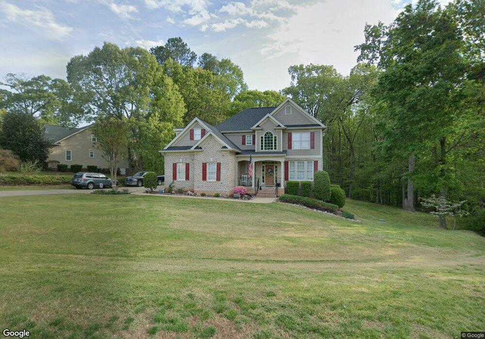
5500 Rolling Field Dr Garner, NC 27529
Estimated Value: $609,354 - $730,000
--
Bed
4
Baths
3,406
Sq Ft
$194/Sq Ft
Est. Value
About This Home
This home is located at 5500 Rolling Field Dr, Garner, NC 27529 and is currently estimated at $659,089, approximately $193 per square foot. 5500 Rolling Field Dr is a home located in Wake County with nearby schools including Aversboro Elementary, East Garner Middle School, and South Garner High.
Ownership History
Date
Name
Owned For
Owner Type
Purchase Details
Closed on
Mar 27, 2007
Sold by
Manning Homes Inc
Bought by
King Timothy and King Holly
Current Estimated Value
Home Financials for this Owner
Home Financials are based on the most recent Mortgage that was taken out on this home.
Original Mortgage
$179,900
Outstanding Balance
$109,488
Interest Rate
6.27%
Mortgage Type
Purchase Money Mortgage
Estimated Equity
$549,601
Purchase Details
Closed on
Apr 18, 2006
Sold by
Winslow Properties Development Co
Bought by
Manning Homes Inc
Purchase Details
Closed on
Feb 2, 2006
Sold by
T H Turner Farms Inc
Bought by
Winslow Properties Development Co
Home Financials for this Owner
Home Financials are based on the most recent Mortgage that was taken out on this home.
Original Mortgage
$409,500
Interest Rate
6.21%
Mortgage Type
Purchase Money Mortgage
Create a Home Valuation Report for This Property
The Home Valuation Report is an in-depth analysis detailing your home's value as well as a comparison with similar homes in the area
Home Values in the Area
Average Home Value in this Area
Purchase History
| Date | Buyer | Sale Price | Title Company |
|---|---|---|---|
| King Timothy | $380,000 | None Available | |
| Manning Homes Inc | $104,000 | None Available | |
| Winslow Properties Development Co | $546,000 | None Available |
Source: Public Records
Mortgage History
| Date | Status | Borrower | Loan Amount |
|---|---|---|---|
| Open | King Timothy | $179,900 | |
| Previous Owner | Winslow Properties Development Co | $409,500 |
Source: Public Records
Tax History Compared to Growth
Tax History
| Year | Tax Paid | Tax Assessment Tax Assessment Total Assessment is a certain percentage of the fair market value that is determined by local assessors to be the total taxable value of land and additions on the property. | Land | Improvement |
|---|---|---|---|---|
| 2025 | $3,680 | $572,171 | $85,000 | $487,171 |
| 2024 | $3,573 | $572,171 | $85,000 | $487,171 |
| 2023 | $2,782 | $354,297 | $40,000 | $314,297 |
| 2022 | $2,579 | $354,297 | $40,000 | $314,297 |
| 2021 | $2,510 | $354,297 | $40,000 | $314,297 |
| 2020 | $2,468 | $354,297 | $40,000 | $314,297 |
| 2019 | $2,590 | $314,628 | $40,000 | $274,628 |
| 2018 | $2,381 | $314,628 | $40,000 | $274,628 |
| 2017 | $2,257 | $314,628 | $40,000 | $274,628 |
| 2016 | $2,211 | $314,628 | $40,000 | $274,628 |
| 2015 | $2,606 | $372,362 | $60,000 | $312,362 |
| 2014 | -- | $372,362 | $60,000 | $312,362 |
Source: Public Records
Map
Nearby Homes
- 1208 Turner Farms Rd
- 1004 Cabin Hill Way
- 9017 Hunterfox Ct
- 941 Grand Mesa Dr
- 937 Grand Mesa Dr
- 933 Grand Mesa Dr
- 929 Grand Mesa Dr
- 925 Grand Mesa Dr
- 921 Grand Mesa Dr
- 1036 Blue River Farm Dr
- 917 Grand Mesa Dr
- 617 Red River Dr
- 913 Grand Mesa Dr
- 909 Grand Mesa Dr
- 625 Red River Dr
- 905 Grand Mesa Dr
- 629 Red River Dr
- 633 Red River Dr
- 604 Red River Dr
- 637 Red River Dr
- 5508 Rolling Field Dr
- 5501 Rolling Field Dr
- 5444 Rolling Field Dr
- 5512 Rolling Field Dr
- 1132 Golden Grain Rd
- 1116 Old Memorial Cir
- 5516 Rolling Field Dr
- 1128 Golden Grain Rd
- 5500 Quails Call Ct
- 1205 Rhea Dr
- 1124 Golden Grain Rd
- 5437 Rolling Field Dr
- 1121 Golden Grain Rd
- 5520 Rolling Field Dr
- 5517 Rolling Field Dr
- 1108 Old Memorial Cir
- 1201 Rhea Dr
- 1120 Golden Grain Rd
- 1217 Rhea Dr
- 1133 Rhea Dr