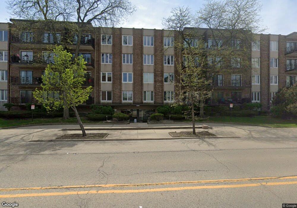
5501 Lincoln Ave Unit 403 Morton Grove, IL 60053
Southwest Skokie NeighborhoodEstimated Value: $266,000 - $318,000
2
Beds
2
Baths
1,565
Sq Ft
$186/Sq Ft
Est. Value
About This Home
This home is located at 5501 Lincoln Ave Unit 403, Morton Grove, IL 60053 and is currently estimated at $290,793, approximately $185 per square foot. 5501 Lincoln Ave Unit 403 is a home located in Cook County with nearby schools including Park View Elementary School, Niles West High School, and Arie Crown Hebrew Day School.
Ownership History
Date
Name
Owned For
Owner Type
Purchase Details
Closed on
Jun 13, 2006
Sold by
Livin Belden Barbara
Bought by
Spyropoulos Fabian J
Current Estimated Value
Home Financials for this Owner
Home Financials are based on the most recent Mortgage that was taken out on this home.
Original Mortgage
$180,000
Outstanding Balance
$106,711
Interest Rate
6.72%
Mortgage Type
Unknown
Estimated Equity
$184,082
Purchase Details
Closed on
Oct 2, 2004
Sold by
Devine Harry L
Bought by
Livin Devine Harry L and Harry L Devine Revocable Living Trust
Create a Home Valuation Report for This Property
The Home Valuation Report is an in-depth analysis detailing your home's value as well as a comparison with similar homes in the area
Home Values in the Area
Average Home Value in this Area
Purchase History
| Date | Buyer | Sale Price | Title Company |
|---|---|---|---|
| Spyropoulos Fabian J | $225,000 | Git | |
| Livin Devine Harry L | -- | -- |
Source: Public Records
Mortgage History
| Date | Status | Borrower | Loan Amount |
|---|---|---|---|
| Open | Spyropoulos Fabian J | $180,000 |
Source: Public Records
Tax History Compared to Growth
Tax History
| Year | Tax Paid | Tax Assessment Tax Assessment Total Assessment is a certain percentage of the fair market value that is determined by local assessors to be the total taxable value of land and additions on the property. | Land | Improvement |
|---|---|---|---|---|
| 2024 | $4,281 | $18,137 | $1,780 | $16,357 |
| 2023 | $4,050 | $18,137 | $1,780 | $16,357 |
| 2022 | $4,050 | $18,137 | $1,780 | $16,357 |
| 2021 | $3,756 | $15,041 | $1,095 | $13,946 |
| 2020 | $2,141 | $15,041 | $1,095 | $13,946 |
| 2019 | $3,746 | $16,808 | $1,095 | $15,713 |
| 2018 | $2,141 | $10,221 | $992 | $9,229 |
| 2017 | $2,176 | $10,221 | $992 | $9,229 |
| 2016 | $2,315 | $10,221 | $992 | $9,229 |
| 2015 | $2,127 | $9,223 | $855 | $8,368 |
| 2014 | $2,142 | $9,223 | $855 | $8,368 |
| 2013 | $2,074 | $9,223 | $855 | $8,368 |
Source: Public Records
Map
Nearby Homes
- 5501 Lincoln Ave Unit 203
- 5500 Lincoln Ave Unit 109W
- 5510 Lincoln Ave Unit B301
- 5510 Lincoln Ave Unit B101
- 5506 Lincoln Ave Unit A117
- 5506 Lincoln Ave Unit A211
- 5506 Lincoln Ave Unit A216
- 8541 Lotus Ave Unit 914
- 8461 Gross Point Rd
- 8328 Mango Ave
- 8655 Harms Rd
- 8708 Central Ave
- 5253 Cleveland St
- 5309 Crain St
- 5249 Hoffman St
- 8605 Laramie Ave
- 5148 Cleveland St
- 5505 Oakton St
- 8717 Gross Point Rd
- 5109 Greenleaf St
- 5501 Lincoln Ave Unit 411
- 5501 Lincoln Ave Unit 202
- 5501 Lincoln Ave Unit 508
- 5501 Lincoln Ave Unit 208
- 5501 Lincoln Ave Unit 308
- 5501 Lincoln Ave Unit 501
- 5501 Lincoln Ave Unit 206
- 5501 Lincoln Ave Unit 507
- 5501 Lincoln Ave Unit 301
- 5501 Lincoln Ave Unit 503
- 5501 Lincoln Ave Unit 401
- 5501 Lincoln Ave Unit 305
- 5501 Lincoln Ave Unit 204
- 5501 Lincoln Ave Unit 502
- 5501 Lincoln Ave Unit 309
- 5501 Lincoln Ave Unit 406
- 5501 Lincoln Ave Unit 302
- 5501 Lincoln Ave Unit 504
- 5501 Lincoln Ave Unit 210
- 5501 Lincoln Ave Unit 201