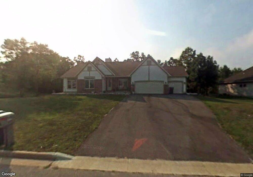
5501 Rock Rapids Dr Schofield, WI 54476
Estimated Value: $369,000 - $612,000
4
Beds
4
Baths
3,391
Sq Ft
$151/Sq Ft
Est. Value
About This Home
This home is located at 5501 Rock Rapids Dr, Schofield, WI 54476 and is currently estimated at $511,810, approximately $150 per square foot. 5501 Rock Rapids Dr is a home located in Marathon County with nearby schools including Riverside Elementary School, D.C. Everest Middle School, and D.C. Everest Junior High School.
Ownership History
Date
Name
Owned For
Owner Type
Purchase Details
Closed on
Jun 20, 2007
Sold by
Gessler Christina L
Bought by
Gessler Daryl R
Current Estimated Value
Purchase Details
Closed on
Jul 3, 2006
Sold by
Foresight Development Corp
Bought by
Gessler Daryl R and Gessler Christina L
Home Financials for this Owner
Home Financials are based on the most recent Mortgage that was taken out on this home.
Original Mortgage
$208,000
Interest Rate
6.68%
Mortgage Type
Unknown
Create a Home Valuation Report for This Property
The Home Valuation Report is an in-depth analysis detailing your home's value as well as a comparison with similar homes in the area
Home Values in the Area
Average Home Value in this Area
Purchase History
| Date | Buyer | Sale Price | Title Company |
|---|---|---|---|
| Gessler Daryl R | -- | None Available | |
| Gessler Daryl R | $279,900 | None Available |
Source: Public Records
Mortgage History
| Date | Status | Borrower | Loan Amount |
|---|---|---|---|
| Previous Owner | Gessler Daryl R | $208,000 |
Source: Public Records
Tax History
| Year | Tax Paid | Tax Assessment Tax Assessment Total Assessment is a certain percentage of the fair market value that is determined by local assessors to be the total taxable value of land and additions on the property. | Land | Improvement |
|---|---|---|---|---|
| 2025 | $7,038 | $451,000 | $79,800 | $371,200 |
| 2024 | $3,580 | $451,000 | $79,800 | $371,200 |
| 2023 | $6,896 | $297,300 | $59,900 | $237,400 |
| 2022 | $7,217 | $297,300 | $59,900 | $237,400 |
| 2021 | $7,022 | $297,300 | $59,900 | $237,400 |
| 2020 | $6,934 | $297,300 | $59,900 | $237,400 |
| 2019 | $6,771 | $297,300 | $59,900 | $237,400 |
| 2018 | $6,460 | $297,300 | $59,900 | $237,400 |
| 2017 | $6,300 | $297,300 | $59,900 | $237,400 |
| 2016 | $6,226 | $297,300 | $59,900 | $237,400 |
| 2015 | $6,044 | $297,300 | $59,900 | $237,400 |
| 2014 | $5,976 | $297,300 | $59,900 | $237,400 |
Source: Public Records
Map
Nearby Homes
- 5601 Rock Rapids Dr
- 5407 Roxann Dr
- 3806 Schoonover Rd
- 4112 River Bend Rd
- 6105 Morning View Ln
- 3816 Muskie Dr
- 4702-A Ross Ave
- 4702 Ross Ave
- 3810 Muskie Dr
- 3806 Muskie Dr
- 3714 Muskie Dr
- 5307 Jean Ellen St
- 3832 Jackrabbit Dr
- 3820 Jackrabbit Dr
- 6304 Perch Dr
- 3725 Muskie Dr
- 3856 Muskie Dr
- 3836 Muskie Dr
- 3840 Muskie Dr
- 3819 Muskie Dr
- 5505 Rock Rapids Dr
- 5409 Rock Rapids Dr
- 5405 Rock Rapids Dr
- 5502 Rock Rapids Dr
- 5509 Rock Rapids Dr
- 5410 Rock Rapids Dr
- 5402 Rock Rapids Dr
- 5506 Rock Rapids Dr
- 5506 D j Ln
- 5401 Rock Rapids Dr
- 5504 D j Ln
- 5513 Rock Rapids Dr
- 5408 D j Ln
- 5510 Rock Rapids Dr
- 5508 D j Ln
- 5604 D j Ln
- 5406 D j Ln
- 5501 Hewitt Ave
- 5409 Hewitt Ave
- 5307 Rock Rapids Dr
Your Personal Tour Guide
Ask me questions while you tour the home.