Estimated Value: $272,769 - $330,000
3
Beds
2
Baths
1,254
Sq Ft
$232/Sq Ft
Est. Value
About This Home
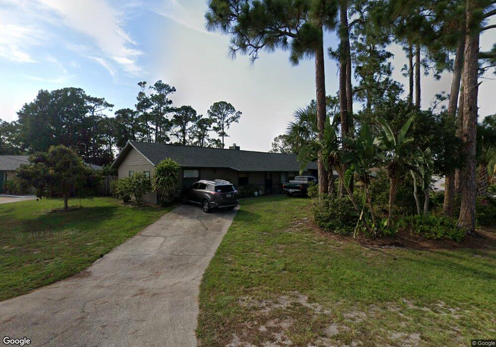
This home is located at 5504 Flint Rd, Cocoa, FL 32927 and is currently estimated at $290,442, approximately $231 per square foot. 5504 Flint Rd is a home located in Brevard County with nearby schools including Enterprise Elementary School, Space Coast Junior/Senior High School, and East Atlantic Prep of Brevard County.
Ownership History
Date
Name
Owned For
Owner Type
Purchase Details
Closed on
Jun 16, 1993
Sold by
Sanford Daniel W and Sanford Melissa P
Bought by
Lewis Gerald L and Lewis Susan C
Current Estimated Value
Home Financials for this Owner
Home Financials are based on the most recent Mortgage that was taken out on this home.
Original Mortgage
$49,600
Interest Rate
7.42%
Create a Home Valuation Report for This Property
The Home Valuation Report is an in-depth analysis detailing your home's value as well as a comparison with similar homes in the area
Home Values in the Area
Average Home Value in this Area
Purchase History
We collect this data history from publicly available records. To have your information removed, we recommend requesting removal directly through your county’s website.
| Date | Buyer | Sale Price | Title Company |
|---|---|---|---|
| Lewis Gerald L | $62,000 | -- |
Source: Public Records
Mortgage History
We collect this data history from publicly available records. To have your information removed, we recommend requesting removal directly through your county’s website.
| Date | Status | Borrower | Loan Amount |
|---|---|---|---|
| Closed | Lewis Gerald L | $49,600 |
Source: Public Records
Tax History
| Year | Tax Paid | Tax Assessment Tax Assessment Total Assessment is a certain percentage of the fair market value that is determined by local assessors to be the total taxable value of land and additions on the property. | Land | Improvement |
|---|---|---|---|---|
| 2025 | $1,105 | $82,540 | -- | -- |
| 2024 | $1,016 | $80,220 | -- | -- |
| 2023 | $1,016 | $72,280 | $0 | $0 |
| 2022 | $958 | $70,180 | $0 | $0 |
| 2021 | $961 | $68,140 | $0 | $0 |
| 2020 | $915 | $67,200 | $0 | $0 |
| 2019 | $863 | $65,690 | $0 | $0 |
| 2018 | $864 | $64,470 | $0 | $0 |
| 2017 | $865 | $63,150 | $0 | $0 |
| 2016 | $872 | $61,860 | $18,000 | $43,860 |
| 2015 | $879 | $61,430 | $15,000 | $46,430 |
| 2014 | $883 | $60,950 | $11,000 | $49,950 |
Source: Public Records
Map
Nearby Homes
- 6438 Hudson Rd
- 5424 Flint Rd
- 5525 Fairbridge St
- 6460 Irving Rd
- 6450 Ember Ave
- 5220 Holden Rd
- 6601 Cedar Ave
- 6581 Bancroft Ave
- 6570 Bancroft Ave
- 6615 Dock Ave
- 5221 Carrick Rd
- 00 Unknown
- 5614 Jamaica Rd
- 5770 Fairbridge St
- 5946 Deer Ln
- 6643 Emil Ave
- 6020 Cannon Ave
- 5945 Coker Ave
- 5687 Holden Rd
- 6375 Cable Ave
- 6350 Gillette Ave
- 6360 Gillette Ave
- 5512 Flint Rd
- 6433 Hudson Rd
- 6370 Gillette Ave
- 6345 Gillette Ave
- 6435 Hudson Rd
- 6365 Gillette Ave
- 5505 Flint Rd
- 5528 Flint Rd
- 6380 Gillette Ave
- 6439 Hudson Rd
- 6375 Gillette Ave
- 5497 Flint Rd
- 5520 Flint Rd
- 5521 Flint Rd
- 5488 Flint Rd
- 6432 Hudson Rd
- 5481 Flint Rd
- 6426 Hudson Rd
Your Personal Tour Guide
Ask me questions while you tour the home.