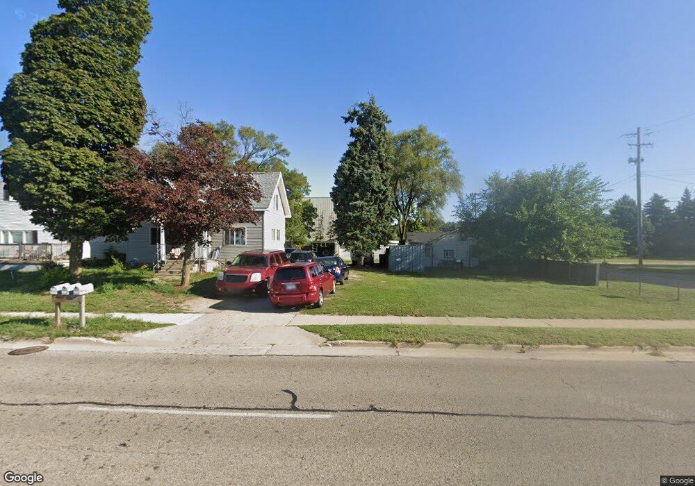
551 32nd St SE Grand Rapids, MI 49548
Garfield Park NeighborhoodEstimated Value: $283,000 - $344,000
--
Bed
2
Baths
2,010
Sq Ft
$153/Sq Ft
Est. Value
About This Home
This home is located at 551 32nd St SE, Grand Rapids, MI 49548 and is currently estimated at $307,438, approximately $152 per square foot. 551 32nd St SE is a home located in Kent County with nearby schools including Godwin Heights Senior High School, Vista Charter Academy, and New Branches Charter Academy.
Ownership History
Date
Name
Owned For
Owner Type
Purchase Details
Closed on
Feb 12, 2015
Sold by
T & C Capital Group Llc
Bought by
Marshall Land Development Llc
Current Estimated Value
Home Financials for this Owner
Home Financials are based on the most recent Mortgage that was taken out on this home.
Original Mortgage
$78,750
Outstanding Balance
$60,227
Interest Rate
3.72%
Mortgage Type
Future Advance Clause Open End Mortgage
Estimated Equity
$247,211
Purchase Details
Closed on
Oct 20, 2004
Sold by
T & C Capital Group Llc
Bought by
Marshall Land Development Llc
Home Financials for this Owner
Home Financials are based on the most recent Mortgage that was taken out on this home.
Original Mortgage
$135,000
Interest Rate
5.8%
Mortgage Type
Purchase Money Mortgage
Purchase Details
Closed on
Oct 28, 1998
Bought by
T & C Capital Group Llc
Create a Home Valuation Report for This Property
The Home Valuation Report is an in-depth analysis detailing your home's value as well as a comparison with similar homes in the area
Home Values in the Area
Average Home Value in this Area
Purchase History
| Date | Buyer | Sale Price | Title Company |
|---|---|---|---|
| Marshall Land Development Llc | -- | None Available | |
| Marshall Land Development Llc | -- | Unified Title & Settlement | |
| T & C Capital Group Llc | $140,000 | -- |
Source: Public Records
Mortgage History
| Date | Status | Borrower | Loan Amount |
|---|---|---|---|
| Open | Marshall Land Development Llc | $78,750 | |
| Previous Owner | Marshall Land Development Llc | $135,000 |
Source: Public Records
Tax History Compared to Growth
Tax History
| Year | Tax Paid | Tax Assessment Tax Assessment Total Assessment is a certain percentage of the fair market value that is determined by local assessors to be the total taxable value of land and additions on the property. | Land | Improvement |
|---|---|---|---|---|
| 2025 | $2,837 | $139,600 | $0 | $0 |
| 2024 | $2,837 | $139,500 | $0 | $0 |
| 2023 | $3,617 | $129,000 | $0 | $0 |
| 2022 | $3,475 | $102,200 | $0 | $0 |
| 2021 | $3,964 | $96,800 | $0 | $0 |
| 2020 | $3,553 | $88,800 | $0 | $0 |
| 2019 | $3,298 | $77,300 | $0 | $0 |
| 2018 | $3,232 | $77,900 | $0 | $0 |
| 2017 | $3,154 | $67,700 | $0 | $0 |
| 2016 | $3,067 | $60,200 | $0 | $0 |
| 2015 | $3,017 | $60,200 | $0 | $0 |
| 2013 | -- | $52,000 | $0 | $0 |
Source: Public Records
Map
Nearby Homes
- 944 Lancashire Ct SE Unit 946
- 435 28th St SE
- 133 Wesley St SE
- 148 Freedom St SE
- 104 Wesley St SE
- 2731 Eastern Ave SE
- 2721 Eastern Ave SE
- 809 Everglade Dr SE
- 36 Celia St SE
- 2707 Eastern Ave SE
- 104 Colrain St SE
- 831 Everglade Dr SE
- 858 Walsh St SE
- 32 Oneida St SW
- 2550 Eastern Ave SE Unit 103
- 2550 Eastern Ave SE Unit 105
- 2550 Eastern Ave SE Unit 114
- 2550 Eastern Ave SE Unit 106
- 2550 Eastern Ave SE Unit 120
- 2550 Eastern Ave SE Unit 115
- 549 32nd St SE
- 549 32nd St SE
- 543 32nd St SE
- 601 32nd St SE
- 3205 Union Ave SE
- 605 32nd St SE
- 612 32nd St SE
- 612 32nd St SE Unit 614
- 609 32nd St SE
- 615 32nd St SE
- 3227 Union Ave SE
- 619 32nd St SE
- 623 32nd St SE
- 3264 Union Ave SE
- 649 32nd St SE
- 580 Van Allen St SE
- 588 Van Allen St SE
- 618 32nd St SE
- 558 Van Allen St SE
- 550 Van Allen St SE