Estimated Value: $214,000 - $296,000
3
Beds
2
Baths
1,888
Sq Ft
$139/Sq Ft
Est. Value
About This Home
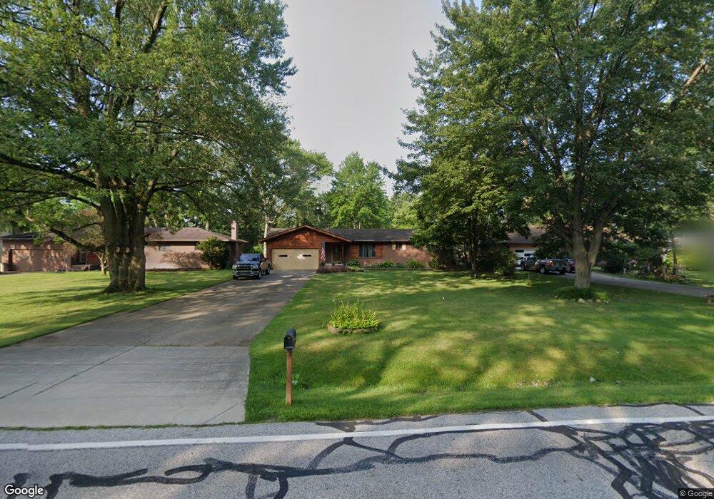
This home is located at 551 Barrett Rd, Berea, OH 44017 and is currently estimated at $261,575, approximately $138 per square foot. 551 Barrett Rd is a home located in Cuyahoga County with nearby schools including Grindstone Elementary School, Berea-Midpark Middle School, and Berea-Midpark High School.
Ownership History
Date
Name
Owned For
Owner Type
Purchase Details
Closed on
Apr 11, 2022
Sold by
Schaedler Iii Gilbert J
Bought by
Schaedler Family Trust
Current Estimated Value
Purchase Details
Closed on
Jun 22, 1979
Sold by
Davis Virgil F and Davis Eva M
Bought by
Schaedler Gilbert J
Purchase Details
Closed on
Jan 1, 1975
Bought by
Davis Virgil F and Davis Eva M
Create a Home Valuation Report for This Property
The Home Valuation Report is an in-depth analysis detailing your home's value as well as a comparison with similar homes in the area
Home Values in the Area
Average Home Value in this Area
Purchase History
| Date | Buyer | Sale Price | Title Company |
|---|---|---|---|
| Schaedler Family Trust | -- | Schroth Michael T | |
| Schaedler Gilbert J | $72,000 | -- | |
| Davis Virgil F | -- | -- |
Source: Public Records
Tax History
| Year | Tax Paid | Tax Assessment Tax Assessment Total Assessment is a certain percentage of the fair market value that is determined by local assessors to be the total taxable value of land and additions on the property. | Land | Improvement |
|---|---|---|---|---|
| 2025 | $4,350 | $84,980 | $16,205 | $68,775 |
| 2024 | $4,362 | $84,980 | $16,205 | $68,775 |
| 2023 | $3,853 | $64,760 | $13,760 | $51,000 |
| 2022 | $3,857 | $64,750 | $13,755 | $50,995 |
| 2021 | $3,822 | $64,750 | $13,760 | $51,000 |
| 2020 | $3,552 | $54,880 | $11,660 | $43,230 |
| 2019 | $3,458 | $156,800 | $33,300 | $123,500 |
| 2018 | $3,441 | $54,880 | $11,660 | $43,230 |
| 2017 | $3,480 | $52,080 | $9,940 | $42,140 |
| 2016 | $3,454 | $52,080 | $9,940 | $42,140 |
| 2015 | $3,471 | $52,080 | $9,940 | $42,140 |
| 2014 | $3,471 | $54,820 | $10,470 | $44,350 |
Source: Public Records
Map
Nearby Homes
- 446 Redwood Dr
- 379 Laurel Dr
- 428 Park Place
- 160 Stonepointe Dr
- 487 Karen Dr
- 132 Stonefield Dr
- 147 Stone Ridge Way
- 659 Wesley Dr
- 725 Shakespeare Dr
- 6574 Burton Dr
- 100 River Rock Way
- 93 W 5th Ave
- 146 Marian Ln
- 0 River Rd Unit 5169658
- 160 Marian Ln Unit 6A
- 56 3rd Ave
- 7461 River Rd
- 143 Baker St
- 211 W Bridge St
- 300 West St
Your Personal Tour Guide
Ask me questions while you tour the home.