Estimated Value: $1,354,000 - $1,967,000
3
Beds
3
Baths
2,300
Sq Ft
$717/Sq Ft
Est. Value
About This Home
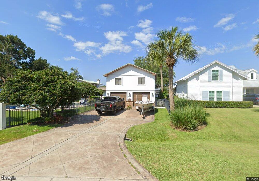
This home is located at 551 Canal Rd, Ponte Vedra Beach, FL 32082 and is currently estimated at $1,649,934, approximately $717 per square foot. 551 Canal Rd is a home located in St. Johns County with nearby schools including Ocean Palms Elementary School, Alice B. Landrum Middle School, and Ponte Vedra High School.
Ownership History
Date
Name
Owned For
Owner Type
Purchase Details
Closed on
May 17, 2006
Sold by
Signature Of North Florida Llc
Bought by
Crowley Daniel W and Crowley Laurie W
Current Estimated Value
Home Financials for this Owner
Home Financials are based on the most recent Mortgage that was taken out on this home.
Original Mortgage
$735,000
Outstanding Balance
$437,021
Interest Rate
6.87%
Mortgage Type
Fannie Mae Freddie Mac
Estimated Equity
$1,212,913
Purchase Details
Closed on
Aug 10, 2004
Sold by
Andrews Henry C and Andrews Betty E
Bought by
Harris John B and Harris Tamara K
Create a Home Valuation Report for This Property
The Home Valuation Report is an in-depth analysis detailing your home's value as well as a comparison with similar homes in the area
Home Values in the Area
Average Home Value in this Area
Purchase History
| Date | Buyer | Sale Price | Title Company |
|---|---|---|---|
| Crowley Daniel W | $1,050,000 | None Available | |
| Harris John B | $10,000 | -- |
Source: Public Records
Mortgage History
| Date | Status | Borrower | Loan Amount |
|---|---|---|---|
| Open | Crowley Daniel W | $735,000 |
Source: Public Records
Tax History Compared to Growth
Tax History
| Year | Tax Paid | Tax Assessment Tax Assessment Total Assessment is a certain percentage of the fair market value that is determined by local assessors to be the total taxable value of land and additions on the property. | Land | Improvement |
|---|---|---|---|---|
| 2025 | $7,692 | $662,736 | -- | -- |
| 2024 | $7,692 | $644,058 | -- | -- |
| 2023 | $7,692 | $625,299 | $0 | $0 |
| 2022 | $7,503 | $607,086 | $0 | $0 |
| 2021 | $7,473 | $589,404 | $0 | $0 |
| 2020 | $7,452 | $581,266 | $0 | $0 |
| 2019 | $7,224 | $540,149 | $0 | $0 |
| 2018 | $7,159 | $530,078 | $0 | $0 |
| 2017 | $7,141 | $519,175 | $0 | $0 |
| 2016 | $7,152 | $523,752 | $0 | $0 |
| 2015 | $8,404 | $508,497 | $0 | $0 |
| 2014 | $8,139 | $514,810 | $0 | $0 |
Source: Public Records
Map
Nearby Homes
- 513 Canal Rd
- 946 S Harbor Lights Dr
- 700 Tranquility Cove
- 613 Timber Pond Dr
- 615 Shell Ridge Ln
- 605 Shell Ridge Ln
- 626 Timber Pond Dr
- 224 Clatter Bridge Rd
- 557 Shell Ridge Ln
- 539 Shell Ridge Ln
- 566 Shell Ridge Ln
- 443 Shell Ridge Ln
- 450 Shell Ridge Ln
- 418 Shell Ridge Ln
- 396 Shell Ridge Ln
- 75 Whistling Palm Ct
- 339 Tidal Vista Way
- 328 Tidal Vista Way
- 360 Shell Ridge Ln
- 340 Shell Ridge Ln
- 547 Canal Rd
- 547 Canal Rd
- 567 Canal Rd
- 567 Canal Rd
- 0 Canal Rd Unit 1131549
- 0 Canal Rd
- 461 S Roscoe Boulevard Extension
- 457 S Roscoe Boulevard Extension Unit EXT
- 457 S Roscoe Boulevard Extension
- 457 S Roscoe Boulevard Extension
- 465 S Roscoe Boulevard Extension
- 465 S Roscoe Boulevard Extension
- 469 S Roscoe Boulevard Extension
- 449 S Roscoe Boulevard Extension
- 563 Canal Rd
- 563 Canal Rd
- 473 S Roscoe Boulevard Extension
- 473 S Roscoe Boulevard Extension Unit EXT
- 473 S Roscoe Ext Blvd
- 489 S Roscoe Boulevard Extension