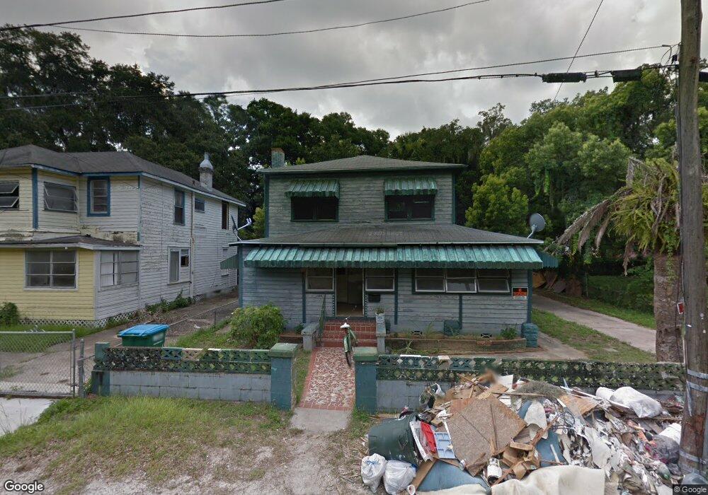
551 Cedar St Daytona Beach, FL 32114
Central Daytona NeighborhoodEstimated Value: $192,000
--
Bed
1
Bath
--
Sq Ft
8,407
Sq Ft Lot
About This Home
This home is located at 551 Cedar St, Daytona Beach, FL 32114 and is currently estimated at $192,000. 551 Cedar St is a home located in Volusia County with nearby schools including Turie T. Small Elementary School, Sugar Mill Elementary School, and Campbell Middle School.
Ownership History
Date
Name
Owned For
Owner Type
Purchase Details
Closed on
Aug 23, 2023
Sold by
County Of Volusia
Bought by
City Of Daytona Beach
Current Estimated Value
Purchase Details
Closed on
Apr 22, 2009
Sold by
Federal Home Loan Mortgage Corporation
Bought by
Dcbnjar Inc
Purchase Details
Closed on
Mar 3, 2009
Sold by
Estate Of Robert W Thompson
Bought by
Federal Home Loan Mortgage Corp
Purchase Details
Closed on
Feb 15, 1987
Bought by
Riggins Dennis C Tr
Create a Home Valuation Report for This Property
The Home Valuation Report is an in-depth analysis detailing your home's value as well as a comparison with similar homes in the area
Home Values in the Area
Average Home Value in this Area
Purchase History
| Date | Buyer | Sale Price | Title Company |
|---|---|---|---|
| City Of Daytona Beach | -- | None Listed On Document | |
| Dcbnjar Inc | $8,000 | Attorney | |
| Federal Home Loan Mortgage Corp | -- | Attorney | |
| Riggins Dennis C Tr | $100 | -- |
Source: Public Records
Tax History Compared to Growth
Tax History
| Year | Tax Paid | Tax Assessment Tax Assessment Total Assessment is a certain percentage of the fair market value that is determined by local assessors to be the total taxable value of land and additions on the property. | Land | Improvement |
|---|---|---|---|---|
| 2025 | -- | $24,809 | $24,809 | -- |
| 2024 | -- | $4,319 | $4,319 | -- |
| 2023 | -- | $5,889 | $5,889 | $0 |
| 2022 | $0 | $5,889 | $5,889 | $0 |
| 2021 | $0 | $5,889 | $5,889 | $0 |
| 2020 | $0 | $5,889 | $5,889 | $0 |
| 2019 | $0 | $7,644 | $7,644 | $0 |
| 2018 | $0 | $7,644 | $7,644 | $0 |
| 2017 | $0 | $5,742 | $5,742 | $0 |
| 2016 | -- | $7,735 | $0 | $0 |
| 2015 | $700 | $29,934 | $0 | $0 |
| 2014 | $720 | $30,512 | $0 | $0 |
Source: Public Records
Map
Nearby Homes
- 547 Division St
- 742 Whitehall St
- 562 South St
- 611 Marion St
- 530 George St
- 506 South St
- 241 Martin Luther King Blvd S
- 735 Martin Luther King Blvd S
- 552 Wells St
- 704 Cedar St
- 600 S Segrave St
- TBD Division St
- 643 Mc Cormick St
- 432 Marion St
- 635 Mccormick St
- 704 Park Dr
- 440 S Segrave St
- 517 Wallace St
- 507 Wallace St
- 521 Wallace St
- 549 Cedar St
- 543 Cedar St
- 563 Cedar St
- 619 Division St
- 554 Cedar St
- 614 Whitehall St
- 541 Cedar St
- 610 Division St
- 548 Cedar St
- 612 Division St
- 623 Division St
- 544 Cedar St
- 616 Division St
- 545 Division St
- 620 Division St
- 629 Division St
- 620 Whitehall St
- 543 Division St Unit 3
- 543 Division St Unit 2
- 543 Division St Unit 1