Estimated Value: $314,802 - $343,000
4
Beds
3
Baths
2,288
Sq Ft
$142/Sq Ft
Est. Value
About This Home
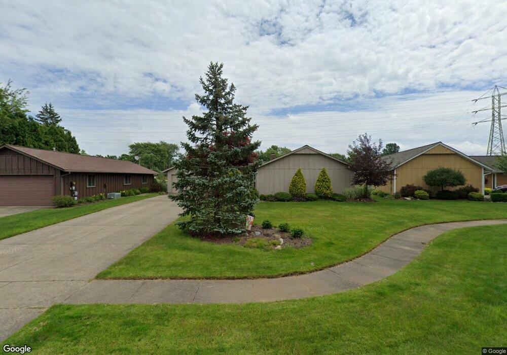
This home is located at 551 Cranston Cir, Berea, OH 44017 and is currently estimated at $324,951, approximately $142 per square foot. 551 Cranston Cir is a home located in Cuyahoga County with nearby schools including Grindstone Elementary School, Berea-Midpark Middle School, and Berea-Midpark High School.
Ownership History
Date
Name
Owned For
Owner Type
Purchase Details
Closed on
Jan 30, 2002
Sold by
Youngblood Bob L and Youngblood Denise L
Bought by
Youngblood Bob L and Youngblood Denise L
Current Estimated Value
Purchase Details
Closed on
Aug 13, 1999
Sold by
Kirkwood Glenn C and Kirwood Loretta V
Bought by
Youngblood Bob L and Youngblood Denise L
Home Financials for this Owner
Home Financials are based on the most recent Mortgage that was taken out on this home.
Original Mortgage
$83,000
Interest Rate
7.4%
Purchase Details
Closed on
Mar 24, 1994
Sold by
Mccumbers Paul
Bought by
Kirkwood Glenn C
Purchase Details
Closed on
Mar 19, 1986
Sold by
Hessel James
Bought by
Mccumbers Paul
Purchase Details
Closed on
Sep 14, 1983
Sold by
Shirley V
Bought by
Hessel James
Purchase Details
Closed on
Jan 1, 1975
Bought by
Shirley
Create a Home Valuation Report for This Property
The Home Valuation Report is an in-depth analysis detailing your home's value as well as a comparison with similar homes in the area
Home Values in the Area
Average Home Value in this Area
Purchase History
| Date | Buyer | Sale Price | Title Company |
|---|---|---|---|
| Youngblood Bob L | -- | -- | |
| Youngblood Bob L | $173,000 | Prospect Title Agency Inc | |
| Kirkwood Glenn C | $146,900 | -- | |
| Mccumbers Paul | $89,500 | -- | |
| Hessel James | $101,000 | -- | |
| Shirley | -- | -- |
Source: Public Records
Mortgage History
| Date | Status | Borrower | Loan Amount |
|---|---|---|---|
| Closed | Youngblood Bob L | $83,000 |
Source: Public Records
Tax History Compared to Growth
Tax History
| Year | Tax Paid | Tax Assessment Tax Assessment Total Assessment is a certain percentage of the fair market value that is determined by local assessors to be the total taxable value of land and additions on the property. | Land | Improvement |
|---|---|---|---|---|
| 2024 | $5,544 | $105,665 | $15,505 | $90,160 |
| 2023 | $4,297 | $71,190 | $13,230 | $57,960 |
| 2022 | $4,298 | $71,190 | $13,230 | $57,960 |
| 2021 | $4,260 | $71,190 | $13,230 | $57,960 |
| 2020 | $3,968 | $60,310 | $11,200 | $49,110 |
| 2019 | $3,863 | $172,300 | $32,000 | $140,300 |
| 2018 | $3,846 | $60,310 | $11,200 | $49,110 |
| 2017 | $4,024 | $58,880 | $10,120 | $48,760 |
| 2016 | $3,994 | $58,880 | $10,120 | $48,760 |
| 2015 | $4,006 | $58,880 | $10,120 | $48,760 |
| 2014 | $4,006 | $61,950 | $10,640 | $51,310 |
Source: Public Records
Map
Nearby Homes
- 517 Wyleswood Dr
- 626 Ensenada Ct Unit 5
- 537 Wyleswood Dr
- 543 Wyleswood Dr
- 549 Wyleswood Dr
- 648 Tampico Ct Unit 37
- 23002 Chandlers Ln Unit 221
- 23002 Chandlers Ln
- 23002 Chandlers Ln Unit 342
- Passionflower II Plan at Aspire at Longbrooke
- Daffodil II Plan at Aspire at Longbrooke
- 23155 Wainwright Terrace
- 540 Crossbrook Dr
- 580 Crossbrook Dr
- 23390 Wainwright Terrace
- 23004 Chandlers Ln Unit 109
- 585 Woodmere Dr
- 23450 Wainwright Terrace
- 9797 Sugarbush Cir
- 396 Crossbrook Dr
- 543 Cranston Cir
- 557 Cranston Cir
- 485 Wyleswood Dr
- 479 Wyleswood Dr
- 563 Cranston Cir
- 556 Cranston Cir
- 564 Cranston Cir
- 455 Wyleswood Dr
- 515 Cranston Dr
- 449 Wyleswood Dr
- 445 Wyleswood Dr
- 507 Cranston Dr
- 456 Wyleswood Dr
- 510 Wyleswood Dr
- 446 Wyleswood Dr
- 518 Beeler Dr
- 499 Cranston Dr
- 544 Beeler Dr
- 552 Beeler Dr
- 524 Beeler Dr