Estimated Value: $300,000 - $325,000
3
Beds
2
Baths
2,020
Sq Ft
$155/Sq Ft
Est. Value
About This Home
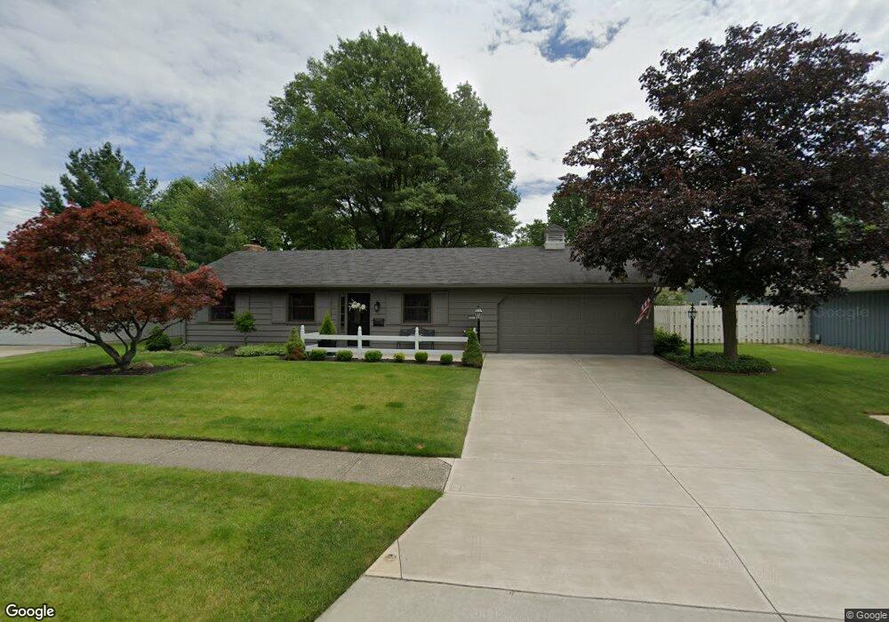
This home is located at 551 Crossbrook Dr, Berea, OH 44017 and is currently estimated at $314,049, approximately $155 per square foot. 551 Crossbrook Dr is a home located in Cuyahoga County with nearby schools including Grindstone Elementary School, Berea-Midpark Middle School, and Berea-Midpark High School.
Ownership History
Date
Name
Owned For
Owner Type
Purchase Details
Closed on
Sep 6, 1985
Sold by
Cadwell Donald E and Cadwell Janet M
Bought by
Colvin Robert L
Current Estimated Value
Purchase Details
Closed on
Jan 1, 1975
Bought by
Cadwell Donald E and Cadwell Janet M
Create a Home Valuation Report for This Property
The Home Valuation Report is an in-depth analysis detailing your home's value as well as a comparison with similar homes in the area
Home Values in the Area
Average Home Value in this Area
Purchase History
| Date | Buyer | Sale Price | Title Company |
|---|---|---|---|
| Colvin Robert L | $71,000 | -- | |
| Cadwell Donald E | -- | -- |
Source: Public Records
Tax History Compared to Growth
Tax History
| Year | Tax Paid | Tax Assessment Tax Assessment Total Assessment is a certain percentage of the fair market value that is determined by local assessors to be the total taxable value of land and additions on the property. | Land | Improvement |
|---|---|---|---|---|
| 2024 | $5,365 | $92,855 | $16,030 | $76,825 |
| 2023 | $4,542 | $65,770 | $13,620 | $52,150 |
| 2022 | $4,514 | $65,770 | $13,620 | $52,150 |
| 2021 | $4,475 | $65,770 | $13,620 | $52,150 |
| 2020 | $4,277 | $55,760 | $11,550 | $44,210 |
| 2019 | $4,163 | $159,300 | $33,000 | $126,300 |
| 2018 | $4,047 | $55,760 | $11,550 | $44,210 |
| 2017 | $4,237 | $52,960 | $10,430 | $42,530 |
| 2016 | $4,206 | $52,960 | $10,430 | $42,530 |
| 2015 | $4,185 | $52,960 | $10,430 | $42,530 |
| 2014 | $4,185 | $55,760 | $10,990 | $44,770 |
Source: Public Records
Map
Nearby Homes
- 540 Crossbrook Dr
- 580 Crossbrook Dr
- Daffodil II Plan at Aspire at Longbrooke
- Passionflower II Plan at Aspire at Longbrooke
- 549 Wyleswood Dr
- 543 Wyleswood Dr
- 455 Woodridge Cir
- 537 Wyleswood Dr
- 517 Wyleswood Dr
- 23390 Wainwright Terrace
- 396 Crossbrook Dr
- 23450 Wainwright Terrace
- 626 Ensenada Ct Unit 5
- 23155 Wainwright Terrace
- 23002 Chandlers Ln
- 23002 Chandlers Ln Unit 342
- 23002 Chandlers Ln Unit 221
- 9757 Wainwright Terrace
- 8797 Westlawn Blvd
- 23003 Chandlers Ln Unit 230
- 543 Crossbrook Dr
- 557 Crossbrook Dr
- 655 Tauton Dr
- 550 Crossbrook Dr
- 535 Crossbrook Dr
- 548 Crossbrook Dr
- 619 Merrimak Dr
- 640 Merrimak Dr
- 661 Tauton Dr
- 650 Merrimak Dr
- 620 Merrimak Dr
- 607 Perham Dr
- 581 Crossbrook Dr
- 609 Merrimak Dr
- 605 Perham Dr
- 667 Tauton Dr
- 656 Tauton Dr
- 673 Merrimak Dr
- 603 Perham Dr
- 610 Merrimak Dr