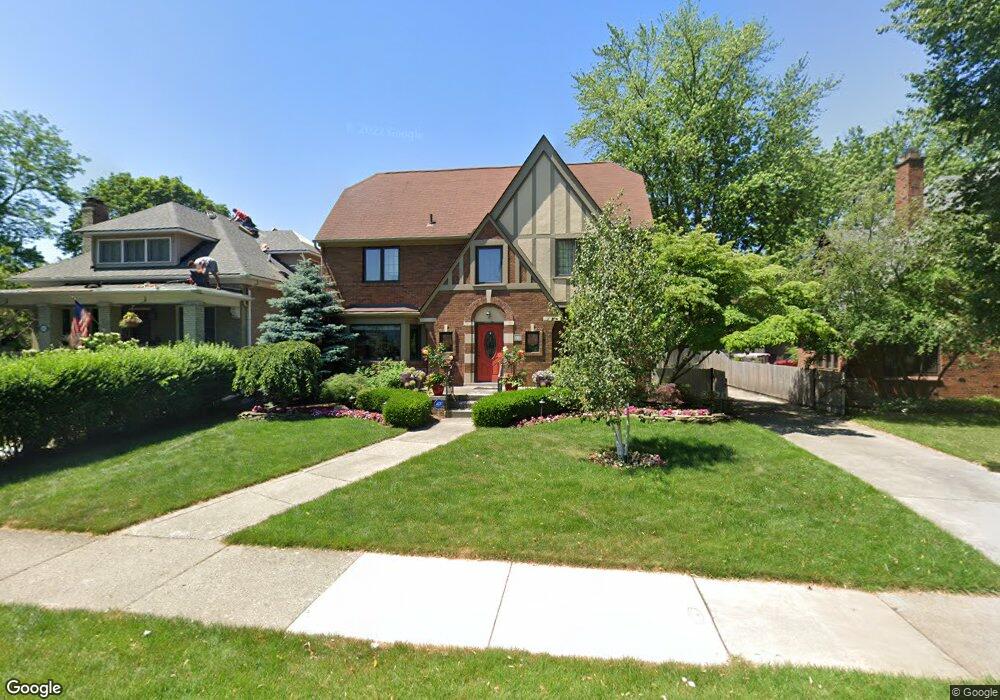
551 Fisher Rd Grosse Pointe, MI 48230
Estimated Value: $648,529 - $798,000
--
Bed
1
Bath
2,386
Sq Ft
$291/Sq Ft
Est. Value
About This Home
This home is located at 551 Fisher Rd, Grosse Pointe, MI 48230 and is currently estimated at $693,382, approximately $290 per square foot. 551 Fisher Rd is a home located in Wayne County with nearby schools including Richard Elementary School, Brownell Middle School, and Grosse Pointe South High School.
Ownership History
Date
Name
Owned For
Owner Type
Purchase Details
Closed on
Nov 30, 2007
Sold by
Beitz Paul J and Hudson-Beitz Kathleen
Bought by
Beitz Living Trust and Beitz
Current Estimated Value
Purchase Details
Closed on
Jun 7, 2007
Sold by
Hudson C Matthew and Hudson Christina B
Bought by
Beitz Paul J
Purchase Details
Closed on
Jun 29, 2005
Sold by
Blevins William E and Blevins Mary J
Bought by
Hudson C Matthew
Create a Home Valuation Report for This Property
The Home Valuation Report is an in-depth analysis detailing your home's value as well as a comparison with similar homes in the area
Home Values in the Area
Average Home Value in this Area
Purchase History
| Date | Buyer | Sale Price | Title Company |
|---|---|---|---|
| Beitz Living Trust | -- | None Listed On Document | |
| Beitz Paul J | $396,245 | Multiple | |
| Hudson C Matthew | $410,000 | Lamont Title Company |
Source: Public Records
Tax History Compared to Growth
Tax History
| Year | Tax Paid | Tax Assessment Tax Assessment Total Assessment is a certain percentage of the fair market value that is determined by local assessors to be the total taxable value of land and additions on the property. | Land | Improvement |
|---|---|---|---|---|
| 2025 | $5,669 | $289,700 | $0 | $0 |
| 2024 | $5,669 | $277,400 | $0 | $0 |
| 2023 | $5,407 | $253,600 | $0 | $0 |
| 2022 | $7,825 | $225,300 | $0 | $0 |
| 2021 | $7,420 | $214,400 | $0 | $0 |
| 2019 | $7,706 | $210,400 | $0 | $0 |
| 2018 | $4,693 | $192,100 | $0 | $0 |
| 2017 | $4,954 | $189,700 | $0 | $0 |
| 2016 | $7,062 | $185,300 | $0 | $0 |
| 2015 | $13,392 | $157,000 | $0 | $0 |
| 2013 | $12,974 | $136,400 | $0 | $0 |
| 2012 | -- | $126,700 | $0 | $0 |
Source: Public Records
Map
Nearby Homes
- 180 Fisher Rd
- 201 Mcmillan Rd
- 213 Muir Rd
- 233 Mcmillan Rd
- 240 Mckinley Ave
- 745 Lincoln Rd
- 166 Lewiston Rd
- 459 Washington Rd
- 276 Lewiston Rd
- 194 Charlevoix Ave
- 355 Lincoln Rd
- 674 Neff Rd
- 425 Rivard Blvd
- 65 Mapleton Rd
- 827 Fisher Rd
- 341 Mcmillan Rd
- 818 Neff Rd
- 352 Mckinley Ave
- 76 Grosse Pointe Blvd
- 218 Merriweather Rd