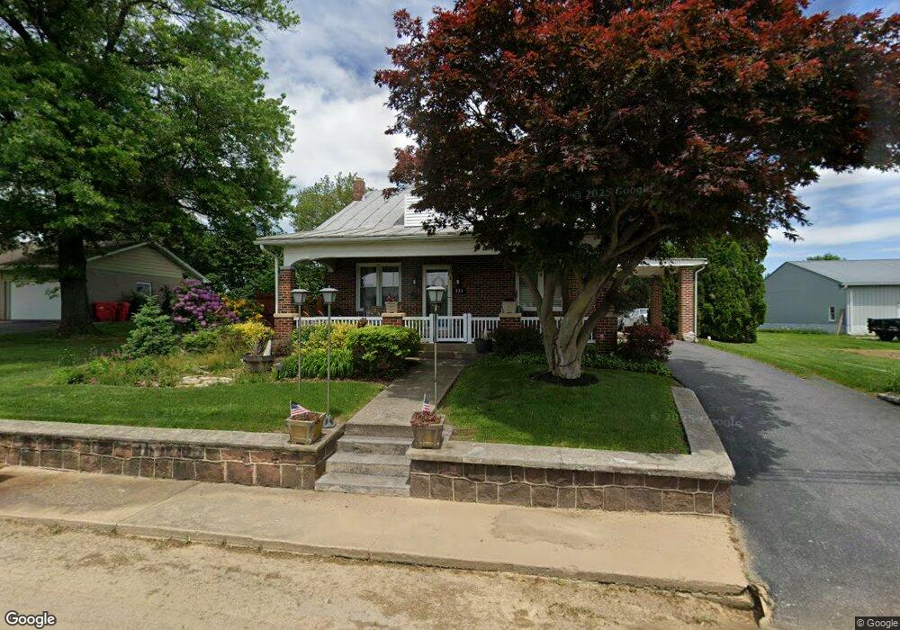
551 Frystown Rd Myerstown, PA 17067
Estimated Value: $224,000 - $256,390
3
Beds
1
Bath
1,440
Sq Ft
$167/Sq Ft
Est. Value
About This Home
This home is located at 551 Frystown Rd, Myerstown, PA 17067 and is currently estimated at $240,598, approximately $167 per square foot. 551 Frystown Rd is a home located in Berks County with nearby schools including Tulpehocken Junior/Senior High School, Lebanon Valley Christian School, and County Line School.
Ownership History
Date
Name
Owned For
Owner Type
Purchase Details
Closed on
Oct 7, 2009
Sold by
Dailey Linda L and Batdorf Robert J
Bought by
Batdorf Brian K and Batdorf Judith P
Current Estimated Value
Home Financials for this Owner
Home Financials are based on the most recent Mortgage that was taken out on this home.
Original Mortgage
$65,000
Interest Rate
5.14%
Mortgage Type
New Conventional
Create a Home Valuation Report for This Property
The Home Valuation Report is an in-depth analysis detailing your home's value as well as a comparison with similar homes in the area
Home Values in the Area
Average Home Value in this Area
Purchase History
| Date | Buyer | Sale Price | Title Company |
|---|---|---|---|
| Batdorf Brian K | $90,000 | None Available |
Source: Public Records
Mortgage History
| Date | Status | Borrower | Loan Amount |
|---|---|---|---|
| Closed | Batdorf Brian K | $65,000 |
Source: Public Records
Tax History Compared to Growth
Tax History
| Year | Tax Paid | Tax Assessment Tax Assessment Total Assessment is a certain percentage of the fair market value that is determined by local assessors to be the total taxable value of land and additions on the property. | Land | Improvement |
|---|---|---|---|---|
| 2025 | $884 | $76,700 | $27,800 | $48,900 |
| 2024 | $2,772 | $76,700 | $27,800 | $48,900 |
| 2023 | $2,727 | $76,700 | $27,800 | $48,900 |
| 2022 | $2,735 | $76,700 | $27,800 | $48,900 |
| 2021 | $2,792 | $76,700 | $27,800 | $48,900 |
| 2020 | $2,800 | $76,700 | $27,800 | $48,900 |
| 2019 | $2,819 | $76,700 | $27,800 | $48,900 |
| 2018 | $2,858 | $76,700 | $27,800 | $48,900 |
| 2017 | $2,843 | $76,700 | $27,800 | $48,900 |
| 2016 | $763 | $76,700 | $27,800 | $48,900 |
| 2015 | $763 | $76,700 | $27,800 | $48,900 |
| 2014 | $763 | $76,700 | $27,800 | $48,900 |
Source: Public Records
Map
Nearby Homes
- 40 Seymour Dr
- 37 Seymour Dr
- 711 Little Mountain Rd
- 625 Brown Rd
- 230 School Rd
- 360 Woleber Rd
- 40 Clover Dr Unit 49
- 46 Clover Dr Unit 46
- 27 Clover Dr Unit 59
- 37 Clover Dr Unit 63
- 66 Clover Dr Unit 36
- 72 Clover Dr Unit 33
- 49 Clover Dr Unit 65
- 31 Clover Dr Unit 61
- 58 Clover Dr Unit 40
- 60 Clover Dr Unit 39
- 48 Clover Dr Unit 45
- 64 Clover Dr Unit 37
- 62 Clover Dr Unit 38
- 57 Clover Dr Unit 67
- 545 Frystown Rd
- 555 Frystown Rd
- 561 Frystown Rd
- 0 Frystown Rd Unit PABK2014726
- 0 Frystown Rd Unit PABK2007008
- 1918 Camp Swatara Rd
- 541 Frystown Rd
- 571 Frystown Rd
- 531 Frystown Rd
- 570 Frystown Rd
- 1922 Camp Swatara Rd
- 1922B Camp Swatara Rd
- 525 Frystown Rd
- 575 Frystown Rd
- 574 Frystown Rd
- 521 Frystown Rd
- 520 Frystown Rd
- 517 Frystown Rd
- 581 Frystown Rd
- 578 Frystown Rd