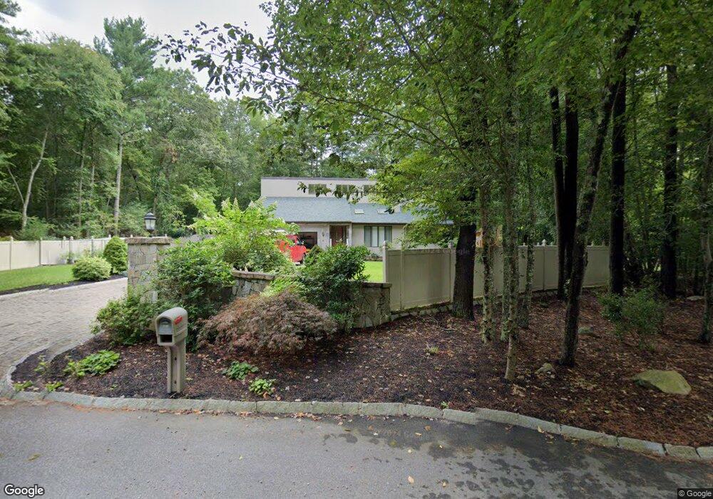
551 Indian Town Rd Westport, MA 02790
Estimated Value: $768,000 - $963,000
3
Beds
3
Baths
3,565
Sq Ft
$239/Sq Ft
Est. Value
About This Home
This home is located at 551 Indian Town Rd, Westport, MA 02790 and is currently estimated at $850,856, approximately $238 per square foot. 551 Indian Town Rd is a home located in Bristol County with nearby schools including North End Elementary School, Talbot Innovation School, and B M C Durfee High School.
Ownership History
Date
Name
Owned For
Owner Type
Purchase Details
Closed on
Jul 10, 2012
Sold by
Daponte Kevin
Bought by
Daponte Kevin and Daponte Diane S
Current Estimated Value
Home Financials for this Owner
Home Financials are based on the most recent Mortgage that was taken out on this home.
Original Mortgage
$245,000
Interest Rate
3.78%
Mortgage Type
New Conventional
Purchase Details
Closed on
May 1, 2003
Sold by
Noseworthy Colleen M and Noseworthy Joseph P
Bought by
Daponte Kevin
Home Financials for this Owner
Home Financials are based on the most recent Mortgage that was taken out on this home.
Original Mortgage
$232,050
Interest Rate
5.82%
Mortgage Type
Purchase Money Mortgage
Create a Home Valuation Report for This Property
The Home Valuation Report is an in-depth analysis detailing your home's value as well as a comparison with similar homes in the area
Home Values in the Area
Average Home Value in this Area
Purchase History
| Date | Buyer | Sale Price | Title Company |
|---|---|---|---|
| Daponte Kevin | -- | -- | |
| Daponte Kevin | $273,000 | -- |
Source: Public Records
Mortgage History
| Date | Status | Borrower | Loan Amount |
|---|---|---|---|
| Closed | Daponte Kevin | $245,000 | |
| Previous Owner | Daponte Kevin | $232,050 | |
| Previous Owner | Daponte Kevin | $167,500 |
Source: Public Records
Tax History Compared to Growth
Tax History
| Year | Tax Paid | Tax Assessment Tax Assessment Total Assessment is a certain percentage of the fair market value that is determined by local assessors to be the total taxable value of land and additions on the property. | Land | Improvement |
|---|---|---|---|---|
| 2025 | $9,066 | $791,800 | $168,600 | $623,200 |
| 2024 | $8,542 | $743,400 | $162,200 | $581,200 |
| 2023 | $7,982 | $650,500 | $140,200 | $510,300 |
| 2022 | $7,426 | $588,400 | $131,100 | $457,300 |
| 2021 | $6,983 | $504,900 | $131,500 | $373,400 |
| 2020 | $7,179 | $496,800 | $131,800 | $365,000 |
| 2019 | $7,010 | $480,800 | $133,900 | $346,900 |
| 2018 | $4,915 | $336,200 | $110,000 | $226,200 |
| 2017 | $3,776 | $269,700 | $110,000 | $159,700 |
| 2016 | $3,653 | $268,000 | $115,800 | $152,200 |
| 2015 | $3,549 | $271,300 | $115,800 | $155,500 |
| 2014 | $3,413 | $271,300 | $115,800 | $155,500 |
Source: Public Records
Map
Nearby Homes
- 309 Yellow Hill Rd
- 1276 Old Fall River Rd
- 3 Diane Way
- 55 Lynch Ln
- 2 Donna Marie Dr
- 128 Old Bedford Rd
- 19 Charles Joseph Dr
- 0 Rich St
- 2-1 N Hixville Rd
- 44 Fenmore St
- 168 Windsor St
- 1261 N Hixville Rd
- 36 Fordney St
- 1796 Locust St
- 200 David St
- 350 Doherty St
- 1739 Meridian St
- 125 Angell St
- 85 Reney St
- 89 Lafayette St
- 551 Indian Town Rd
- 521 Indian Town Rd
- 581 Indian Town Rd
- 884 Mohawk Dr
- 15 Mohawk Dr
- 81 Mohawk Dr
- 625 Indian Town Rd
- 150 Mohawk Dr
- 816 Mohawk Dr
- 825 Mohawk Dr
- 141 Mohawk Dr
- 182 Mohawk Dr
- 400 Indian Town Rd
- 177 Mohawk Dr
- 320 Indian Town Rd
- 720 Mohawk Dr
- 248 Mohawk Dr
- 727 Mohawk Rd
- 289 Indian Town Rd
- 300 Indian Town Rd